
Previsioni:

Previsione a breve termineper lo più asciutto. Warm (Max 21°C giovedì pomeriggio, Min 16°C mercoledì notte). Vento sarà generalmente leggero. | ||||||||||||||||||||||||
Mer 15 | Giovedì 16 | Venerdì 17 | 18 | |||||||||||||||||||||
11 AM | 2 PM | 5 PM | 8 PM | 11 PM | 2 AM | 5 AM | 8 AM | 11 AM | 2 PM | 5 PM | 8 PM | 11 PM | 2 AM | 5 AM | 8 AM | 11 AM | 2 PM | 5 PM | 8 PM | 11 PM | 2 AM | 5 AM | 8 AM | |
Mappa dell'altezza del moto ondoso |  |  | 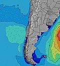 | 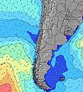 |  |  | 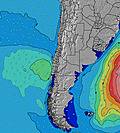 | 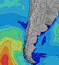 |  | |||||||||||||||
Onda Altezza (m) Direzione Periodo (s) | SW 13 | SW 14 | SW 12 | SW 13 | SW 13 | SW 14 | SW 13 | SW 13 | SW 13 | SW 13 | SW 13 | SW 12 | SSW 12 | SW 12 | SW 12 | SW 12 | SSW 12 | SW 12 | SW 11 | SW 11 | SW 12 | SW 12 | SW 11 | SW 11 |
Grafico delle onde | ||||||||||||||||||||||||
969 | 788 | 854 | 974 | 1021 | 1036 | 1006 | 1067 | 996 | 981 | 803 | 766 | 714 | 607 | 522 | 421 | 378 | 319 | 250 | 137 | 324 | 396 | 398 | 429 | |
Vento (km/h) | ||||||||||||||||||||||||
Stato del vento onshore cross-onshore cross-shore cross-offshore offshore piatto | on | on | on | glassy | glassy | glassy | glassy | glassy | glassy | on | glassy | glassy | glassy | glassy | glassy | glassy | cross-on | on | on | glassy | glassy | glassy | glassy | glassy |
Alta Marea | 9:40AM1.44m | 10:05PM0.78m | 10:28AM1.41m | 10:58PM0.81m | 11:15AM1.35m | 11:51PM0.84m | ||||||||||||||||||
Basso Marea | 4:33PM0.10m | 3:38AM0.10m | 5:18PM0.09m | 4:31AM0.14m | 6:02PM0.10m | 5:26AM0.20m | ||||||||||||||||||
— | — | — | — | — | — | 7:13 | — | — | — | — | — | — | — | 7:13 | — | — | — | — | — | — | — | 7:13 | — | |
— | — | 6:20 | — | — | — | — | — | — | — | 6:21 | — | — | — | — | — | — | — | 6:21 | — | — | — | — | 6:22 | |
mm | — | — | — | — | — | — | — | — | — | — | — | — | — | — | — | — | — | — | — | — | — | — | — | — |
Temp. °C | 19 | 19 | 18 | 16 | 17 | 17 | 16 | 16 | 18 | 21 | 20 | 18 | 16 | 16 | 16 | 16 | 19 | 20 | 19 | 17 | 16 | 16 | 17 | 17 |
Gelo °C | 19 | 18 | 18 | 17 | 18 | 18 | 17 | 17 | 18 | 21 | 20 | 19 | 16 | 16 | 17 | 17 | 19 | 20 | 19 | 18 | 17 | 17 | 18 | 17 |
Onda 1 Altezza (m) Direzione Periodo (s) | SW 13 | SW 14 | SW 12 | SW 13 | SW 13 | SW 14 | SW 13 | SW 13 | SW 13 | SW 13 | SW 13 | SW 12 | SSW 12 | SW 12 | SW 12 | SW 12 | SSW 12 | SW 12 | SW 11 | SW 11 | SW 12 | SW 12 | SW 11 | SW 11 |
969 | 788 | 854 | 974 | 1021 | 1036 | 1006 | 1067 | 996 | 981 | 803 | 766 | 714 | 607 | 522 | 421 | 378 | 319 | 250 | 137 | 324 | 396 | 398 | 429 | |
Onda 2 Altezza (m) Direzione Periodo (s) | W 13 | WSW 12 | W 13 | W 13 | W 13 | W 13 | — | — | — | W 12 | W 12 | SW 20 | WSW 10 | SW 20 | SW 20 | SSW 19 | SSW 19 | SW 18 | SW 18 | SSW 13 | SSW 17 | SSW 16 | SSW 16 | SSW 16 |
3 | 222 | 3 | 3 | 3 | 3 | — | — | — | 3 | 3 | 16 | 10 | 16 | 15 | 34 | 34 | 80 | 79 | 114 | 111 | 173 | 171 | 215 | |
Onda 3 Altezza (m) Direzione Periodo (s) | — | W 13 | W 13 | — | — | W 13 | — | — | — | — | — | W 12 | SW 20 | W 12 | W 12 | W 12 | W 9 | WSW 9 | WSW 9 | SW 17 | W 9 | W 16 | W 16 | W 16 |
— | 3 | 3 | — | — | 3 | — | — | — | — | — | 3 | 15 | 3 | 3 | 3 | 6 | 8 | 8 | 77 | 2 | 5 | 5 | 5 | |
onde vento Altezza (m) Direzione Periodo (s) | — | SSW 6 | SSW 6 | — | — | — | — | — | — | — | — | — | — | — | — | — | — | — | — | — | — | — | — | — |
— | 13 | 13 | — | — | — | — | — | — | — | — | — | — | — | — | — | — | — | — | — | — | — | — | — | |
Il più vicino Offshore or Glassy | ||||||||||||||||||||||||
Distanza (km) | 4 | 144 | 144 | 0 | 0 | 0 | 0 | 0 | 0 | 114 | 0 | 0 | 0 | 0 | 0 | 0 | 4 | 144 | 6 | 0 | 0 | 0 | 0 | 0 |
Migliori previsioni per le condizioni d'onda in Atacama | ||||||||||||||||||||||||
Migliori previsioni per le condizioni d'onda in Chile | ||||||||||||||||||||||||
Trova Onde Globale | ||||||||||||||||||||||||
- Map Icons:
 Break
Break Live Wave Height (m)
 Live Wind Speed (km/h)
 Surf Rating (10 Max)
 Ocean Swells (m)
- Wind Speed (km/h)
Widget Free Surf-Forecast.com per il tuo sito
La relazione di surf / widget meteo è disponibile qui sotto per incorporare su siti esterni a titolo gratuito e fornisce una sintesi delle nostre El Chinchorro previsione surf. Basta prendere il frammento di codice html da noi fornito e copiarlo nel proprio sito. È possibile scegliere la lingua preferita e unità metriche / imperiali per il feed delle previsioni surf per soddisfare le esigenze degli utenti del vostro sito .... Clicca qui per ottenere il codice.
 Nearest