
Previsioni:

Previsione a breve termineper lo più asciutto. Warm (Max 23°C Sabato pomeriggio, Min 18°C Venerdì notte). Vento sarà generalmente leggero. | |||||||||||||||||||
Ven 17 | Sabato 18 | Domenica 19 | |||||||||||||||||
5 PM | 8 PM | 11 PM | 2 AM | 5 AM | 8 AM | 11 AM | 2 PM | 5 PM | 8 PM | 11 PM | 2 AM | 5 AM | 8 AM | 11 AM | 2 PM | 5 PM | 8 PM | 11 PM | |
Mappa dell'altezza del moto ondoso |  |  | 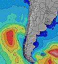 |  |  |  |  | ||||||||||||
Onda Altezza (m) Direzione Periodo (s) | SW 12 | SW 12 | SW 11 | SW 11 | WSW 11 | SW 15 | WSW 10 | WSW 10 | WSW 10 | WSW 10 | WSW 10 | SSW 13 | WSW 13 | WSW 12 | WSW 12 | WSW 12 | WSW 12 | WSW 12 | WSW 12 |
Grafico delle onde | |||||||||||||||||||
314 | 425 | 493 | 476 | 397 | 309 | 292 | 292 | 292 | 304 | 292 | 346 | 679 | 589 | 579 | 569 | 560 | 461 | 454 | |
Vento (km/h) | |||||||||||||||||||
Stato del vento onshore cross-onshore cross-shore cross-offshore offshore piatto | cross-on | cross-on | cross-on | cross-on | glassy | glassy | on | on | on | glassy | cross-on | glassy | glassy | glassy | cross-on | cross-on | on | glassy | glassy |
Alta Marea | 00:04AM0.81m | 12:09PM1.18m | 00:56AM0.84m | 12:55PM1.05m | |||||||||||||||
Basso Marea | 6:10PM-0.03m | 5:42AM0.11m | 6:52PM0.00m | 6:39AM0.19m | 7:34PM0.05m | ||||||||||||||
— | — | — | — | 7:16 | — | — | — | — | — | — | — | 7:16 | — | — | — | — | — | — | |
6:15 | — | — | — | — | — | — | — | 6:15 | — | — | — | — | — | — | — | 6:15 | — | — | |
mm | — | — | — | — | — | — | — | — | — | — | — | — | — | — | — | — | — | — | — |
Temp. °C | 22 | 21 | 19 | 18 | 20 | 19 | 22 | 23 | 22 | 21 | 19 | 20 | 20 | 21 | 23 | 23 | 21 | 20 | 20 |
Gelo °C | 20 | 19 | 18 | 17 | 20 | 18 | 21 | 22 | 21 | 20 | 18 | 19 | 19 | 20 | 22 | 22 | 20 | 19 | 20 |
Onda 1 Altezza (m) Direzione Periodo (s) | SW 12 | SW 12 | SW 11 | SW 11 | WSW 11 | WSW 10 | WSW 10 | WSW 10 | WSW 10 | WSW 10 | WSW 10 | WSW 10 | WSW 13 | WSW 12 | WSW 12 | WSW 12 | WSW 12 | WSW 12 | WSW 12 |
314 | 425 | 493 | 476 | 397 | 298 | 292 | 292 | 292 | 292 | 292 | 285 | 679 | 589 | 579 | 569 | 560 | 461 | 454 | |
Onda 2 Altezza (m) Direzione Periodo (s) | SW 17 | SW 16 | SSW 16 | SSW 16 | SSW 15 | SW 15 | SW 14 | SW 14 | SSW 14 | SSW 13 | SSW 13 | SSW 13 | SSW 12 | SSW 12 | SSW 12 | SSW 13 | SSW 13 | SSW 13 | SSW 13 |
73 | 129 | 169 | 162 | 146 | 309 | 214 | 206 | 232 | 304 | 154 | 346 | 190 | 187 | 241 | 269 | 269 | 219 | 183 | |
Onda 3 Altezza (m) Direzione Periodo (s) | WNW 12 | NW 12 | NW 12 | W 16 | SW 12 | WSW 15 | SW 11 | SW 11 | SSW 11 | WSW 13 | WSW 13 | WSW 13 | SSW 15 | SSW 15 | NW 11 | NW 11 | NW 11 | NW 11 | NW 11 |
14 | 6 | 6 | 5 | 37 | 21 | 60 | 59 | 46 | 35 | 118 | 139 | 85 | 72 | 5 | 5 | 5 | 5 | 5 | |
onde vento Altezza (m) Direzione Periodo (s) | — | — | — | — | — | — | — | — | — | — | — | — | — | — | — | — | — | — | — |
— | — | — | — | — | — | — | — | — | — | — | — | — | — | — | — | — | — | — | |
Il più vicino Offshore or Glassy | |||||||||||||||||||
Distanza (km) | 136 | 136 | 52 | 52 | 0 | 0 | 45 | 45 | 45 | 0 | 9 | 0 | 0 | 0 | 45 | 45 | 45 | 0 | 0 |
Migliori previsioni per le condizioni d'onda in Tarapaca | |||||||||||||||||||
Migliori previsioni per le condizioni d'onda in Chile | |||||||||||||||||||
Trova Onde Globale | |||||||||||||||||||
- Map Icons:
 Break
Break Live Wave Height (m)
 Live Wind Speed (km/h)
 Surf Rating (10 Max)
 Ocean Swells (m)
- Wind Speed (km/h)
Widget Free Surf-Forecast.com per il tuo sito
La relazione di surf / widget meteo è disponibile qui sotto per incorporare su siti esterni a titolo gratuito e fornisce una sintesi delle nostre El Loa previsione surf. Basta prendere il frammento di codice html da noi fornito e copiarlo nel proprio sito. È possibile scegliere la lingua preferita e unità metriche / imperiali per il feed delle previsioni surf per soddisfare le esigenze degli utenti del vostro sito .... Clicca qui per ottenere il codice.
 Nearest