
Previsioni:

Previsione a breve termineper lo più asciutto. Warm (Max 20°C giovedì pomeriggio, Min 15°C Lunedì notte). Vento sarà generalmente leggero. | |||||||||||||||||||
Lun 20 | Martedì 21 | Mercoledì 22 | |||||||||||||||||
5 PM | 8 PM | 11 PM | 2 AM | 5 AM | 8 AM | 11 AM | 2 PM | 5 PM | 8 PM | 11 PM | 2 AM | 5 AM | 8 AM | 11 AM | 2 PM | 5 PM | 8 PM | 11 PM | |
Mappa dell'altezza del moto ondoso |  |  | 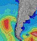 |  |  | 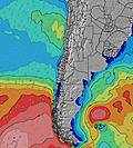 |  | ||||||||||||
Onda Altezza (m) Direzione Periodo (s) | WSW 11 | WSW 12 | WSW 12 | WSW 12 | WSW 12 | WSW 12 | WSW 12 | WSW 12 | WSW 12 | WSW 12 | WSW 11 | WSW 11 | WSW 11 | WSW 11 | WSW 11 | SW 11 | WSW 11 | SW 10 | SW 11 |
Grafico delle onde | |||||||||||||||||||
379 | 458 | 458 | 443 | 412 | 347 | 341 | 336 | 336 | 330 | 307 | 302 | 291 | 291 | 238 | 263 | 214 | 243 | 286 | |
Vento (km/h) | |||||||||||||||||||
Stato del vento onshore cross-onshore cross-shore cross-offshore offshore piatto | cross | glassy | glassy | cross-off | glassy | glassy | cross | cross | cross-off | glassy | glassy | glassy | glassy | glassy | cross-off | cross | cross | glassy | glassy |
Alta Marea | 2:43AM0.93m | 2:25PM0.86m | 3:46AM0.96m | 3:24PM0.76m | |||||||||||||||
Basso Marea | 8:10PM0.20m | 8:40AM0.42m | 8:55PM0.24m | 10:04AM0.46m | 9:41PM0.27m | ||||||||||||||
— | — | — | — | 7:11 | — | — | — | — | — | — | — | 7:11 | — | — | — | — | — | — | |
6:22 | — | — | — | — | — | — | — | 6:22 | — | — | — | — | — | — | — | 6:22 | — | — | |
mm | — | — | — | — | — | — | — | — | — | — | — | — | — | — | — | — | — | — | — |
Temp. °C | 18 | 16 | 16 | 15 | 15 | 16 | 18 | 19 | 18 | 16 | 16 | 16 | 16 | 16 | 18 | 19 | 18 | 17 | 16 |
Gelo °C | 17 | 16 | 17 | 15 | 16 | 16 | 17 | 19 | 18 | 17 | 17 | 16 | 16 | 17 | 18 | 19 | 19 | 19 | 17 |
Onda 1 Altezza (m) Direzione Periodo (s) | WSW 11 | WSW 12 | WSW 12 | WSW 12 | WSW 12 | WSW 12 | WSW 12 | WSW 12 | WSW 12 | WSW 12 | WSW 11 | WSW 11 | WSW 11 | WSW 11 | WSW 11 | SW 11 | WSW 11 | SW 10 | SW 11 |
379 | 458 | 458 | 443 | 412 | 347 | 341 | 336 | 336 | 330 | 307 | 302 | 291 | 291 | 238 | 263 | 214 | 243 | 286 | |
Onda 2 Altezza (m) Direzione Periodo (s) | SSW 12 | SSW 12 | SSW 12 | SSW 11 | SSW 11 | SSW 11 | SSW 11 | SSW 11 | SSW 11 | SSW 11 | SSW 11 | SSW 11 | SSW 11 | SSW 11 | SSW 11 | SSW 11 | SSW 11 | SSW 11 | SSW 6 |
206 | 203 | 199 | 186 | 176 | 176 | 180 | 186 | 186 | 176 | 173 | 135 | 135 | 133 | 135 | 135 | 103 | 103 | 17 | |
Onda 3 Altezza (m) Direzione Periodo (s) | W 22 | W 22 | W 22 | W 21 | W 21 | W 21 | W 21 | W 21 | W 20 | S 4 | SSW 4 | SSW 4 | SSW 5 | SSW 5 | SSW 5 | SSW 26 | SW 26 | SW 26 | SSW 10 |
9 | 9 | 9 | 9 | 9 | 9 | 9 | 8 | 33 | 6 | 5 | 6 | 7 | 7 | 4 | 66 | 105 | 105 | 33 | |
onde vento Altezza (m) Direzione Periodo (s) | — | — | — | — | — | — | — | — | SSW 3 | S 4 | — | — | — | — | — | SSW 4 | SSW 4 | — | — |
— | — | — | — | — | — | — | — | 3 | 6 | — | — | — | — | — | 7 | 8 | — | — | |
Il più vicino Offshore or Glassy | |||||||||||||||||||
Distanza (km) | 112 | 0 | 0 | 0 | 0 | 0 | 147 | 195 | 0 | 0 | 0 | 0 | 0 | 0 | 0 | 147 | 147 | 0 | 0 |
Migliori previsioni per le condizioni d'onda in Atacama | |||||||||||||||||||
Migliori previsioni per le condizioni d'onda in Chile | |||||||||||||||||||
Trova Onde Globale | |||||||||||||||||||
- Map Icons:
 Break
Break Live Wave Height (m)
 Live Wind Speed (km/h)
 Surf Rating (10 Max)
 Ocean Swells (m)
- Wind Speed (km/h)
Widget Free Surf-Forecast.com per il tuo sito
La relazione di surf / widget meteo è disponibile qui sotto per incorporare su siti esterni a titolo gratuito e fornisce una sintesi delle nostre El Puerto previsione surf. Basta prendere il frammento di codice html da noi fornito e copiarlo nel proprio sito. È possibile scegliere la lingua preferita e unità metriche / imperiali per il feed delle previsioni surf per soddisfare le esigenze degli utenti del vostro sito .... Clicca qui per ottenere il codice.
 Nearest