
Previsioni:

Previsione a breve terminepioggia leggera (Totale 6mm), per lo più che cade Lunedì notte. Condizioni di ghiaccio (Max 3°C Domenica mattina, Min 0°C Sabato mattina). Venti in aumento (venti deboli da ESE Sabato notte, raffiche di vento da ESE per lunedì notte). | ||||||||||||||||||||||||
Sabato 1 | Domenica 2 | Lunedì 3 | ||||||||||||||||||||||
12 AM | 3 AM | 6 AM | 9 AM | 12 PM | 3 PM | 6 PM | 9 PM | 12 AM | 3 AM | 6 AM | 9 AM | 12 PM | 3 PM | 6 PM | 9 PM | 12 AM | 3 AM | 6 AM | 9 AM | 12 PM | 3 PM | 6 PM | 9 PM | |
Mappa dell'altezza del moto ondoso |  |  |  |  | 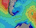 | 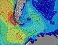 | 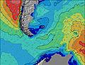 | 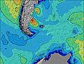 | 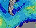 | |||||||||||||||
Onda Altezza (m) Direzione Periodo (s) | N 9 | N 9 | N 9 | N 9 | N 9 | ENE 7 | N 9 | ENE 9 | ENE 9 | ENE 9 | NE 9 | NE 10 | NE 10 | NE 10 | NE 10 | NE 10 | NE 10 | NE 10 | NE 7 | NE 7 | NE 8 | NE 8 | NE 9 | NE 10 |
Grafico delle onde | ||||||||||||||||||||||||
42 | 103 | 125 | 126 | 99 | 0 | 76 | 0 | 0 | 0 | 0 | 0 | 0 | 0 | 0 | 0 | 0 | 0 | 0 | 0 | 0 | 0 | 0 | 0 | |
Vento (km/h) | ||||||||||||||||||||||||
Stato del vento onshore cross-onshore cross-shore cross-offshore offshore piatto | off | off | off | off | off | off | off | off | off | off | cross-off | cross-off | cross-off | cross-off | cross-off | cross-off | cross-off | cross-off | cross-off | cross-off | cross-off | cross-off | cross-off | off |
Alta Marea | 9:45AM1.65m | 9:39PM2.12m | 10:18AM1.67m | 10:16PM2.07m | 10:53AM1.71m | |||||||||||||||||||
Basso Marea | 3:11PM0.68m | 4:25AM0.35m | 3:44PM0.67m | 4:50AM0.40m | 4:21PM0.66m | |||||||||||||||||||
— | — | 8:32 | — | — | — | — | — | — | — | 8:30 | — | — | — | — | — | — | — | 8:27 | — | — | — | — | — | |
— | — | — | — | — | 5:31 | — | — | — | — | — | — | — | 5:32 | — | — | — | — | — | — | — | 5:34 | — | — | |
mm | — | — | — | — | — | — | — | — | — | — | — | — | — | — | — | — | — | — | — | — | — | — | 1 | 1 |
Temp. °C | 1 | 1 | 0 | 0 | 1 | 1 | 1 | 1 | 1 | 1 | 1 | 1 | 2 | 2 | 2 | 2 | 2 | 3 | 3 | 2 | 3 | 3 | 3 | 3 |
Gelo °C | -7 | -8 | -9 | -9 | -8 | -7 | -6 | -5 | -5 | -5 | -5 | -5 | -5 | -5 | -5 | -5 | -6 | -5 | -5 | -6 | -6 | -6 | -6 | -6 |
Onda 1 Altezza (m) Direzione Periodo (s) | N 9 | N 9 | N 9 | N 9 | N 9 | N 9 | NE 9 | N 9 | N 8 | N 8 | N 8 | N 8 | NNE 10 | NNE 12 | E 10 | E 10 | — | — | NNE 11 | NNE 10 | NNE 10 | — | — | — |
42 | 103 | 125 | 126 | 99 | 99 | 152 | 73 | 71 | 69 | 48 | 35 | 170 | 228 | 2 | 2 | — | — | 117 | 112 | 141 | — | — | — | |
Onda 2 Altezza (m) Direzione Periodo (s) | — | — | — | — | — | — | N 9 | — | — | — | — | — | — | E 11 | — | — | — | — | — | — | — | — | — | — |
— | — | — | — | — | — | 76 | — | — | — | — | — | — | 2 | — | — | — | — | — | — | — | — | — | — | |
Onda 3 Altezza (m) Direzione Periodo (s) | — | — | — | — | — | — | — | — | — | — | — | — | — | — | — | — | — | — | — | — | — | — | — | — |
— | — | — | — | — | — | — | — | — | — | — | — | — | — | — | — | — | — | — | — | — | — | — | — | |
onde vento Altezza (m) Direzione Periodo (s) | ESE 5 | E 6 | E 6 | E 7 | ENE 7 | ENE 7 | E 7 | ENE 9 | ENE 9 | ENE 9 | NE 9 | NE 10 | NE 10 | NE 10 | NE 10 | NE 10 | NE 10 | NE 10 | NE 7 | NE 7 | NE 8 | NE 8 | NE 9 | NE 10 |
85 | 141 | 193 | 250 | 285 | 294 | 178 | 360 | 339 | 307 | 300 | 388 | 499 | 557 | 546 | 659 | 721 | 800 | 357 | 492 | 558 | 765 | 942 | 1175 | |
Il più vicino Offshore or Glassy | ||||||||||||||||||||||||
Distanza (km) | 876 | 1412 | 1480 | 1489 | 1182 | 1658 | 915 | 915 | 0 | 1182 | 1182 | 1412 | 1422 | 1423 | 876 | 876 | 1412 | 1186 | 1182 | 1182 | 878 | 1412 | 1489 | 876 |
Migliori previsioni per le condizioni d'onda in Falkland Islands | ||||||||||||||||||||||||
Migliori previsioni per le condizioni d'onda in Falkland Islands | ||||||||||||||||||||||||
Trova Onde Globale | ||||||||||||||||||||||||
- Map Icons:
 Break
Break Live Wave Height (m)
 Live Wind Speed (km/h)
 Surf Rating (10 Max)
 Ocean Swells (m)
- Wind Speed (km/h)
Widget Free Surf-Forecast.com per il tuo sito
La relazione di surf / widget meteo è disponibile qui sotto per incorporare su siti esterni a titolo gratuito e fornisce una sintesi delle nostre Elephant Beach previsione surf. Basta prendere il frammento di codice html da noi fornito e copiarlo nel proprio sito. È possibile scegliere la lingua preferita e unità metriche / imperiali per il feed delle previsioni surf per soddisfare le esigenze degli utenti del vostro sito .... Clicca qui per ottenere il codice.
 Nearest