
Previsioni:

Previsione a breve termineper lo più asciutto. Warm (Max 25°C Sabato mattina, Min 23°C giovedì notte). Principalmente venti freschi. | |||||||||||||||||||
Gio 30 | Venerdì 31 | Sabato 1 | |||||||||||||||||
4 PM | 7 PM | 10 PM | 1 AM | 4 AM | 7 AM | 10 AM | 1 PM | 4 PM | 7 PM | 10 PM | 1 AM | 4 AM | 7 AM | 10 AM | 1 PM | 4 PM | 7 PM | 10 PM | |
Mappa dell'altezza del moto ondoso |  |  |  | 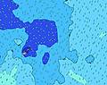 | 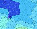 |  | 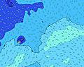 | ||||||||||||
Onda Altezza (m) Direzione Periodo (s) | S 11 | S 11 | S 11 | S 11 | ESE 7 | E 7 | E 7 | E 7 | E 7 | E 7 | SSE 12 | SSE 12 | SSE 12 | SSE 12 | SSE 12 | SSE 12 | SSE 12 | SSE 12 | SSE 12 |
Grafico delle onde | |||||||||||||||||||
459 | 345 | 286 | 281 | 255 | 247 | 255 | 264 | 233 | 239 | 230 | 226 | 387 | 477 | 477 | 477 | 443 | 500 | 491 | |
Vento (km/h) | |||||||||||||||||||
Stato del vento onshore cross-onshore cross-shore cross-offshore offshore piatto | on | on | on | cross-on | cross-on | cross-on | on | on | cross-on | cross-on | cross-on | cross-on | cross-on | cross-on | cross-on | on | on | on | on |
Alta Marea | 7:56PM0.88m | 8:05AM0.97m | 8:34PM0.89m | 8:44AM0.95m | 9:14PM0.90m | ||||||||||||||
Basso Marea | 1:46PM0.16m | 1:50AM0.22m | 2:22PM0.17m | 2:31AM0.23m | 2:59PM0.19m | ||||||||||||||
— | — | — | — | 6:45 | — | — | — | — | — | — | — | 6:43 | — | — | — | — | — | — | |
6:13 | — | — | — | — | — | — | — | 6:13 | — | — | — | — | — | — | — | 6:13 | — | — | |
mm | — | — | — | — | — | — | — | — | — | — | — | — | — | — | — | — | — | — | — |
Temp. °C | 24 | 24 | 24 | 23 | 23 | 23 | 24 | 24 | 24 | 24 | 24 | 24 | 24 | 24 | 25 | 25 | 25 | 25 | 25 |
Gelo °C | 20 | 20 | 21 | 20 | 19 | 19 | 21 | 21 | 22 | 22 | 23 | 23 | 24 | 23 | 25 | 26 | 25 | 25 | 26 |
Onda 1 Altezza (m) Direzione Periodo (s) | S 11 | S 11 | S 11 | S 11 | S 10 | S 10 | S 10 | S 10 | S 10 | S 10 | SSE 12 | SSE 12 | SSE 12 | SSE 12 | SSE 12 | SSE 12 | SSE 12 | SSE 12 | SSE 12 |
459 | 345 | 286 | 281 | 216 | 206 | 198 | 161 | 125 | 125 | 230 | 226 | 387 | 477 | 477 | 477 | 443 | 500 | 491 | |
Onda 2 Altezza (m) Direzione Periodo (s) | NE 13 | NE 13 | NE 13 | NE 13 | NE 12 | SSE 13 | SSE 13 | SSE 13 | SSE 12 | SSE 12 | S 10 | S 10 | SW 15 | E 8 | E 8 | E 8 | E 8 | E 8 | E 8 |
87 | 85 | 84 | 84 | 77 | 95 | 131 | 145 | 175 | 169 | 122 | 92 | 141 | 149 | 124 | 122 | 129 | 108 | 130 | |
Onda 3 Altezza (m) Direzione Periodo (s) | SW 12 | SSE 11 | SW 12 | SW 12 | SSE 11 | NE 12 | NE 12 | NE 12 | NE 12 | NE 12 | SW 15 | SW 15 | NE 11 | SW 17 | SW 14 | SW 14 | SW 15 | SW 16 | SW 16 |
68 | 74 | 68 | 49 | 49 | 72 | 72 | 71 | 69 | 47 | 109 | 141 | 56 | 183 | 93 | 164 | 229 | 239 | 242 | |
onde vento Altezza (m) Direzione Periodo (s) | ESE 6 | ESE 6 | ESE 6 | ESE 7 | ESE 7 | E 7 | E 7 | E 7 | E 7 | E 7 | E 7 | E 7 | E 8 | — | — | — | — | — | — |
139 | 175 | 203 | 240 | 255 | 247 | 255 | 264 | 233 | 239 | 206 | 183 | 164 | — | — | — | — | — | — | |
Il più vicino Offshore or Glassy | |||||||||||||||||||
Distanza (km) | 2298 | 1343 | 1343 | 611 | 611 | 895 | 897 | 611 | 15 | 13 | 11 | 11 | 11 | 11 | 11 | 4 | 11 | 11 | 11 |
Migliori previsioni per le condizioni d'onda in American-Samoa - Tutuila | |||||||||||||||||||
Migliori previsioni per le condizioni d'onda in American Samoa | |||||||||||||||||||
Trova Onde Globale | |||||||||||||||||||
- Map Icons:
 Break
Break Live Wave Height (m)
 Live Wind Speed (km/h)
 Surf Rating (10 Max)
 Ocean Swells (m)
- Wind Speed (km/h)
Widget Free Surf-Forecast.com per il tuo sito
La relazione di surf / widget meteo è disponibile qui sotto per incorporare su siti esterni a titolo gratuito e fornisce una sintesi delle nostre Faganeanea previsione surf. Basta prendere il frammento di codice html da noi fornito e copiarlo nel proprio sito. È possibile scegliere la lingua preferita e unità metriche / imperiali per il feed delle previsioni surf per soddisfare le esigenze degli utenti del vostro sito .... Clicca qui per ottenere il codice.
 Nearest