
Previsioni:

Aggiornamento in hr min s Forecast update imminent
Previsione a breve termineper lo più asciutto. Very mild (Max 15°C Venerdì pomeriggio, Min 7°C martedì notte). Vento sarà generalmente leggero. | ||||||||||||||||||||||||
Mercoledì 1 | Giovedì 2 | Venerdì 3 | ||||||||||||||||||||||
9 PM | 12 AM | 3 AM | 6 AM | 9 AM | 12 PM | 3 PM | 6 PM | 9 PM | 12 AM | 3 AM | 6 AM | 9 AM | 12 PM | 3 PM | 6 PM | 9 PM | 12 AM | 3 AM | 6 AM | 9 AM | 12 PM | 3 PM | 6 PM | |
Mappa dell'altezza del moto ondoso |  |  |  |  |  |  |  |  | 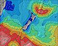 |  | ||||||||||||||
Onda Altezza (m) Direzione Periodo (s) | SSE 14 | SSE 14 | SSE 13 | SSE 13 | E 10 | E 10 | E 10 | E 10 | E 10 | E 10 | E 10 | E 10 | E 10 | E 11 | E 11 | E 10 | E 10 | E 10 | E 10 | E 10 | E 10 | E 10 | E 11 | E 11 |
Grafico delle onde | ||||||||||||||||||||||||
389 | 281 | 257 | 238 | 157 | 120 | 148 | 145 | 117 | 115 | 115 | 122 | 177 | 184 | 181 | 171 | 167 | 164 | 161 | 161 | 164 | 174 | 231 | 231 | |
Vento (km/h) | ||||||||||||||||||||||||
Stato del vento onshore cross-onshore cross-shore cross-offshore offshore piatto | cross-off | cross-off | glassy | off | glassy | glassy | cross-on | cross | cross-off | cross-off | off | cross-off | off | glassy | cross-on | cross | cross-off | cross-off | cross-off | cross-off | cross-off | cross-off | cross-off | cross-off |
Alta Marea | 5:25AM1.56m | 5:50PM1.71m | 6:08AM1.55m | 6:33PM1.69m | 6:51AM1.53m | |||||||||||||||||||
Basso Marea | 11:26PM0.37m | 11:33AM0.32m | 00:10AM0.36m | 12:17PM0.32m | 00:54AM0.35m | 1:01PM0.32m | ||||||||||||||||||
— | — | — | 8:00 | — | — | — | — | — | — | — | 7:58 | — | — | — | — | — | — | — | 7:58 | — | — | — | — | |
— | — | — | — | — | — | 5:01 | — | — | — | — | — | — | — | 5:02 | — | — | — | — | — | — | — | 5:04 | — | |
mm | — | — | — | — | — | — | — | — | — | — | — | — | — | — | — | — | — | — | — | — | — | — | — | — |
Temp. °C | 8 | 7 | 7 | 7 | 8 | 9 | 10 | 9 | 9 | 9 | 8 | 8 | 8 | 10 | 11 | 10 | 10 | 8 | 8 | 8 | 8 | 12 | 15 | 13 |
Gelo °C | 5 | 4 | 5 | 4 | 6 | 7 | 8 | 6 | 6 | 7 | 5 | 5 | 5 | 8 | 8 | 6 | 7 | 5 | 4 | 4 | 4 | 8 | 11 | 9 |
Onda 1 Altezza (m) Direzione Periodo (s) | SSE 14 | SSE 14 | SSE 13 | SSE 13 | E 10 | E 10 | E 10 | E 10 | E 10 | E 10 | E 10 | E 10 | E 10 | E 11 | E 11 | E 10 | E 10 | E 10 | E 10 | E 10 | E 10 | E 10 | E 11 | E 11 |
389 | 281 | 257 | 238 | 154 | 120 | 148 | 145 | 117 | 115 | 115 | 122 | 177 | 184 | 181 | 171 | 167 | 164 | 161 | 161 | 164 | 174 | 231 | 231 | |
Onda 2 Altezza (m) Direzione Periodo (s) | E 10 | E 10 | E 10 | E 10 | SSE 12 | SSE 11 | SSE 11 | SSE 10 | SSE 10 | S 10 | S 9 | SSE 9 | SSE 9 | SSE 9 | SSE 8 | SSE 8 | SSE 8 | S 7 | S 7 | S 7 | S 7 | S 15 | S 15 | S 14 |
122 | 122 | 122 | 122 | 157 | 97 | 90 | 63 | 55 | 48 | 44 | 26 | 26 | 15 | 13 | 12 | 6 | 4 | 4 | 1 | 1 | 4 | 4 | 4 | |
Onda 3 Altezza (m) Direzione Periodo (s) | ENE 5 | ENE 5 | E 5 | E 5 | SE 16 | ENE 5 | SSE 15 | SSE 15 | SE 15 | SE 15 | SSE 15 | ENE 5 | SSE 15 | SSE 15 | SSE 16 | SSE 15 | SE 15 | S 16 | S 16 | S 16 | S 15 | S 15 | — | — |
20 | 18 | 12 | 12 | 64 | 8 | 93 | 92 | 60 | 60 | 47 | 5 | 23 | 23 | 24 | 22 | 9 | 5 | 5 | 5 | 4 | 17 | — | — | |
onde vento Altezza (m) Direzione Periodo (s) | NE 5 | NE 5 | NE 5 | — | — | — | — | ENE 5 | — | — | — | — | — | — | — | NE 2 | — | — | — | NNW 2 | NNW 2 | — | NNE 7 | NE 7 |
37 | 31 | 25 | — | — | — | — | 8 | — | — | — | — | — | — | — | 1 | — | — | — | 1 | 1 | — | 5 | 2 | |
Il più vicino Offshore or Glassy | ||||||||||||||||||||||||
Distanza (km) | 0 | 0 | 0 | 0 | 0 | 0 | 1 | 1 | 0 | 0 | 0 | 0 | 0 | 0 | 1 | 1 | 0 | 0 | 0 | 0 | 0 | 0 | 20 | 0 |
Migliori previsioni per le condizioni d'onda in Canterbury | ||||||||||||||||||||||||
Migliori previsioni per le condizioni d'onda in New Zealand | ||||||||||||||||||||||||
Trova Onde Globale | ||||||||||||||||||||||||
- Map Icons:
 Break
Break Live Wave Height (m)
 Live Wind Speed (km/h)
 Surf Rating (10 Max)
 Ocean Swells (m)
- Wind Speed (km/h)
Widget Free Surf-Forecast.com per il tuo sito
La relazione di surf / widget meteo è disponibile qui sotto per incorporare su siti esterni a titolo gratuito e fornisce una sintesi delle nostre Fields previsione surf. Basta prendere il frammento di codice html da noi fornito e copiarlo nel proprio sito. È possibile scegliere la lingua preferita e unità metriche / imperiali per il feed delle previsioni surf per soddisfare le esigenze degli utenti del vostro sito .... Clicca qui per ottenere il codice.
 Nearest