
Previsioni:

Previsione a breve terminepioggia leggera (Totale 2mm), per lo più che cade giovedì notte. Warm (Max 26°C giovedì notte, Min 25°C mercoledì pomeriggio). Venti decrescenti (venti freschi da E mercoledì notte, calma per sabato mattina). | |||||||||||||||||||||
Mer 22 | Giovedì 23 | Venerdì 24 | |||||||||||||||||||
11 AM | 2 PM | 5 PM | 8 PM | 11 PM | 2 AM | 5 AM | 8 AM | 11 AM | 2 PM | 5 PM | 8 PM | 11 PM | 2 AM | 5 AM | 8 AM | 11 AM | 2 PM | 5 PM | 8 PM | 11 PM | |
Mappa dell'altezza del moto ondoso | 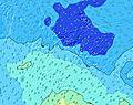 |  |  |  |  |  |  |  | |||||||||||||
Onda Altezza (m) Direzione Periodo (s) | SSW 19 | SSW 18 | SSW 18 | SSW 17 | SSW 17 | SSW 16 | SSW 16 | SSW 16 | SSW 16 | SSW 16 | SSW 16 | SSW 16 | SSW 15 | SSW 15 | SSW 15 | SSW 15 | SSW 15 | SSW 14 | SSW 14 | SSW 14 | SSW 14 |
Grafico delle onde | |||||||||||||||||||||
4134 | 3793 | 3820 | 3691 | 3606 | 3256 | 2907 | 2503 | 2271 | 2054 | 1780 | 1531 | 1323 | 1088 | 1074 | 936 | 773 | 763 | 651 | 651 | 642 | |
Vento (km/h) | |||||||||||||||||||||
Stato del vento onshore cross-onshore cross-shore cross-offshore offshore piatto | off | off | off | off | off | off | off | off | cross-off | cross-off | cross-off | cross-off | cross-off | cross-off | cross | cross-on | cross-on | cross-on | on | glassy | cross-on |
Alta Marea | 1:38PM0.12m | 1:06AM0.15m | 11:34AM0.13m | 00:22AM0.15m | 11:30AM0.15m | ||||||||||||||||
Basso Marea | 9:21AM0.11m | 5:55PM0.10m | 6:26AM0.10m | 5:52PM0.07m | 6:12AM0.08m | 6:06PM0.05m | |||||||||||||||
— | — | — | — | — | — | 6:31 | — | — | — | — | — | — | — | 6:31 | — | — | — | — | — | — | |
— | — | 5:49 | — | — | — | — | — | — | — | 5:49 | — | — | — | — | — | — | — | 5:49 | — | — | |
mm | — | — | — | — | — | — | — | — | — | — | — | — | 1 | — | 1 | — | — | — | — | — | — |
Temp. °C | 25 | 25 | 25 | 25 | 25 | 25 | 25 | 25 | 25 | 25 | 25 | 25 | 25 | 25 | 26 | 26 | 26 | 26 | 26 | 26 | 25 |
Gelo °C | 24 | 23 | 23 | 23 | 23 | 23 | 23 | 24 | 24 | 25 | 25 | 26 | 26 | 26 | 28 | 29 | 29 | 29 | 29 | 30 | 28 |
Onda 1 Altezza (m) Direzione Periodo (s) | SSW 19 | SSW 18 | SSW 18 | SSW 17 | SSW 17 | SSW 16 | SSW 16 | SSW 16 | SSW 16 | SSW 16 | SSW 16 | SSW 16 | SSW 15 | SSW 15 | SSW 15 | SSW 15 | SSW 15 | SSW 14 | SSW 14 | SSW 14 | SSW 14 |
4134 | 3793 | 3820 | 3691 | 3606 | 3256 | 2907 | 2503 | 2271 | 2054 | 1780 | 1531 | 1323 | 1088 | 1074 | 936 | 773 | 763 | 651 | 651 | 642 | |
Onda 2 Altezza (m) Direzione Periodo (s) | SSE 10 | SSE 10 | SSE 10 | SSE 10 | SSE 10 | SSE 10 | SSE 9 | SSE 9 | ESE 7 | SSE 9 | SSE 9 | E 7 | ENE 7 | ENE 7 | ENE 7 | ENE 7 | ENE 7 | ENE 7 | ENE 7 | ENE 7 | ENE 7 |
237 | 184 | 146 | 143 | 111 | 77 | 68 | 62 | 102 | 31 | 32 | 203 | 181 | 193 | 167 | 136 | 111 | 84 | 65 | 65 | 70 | |
Onda 3 Altezza (m) Direzione Periodo (s) | NNE 12 | NE 12 | — | — | NE 11 | N 9 | N 9 | N 9 | SSE 9 | N 8 | N 8 | N 8 | N 8 | NE 12 | NE 12 | SSE 15 | NE 11 | NNE 9 | NNE 9 | NNE 11 | NE 11 |
14 | 6 | — | — | 5 | 7 | 7 | 6 | 44 | 6 | 6 | 5 | 5 | 6 | 6 | 22 | 5 | 8 | 15 | 49 | 30 | |
onde vento Altezza (m) Direzione Periodo (s) | E 7 | E 7 | E 7 | E 7 | E 7 | E 7 | E 7 | E 7 | ENE 7 | E 7 | E 7 | — | — | — | — | — | — | — | — | — | — |
134 | 187 | 214 | 225 | 255 | 274 | 274 | 274 | 183 | 250 | 257 | — | — | — | — | — | — | — | — | — | — | |
Il più vicino Offshore or Glassy | |||||||||||||||||||||
Distanza (km) | 2111 | 2111 | 2111 | 2140 | 2140 | 2140 | 2597 | 2465 | 1042 | 1042 | 2465 | 49 | 49 | 1042 | 13 | 7 | 7 | 7 | 7 | 0 | 7 |
Migliori previsioni per le condizioni d'onda in Huahine | |||||||||||||||||||||
Migliori previsioni per le condizioni d'onda in French Polynesia | |||||||||||||||||||||
Trova Onde Globale | |||||||||||||||||||||
- Map Icons:
 Break
Break Live Wave Height (m)
 Live Wind Speed (km/h)
 Surf Rating (10 Max)
 Ocean Swells (m)
- Wind Speed (km/h)
Widget Free Surf-Forecast.com per il tuo sito
La relazione di surf / widget meteo è disponibile qui sotto per incorporare su siti esterni a titolo gratuito e fornisce una sintesi delle nostre Fitii previsione surf. Basta prendere il frammento di codice html da noi fornito e copiarlo nel proprio sito. È possibile scegliere la lingua preferita e unità metriche / imperiali per il feed delle previsioni surf per soddisfare le esigenze degli utenti del vostro sito .... Clicca qui per ottenere il codice.
 Nearest