
Previsioni:

Previsione a breve termineQualche pioggerella, più pesante durante domenica mattina. Warm (Max 22°C martedì pomeriggio, Min 13°C Domenica mattina). Vento sarà generalmente leggero. | ||||||||||||||||||||||
Domenica 2 | Lunedì 3 | Martedì 4 | ||||||||||||||||||||
8 AM | 11 AM | 2 PM | 5 PM | 8 PM | 11 PM | 2 AM | 5 AM | 8 AM | 11 AM | 2 PM | 5 PM | 8 PM | 11 PM | 2 AM | 5 AM | 8 AM | 11 AM | 2 PM | 5 PM | 8 PM | 11 PM | |
Mappa dell'altezza del moto ondoso | 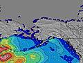 | 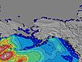 | 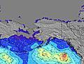 | 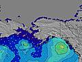 | 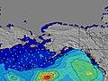 | 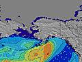 | 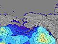 | 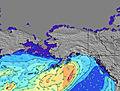 | ||||||||||||||
Onda Altezza (m) Direzione Periodo (s) | W 8 | W 9 | W 9 | W 9 | W 8 | W 8 | W 8 | W 7 | W 7 | W 7 | W 7 | W 7 | W 7 | W 7 | W 7 | W 7 | W 7 | W 7 | W 7 | W 9 | W 9 | W 9 |
Grafico delle onde | ||||||||||||||||||||||
239 | 281 | 275 | 220 | 169 | 161 | 144 | 130 | 130 | 104 | 85 | 65 | 48 | 47 | 44 | 58 | 62 | 64 | 51 | 99 | 96 | 96 | |
Vento (km/h) | ||||||||||||||||||||||
Stato del vento onshore cross-onshore cross-shore cross-offshore offshore piatto | cross-on | on | on | on | on | on | on | glassy | glassy | cross-on | cross-on | on | cross-on | on | cross-on | cross-on | cross-on | cross-on | cross-on | cross-on | cross-on | on |
Alta Marea | 6:36AM1.70m | 8:07PM2.34m | 7:43AM1.60m | 8:30PM2.35m | 9:04AM1.54m | 8:53PM2.37m | ||||||||||||||||
Basso Marea | 12:39PM0.17m | 1:57AM0.86m | 1:12PM0.52m | 2:44AM0.59m | 1:45PM0.92m | |||||||||||||||||
5:47 | — | — | — | — | — | — | 5:48 | — | — | — | — | — | — | — | 5:50 | — | — | — | — | — | — | |
— | — | — | — | 8:45 | — | — | — | — | — | — | — | 8:45 | — | — | — | — | — | — | — | 8:43 | — | |
mm | 1 | — | — | — | — | — | — | — | — | — | — | — | — | — | — | — | — | — | — | — | — | — |
Temp. °C | 13 | 14 | 15 | 16 | 16 | 15 | 14 | 14 | 13 | 14 | 17 | 20 | 18 | 18 | 17 | 17 | 15 | 17 | 20 | 22 | 20 | 20 |
Gelo °C | 12 | 12 | 12 | 12 | 11 | 11 | 12 | 13 | 12 | 12 | 14 | 17 | 14 | 14 | 15 | 15 | 13 | 15 | 18 | 20 | 17 | 17 |
Onda 1 Altezza (m) Direzione Periodo (s) | W 8 | W 9 | W 9 | W 9 | W 8 | W 8 | W 8 | W 7 | W 7 | W 7 | W 7 | W 7 | W 7 | W 7 | W 7 | W 7 | W 7 | W 7 | W 7 | W 9 | W 9 | W 9 |
239 | 281 | 275 | 220 | 169 | 161 | 144 | 130 | 130 | 104 | 85 | 65 | 48 | 47 | 44 | 58 | 62 | 64 | 51 | 99 | 96 | 96 | |
Onda 2 Altezza (m) Direzione Periodo (s) | SW 14 | SW 14 | SW 14 | SW 13 | SW 13 | SW 13 | SW 13 | SW 13 | SW 13 | SW 13 | SW 13 | SW 13 | SW 13 | SW 13 | SSW 13 | WSW 16 | WSW 16 | WNW 10 | WNW 9 | WSW 16 | WSW 16 | WSW 16 |
29 | 29 | 29 | 28 | 28 | 28 | 28 | 28 | 28 | 28 | 28 | 27 | 27 | 27 | 17 | 25 | 25 | 9 | 28 | 25 | 25 | 24 | |
Onda 3 Altezza (m) Direzione Periodo (s) | SW 19 | SW 19 | SW 19 | W 19 | — | SW 18 | SW 18 | WSW 18 | WSW 18 | WSW 18 | SW 18 | SW 18 | SW 17 | SW 16 | WSW 16 | SW 13 | SW 13 | WSW 16 | WSW 16 | SW 13 | SW 12 | SW 12 |
15 | 15 | 15 | 7 | — | 12 | 12 | 31 | 31 | 31 | 12 | 12 | 12 | 11 | 26 | 7 | 7 | 25 | 25 | 6 | 6 | 6 | |
onde vento Altezza (m) Direzione Periodo (s) | — | — | — | — | — | — | — | — | — | — | — | — | — | — | — | — | — | — | — | — | — | — |
— | — | — | — | — | — | — | — | — | — | — | — | — | — | — | — | — | — | — | — | — | — | |
Il più vicino Offshore or Glassy | ||||||||||||||||||||||
Distanza (km) | 75 | 98 | 1148 | 1556 | 1148 | 60 | 60 | 60 | 89 | 101 | 89 | 89 | 811 | 89 | 89 | 89 | 89 | 101 | 89 | 89 | 101 | 89 |
Migliori previsioni per le condizioni d'onda in Washington State | ||||||||||||||||||||||
Migliori previsioni per le condizioni d'onda in United States | ||||||||||||||||||||||
Trova Onde Globale | ||||||||||||||||||||||
- Map Icons:
 Break
Break Live Wave Height (m)
 Live Wind Speed (km/h)
 Surf Rating (10 Max)
 Ocean Swells (m)
- Wind Speed (km/h)
Widget Free Surf-Forecast.com per il tuo sito
La relazione di surf / widget meteo è disponibile qui sotto per incorporare su siti esterni a titolo gratuito e fornisce una sintesi delle nostre Fort. Ebey previsione surf. Basta prendere il frammento di codice html da noi fornito e copiarlo nel proprio sito. È possibile scegliere la lingua preferita e unità metriche / imperiali per il feed delle previsioni surf per soddisfare le esigenze degli utenti del vostro sito .... Clicca qui per ottenere il codice.
 Nearest