
Previsioni:

Previsione a breve termineQualche pioggerella, più pesante durante venerdì notte. Warm (Max 28°C Sabato pomeriggio, Min 27°C Venerdì notte). Principalmente venti freschi. | |||||||||||||||||||
Ven 31 | Sabato 1 | Domenica 2 | |||||||||||||||||
5 PM | 8 PM | 11 PM | 2 AM | 5 AM | 8 AM | 11 AM | 2 PM | 5 PM | 8 PM | 11 PM | 2 AM | 5 AM | 8 AM | 11 AM | 2 PM | 5 PM | 8 PM | 11 PM | |
Mappa dell'altezza del moto ondoso |  | 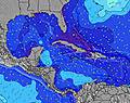 | 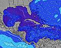 | 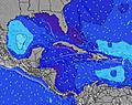 | 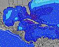 | 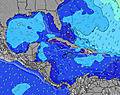 | 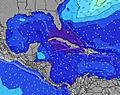 | ||||||||||||
Onda Altezza (m) Direzione Periodo (s) | N 6 | E 8 | E 8 | E 6 | NE 8 | NE 9 | E 8 | NE 8 | E 8 | E 8 | E 8 | E 8 | E 8 | E 8 | E 8 | E 8 | E 8 | E 6 | E 6 |
Grafico delle onde | |||||||||||||||||||
1 | 0 | 0 | 0 | 11 | 3 | 0 | 11 | 0 | 0 | 0 | 0 | 0 | 0 | 0 | 0 | 0 | 0 | 0 | |
Vento (km/h) | |||||||||||||||||||
Stato del vento onshore cross-onshore cross-shore cross-offshore offshore piatto | cross-off | cross-off | cross-off | cross-off | cross-off | cross-off | cross-off | cross-off | cross-off | cross-off | cross-off | cross-off | off | cross-off | cross-off | cross-off | cross-off | cross-off | cross-off |
Alta Marea | 10:09PM0.79m | 10:28AM0.67m | 10:44PM0.76m | 11:12AM0.70m | |||||||||||||||
Basso Marea | 3:40PM0.15m | 4:30AM0.17m | 4:25PM0.17m | 5:03AM0.16m | 5:13PM0.19m | ||||||||||||||
— | — | — | — | 6:20 | — | — | — | — | — | — | — | 6:20 | — | — | — | — | — | — | |
7:29 | — | — | — | — | — | — | — | 7:28 | — | — | — | — | — | — | — | 7:28 | — | — | |
mm | — | — | — | — | 1 | — | — | — | — | — | — | — | — | — | — | — | — | — | — |
Temp. °C | 28 | 27 | 27 | 27 | 27 | 27 | 27 | 27 | 28 | 28 | 27 | 27 | 27 | 28 | 27 | 28 | 28 | 27 | 28 |
Gelo °C | 28 | 26 | 25 | 26 | 26 | 26 | 26 | 26 | 28 | 27 | 26 | 26 | 26 | 28 | 26 | 28 | 27 | 26 | 27 |
Onda 1 Altezza (m) Direzione Periodo (s) | N 6 | — | — | SSE 5 | NE 8 | NE 9 | — | NE 8 | NE 8 | — | — | — | — | — | — | — | S 5 | — | — |
1 | — | — | 10 | 11 | 3 | — | 11 | 16 | — | — | — | — | — | — | — | 2 | — | — | |
Onda 2 Altezza (m) Direzione Periodo (s) | N 6 | — | — | — | — | — | — | ENE 7 | — | — | — | — | — | — | — | — | — | — | — |
1 | — | — | — | — | — | — | 5 | — | — | — | — | — | — | — | — | — | — | — | |
Onda 3 Altezza (m) Direzione Periodo (s) | — | — | — | — | — | — | — | — | — | — | — | — | — | — | — | — | — | — | — |
— | — | — | — | — | — | — | — | — | — | — | — | — | — | — | — | — | — | — | |
onde vento Altezza (m) Direzione Periodo (s) | E 8 | E 8 | E 8 | E 6 | E 6 | E 6 | E 8 | E 8 | E 8 | E 8 | E 8 | E 8 | E 8 | E 8 | E 8 | E 8 | E 8 | E 6 | E 6 |
185 | 219 | 253 | 134 | 149 | 170 | 255 | 228 | 234 | 240 | 270 | 255 | 256 | 223 | 223 | 193 | 217 | 121 | 148 | |
Il più vicino Offshore or Glassy | |||||||||||||||||||
Distanza (km) | 548 | 593 | 273 | 267 | 267 | 267 | 1183 | 528 | 528 | 590 | 288 | 267 | 267 | 267 | 777 | 777 | 738 | 977 | 267 |
Migliori previsioni per le condizioni d'onda in Turks-and-Caicos-Islands | |||||||||||||||||||
Migliori previsioni per le condizioni d'onda in Turks and Caicos Islands | |||||||||||||||||||
Trova Onde Globale | |||||||||||||||||||
- Map Icons:
 Break
Break Live Wave Height (m)
 Live Wind Speed (km/h)
 Surf Rating (10 Max)
 Ocean Swells (m)
- Wind Speed (km/h)
Widget Free Surf-Forecast.com per il tuo sito
La relazione di surf / widget meteo è disponibile qui sotto per incorporare su siti esterni a titolo gratuito e fornisce una sintesi delle nostre Fort George Cut (Pine Cay) previsione surf. Basta prendere il frammento di codice html da noi fornito e copiarlo nel proprio sito. È possibile scegliere la lingua preferita e unità metriche / imperiali per il feed delle previsioni surf per soddisfare le esigenze degli utenti del vostro sito .... Clicca qui per ottenere il codice.
 Nearest