
Previsioni:

Previsione a breve termineper lo più asciutto. Warm (Max 26°C Lunedì mattina, Min 18°C Sabato notte). Venti decrescenti (venti freschi da N Sabato notte, calma per lunedì mattina). | ||||||||||||||||||||||||
Domenica 26 | Lunedì 27 | Martedì 28 | ||||||||||||||||||||||
1 AM | 4 AM | 7 AM | 10 AM | 1 PM | 4 PM | 7 PM | 10 PM | 1 AM | 4 AM | 7 AM | 10 AM | 1 PM | 4 PM | 7 PM | 10 PM | 1 AM | 4 AM | 7 AM | 10 AM | 1 PM | 4 PM | 7 PM | 10 PM | |
Mappa dell'altezza del moto ondoso |  | 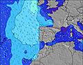 |  |  | 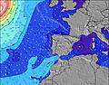 |  |  | 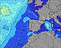 |  | |||||||||||||||
Onda Altezza (m) Direzione Periodo (s) | NNW 7 | NNW 7 | NNW 7 | NNW 7 | NNW 7 | NNW 7 | NNW 7 | NNW 7 | NNW 7 | NNW 7 | NNW 7 | NNW 7 | NNW 7 | NNW 10 | NNW 10 | NNW 10 | NNW 10 | NNW 11 | NNW 10 | NNW 10 | NNW 10 | NNW 10 | NNW 10 | NW 10 |
Grafico delle onde | ||||||||||||||||||||||||
241 | 277 | 321 | 330 | 233 | 227 | 214 | 189 | 166 | 149 | 145 | 145 | 124 | 123 | 353 | 319 | 367 | 397 | 374 | 360 | 308 | 261 | 256 | 211 | |
Vento (km/h) | ||||||||||||||||||||||||
Stato del vento onshore cross-onshore cross-shore cross-offshore offshore piatto | cross-on | cross-on | cross-on | cross-on | cross-on | cross-on | cross-on | cross-on | cross-on | cross-on | cross | glassy | cross-on | cross-on | on | on | glassy | glassy | glassy | on | cross-on | on | cross-on | cross-on |
Alta Marea | 1:31AM2.13m | 1:50PM2.35m | 2:16AM2.25m | 2:32PM2.49m | 2:55AM2.36m | 3:10PM2.63m | ||||||||||||||||||
Basso Marea | 7:33AM0.84m | 8:08PM0.71m | 8:16AM0.71m | 8:48PM0.57m | 8:54AM0.57m | 9:24PM0.45m | ||||||||||||||||||
— | 6:30 | — | — | — | — | — | — | — | 6:31 | — | — | — | — | — | — | — | 6:31 | — | — | — | — | — | — | |
— | — | — | — | — | — | 8:54 | — | — | — | — | — | — | — | 8:53 | — | — | — | — | — | — | — | 8:52 | — | |
mm | — | — | — | — | — | — | — | — | — | — | — | — | — | — | — | — | — | — | — | — | — | — | — | — |
Temp. °C | 18 | 18 | 18 | 19 | 20 | 20 | 19 | 18 | 18 | 18 | 19 | 24 | 26 | 23 | 22 | 21 | 21 | 20 | 20 | 22 | 23 | 22 | 21 | 19 |
Gelo °C | 14 | 15 | 15 | 16 | 17 | 17 | 16 | 16 | 17 | 19 | 21 | 26 | 25 | 23 | 23 | 23 | 23 | 22 | 22 | 24 | 23 | 22 | 21 | 20 |
Onda 1 Altezza (m) Direzione Periodo (s) | WNW 10 | WNW 10 | WNW 9 | WNW 9 | WNW 9 | WNW 9 | WNW 9 | WNW 9 | WNW 9 | NNW 7 | NNW 7 | NNW 7 | NNW 7 | NNW 7 | NNW 10 | NNW 10 | NNW 10 | NNW 11 | NNW 10 | NNW 10 | NNW 10 | NNW 10 | NNW 10 | NW 10 |
10 | 10 | 17 | 17 | 16 | 16 | 31 | 26 | 26 | 149 | 145 | 145 | 124 | 102 | 353 | 319 | 367 | 397 | 374 | 360 | 308 | 261 | 256 | 211 | |
Onda 2 Altezza (m) Direzione Periodo (s) | — | — | — | — | — | N 13 | NW 12 | NNW 14 | NNW 13 | WNW 9 | NNW 12 | NNW 12 | NNW 11 | NNW 10 | WNW 9 | WNW 8 | WNW 9 | WNW 9 | WNW 8 | WNW 8 | WNW 8 | WNW 8 | WNW 8 | WNW 8 |
— | — | — | — | — | 3 | 6 | 19 | 17 | 25 | 57 | 90 | 107 | 123 | 15 | 14 | 15 | 15 | 13 | 13 | 13 | 13 | 13 | 6 | |
Onda 3 Altezza (m) Direzione Periodo (s) | — | — | — | — | — | — | N 15 | — | — | NW 13 | WNW 9 | WNW 9 | WNW 9 | WNW 9 | — | — | — | W 13 | W 13 | W 13 | W 12 | W 12 | W 12 | WNW 12 |
— | — | — | — | — | — | 4 | — | — | 42 | 26 | 15 | 26 | 15 | — | — | — | 3 | 3 | 3 | 3 | 3 | 11 | 13 | |
onde vento Altezza (m) Direzione Periodo (s) | NNW 7 | NNW 7 | NNW 7 | NNW 7 | NNW 7 | NNW 7 | NNW 7 | NNW 7 | NNW 7 | — | — | — | — | WNW 5 | — | — | — | — | — | — | — | — | — | — |
241 | 277 | 321 | 330 | 233 | 227 | 214 | 189 | 166 | — | — | — | — | 7 | — | — | — | — | — | — | — | — | — | — | |
Il più vicino Offshore or Glassy | ||||||||||||||||||||||||
Distanza (km) | 212 | 96 | 118 | 168 | 1031 | 545 | 524 | 86 | 86 | 17 | 17 | 0 | 15 | 270 | 47 | 17 | 0 | 0 | 0 | 17 | 270 | 270 | 86 | 17 |
Migliori previsioni per le condizioni d'onda in Peniche | ||||||||||||||||||||||||
Migliori previsioni per le condizioni d'onda in Portugal | ||||||||||||||||||||||||
Trova Onde Globale | ||||||||||||||||||||||||
- Map Icons:
 Break
Break Live Wave Height (m)
 Live Wind Speed (km/h)
 Surf Rating (10 Max)
 Ocean Swells (m)
- Wind Speed (km/h)
Widget Free Surf-Forecast.com per il tuo sito
La relazione di surf / widget meteo è disponibile qui sotto per incorporare su siti esterni a titolo gratuito e fornisce una sintesi delle nostre Foz do Arelho previsione surf. Basta prendere il frammento di codice html da noi fornito e copiarlo nel proprio sito. È possibile scegliere la lingua preferita e unità metriche / imperiali per il feed delle previsioni surf per soddisfare le esigenze degli utenti del vostro sito .... Clicca qui per ottenere il codice.
 Nearest