
Previsioni:

Previsione a breve terminePioggia abbondante (Totale 49mm), più pesante durante mercoledì notte. Warm (Max 29°C giovedì pomeriggio, Min 26°C giovedì notte). Vento sarà generalmente leggero. | ||||||||||||||||||||||||
Mer 15 | Giovedì 16 | Venerdì 17 | 18 | |||||||||||||||||||||
11 AM | 2 PM | 5 PM | 8 PM | 11 PM | 2 AM | 5 AM | 8 AM | 11 AM | 2 PM | 5 PM | 8 PM | 11 PM | 2 AM | 5 AM | 8 AM | 11 AM | 2 PM | 5 PM | 8 PM | 11 PM | 2 AM | 5 AM | 8 AM | |
Mappa dell'altezza del moto ondoso | 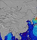 | 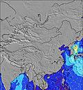 | 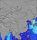 | 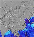 | 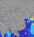 | 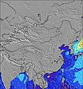 | 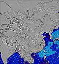 | 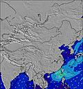 | 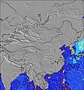 | |||||||||||||||
Onda Altezza (m) Direzione Periodo (s) | S 8 | S 8 | S 8 | S 8 | S 8 | S 8 | S 8 | S 8 | S 8 | S 8 | S 8 | S 8 | S 8 | S 8 | S 8 | S 8 | E 10 | E 10 | E 9 | E 9 | E 9 | E 9 | E 9 | E 8 |
Grafico delle onde | ||||||||||||||||||||||||
0 | 0 | 0 | 0 | 0 | 0 | 0 | 0 | 0 | 0 | 0 | 0 | 0 | 0 | 0 | 0 | 2 | 2 | 2 | 2 | 2 | 2 | 1 | 1 | |
Vento (km/h) | ||||||||||||||||||||||||
Stato del vento onshore cross-onshore cross-shore cross-offshore offshore piatto | cross | cross-on | cross-on | cross-on | cross-on | cross | cross-on | cross-on | cross-on | cross-on | cross-on | cross-on | cross-on | cross-on | cross | cross | cross | cross | cross | cross | cross | glassy | glassy | glassy |
Alta Marea | 00:03AM0.82m | 9:15AM2.00m | 00:40AM0.85m | 10:01AM1.87m | 1:15AM0.91m | |||||||||||||||||||
Basso Marea | 4:19PM-0.11m | 2:34AM0.70m | 5:01PM-0.04m | 3:32AM0.68m | 5:39PM0.06m | 4:33AM0.68m | ||||||||||||||||||
— | — | — | — | — | — | 5:47 | — | — | — | — | — | — | — | 5:47 | — | — | — | — | — | — | — | 5:48 | — | |
— | — | 7:08 | — | — | — | — | — | — | — | 7:08 | — | — | — | — | — | — | — | 7:08 | — | — | — | — | 7:08 | |
mm | 4 | 3 | 3 | 3 | 1 | 3 | 5 | 5 | 1 | — | — | 1 | 2 | 3 | 4 | 5 | 5 | 1 | 1 | — | 1 | 1 | 1 | — |
Temp. °C | 27 | 27 | 27 | 27 | 27 | 27 | 27 | 27 | 28 | 29 | 29 | 27 | 27 | 27 | 26 | 27 | 28 | 29 | 29 | 28 | 27 | 27 | 27 | 28 |
Gelo °C | 29 | 30 | 29 | 28 | 29 | 30 | 30 | 30 | 31 | 30 | 31 | 29 | 30 | 30 | 29 | 30 | 30 | 31 | 31 | 32 | 31 | 32 | 32 | 33 |
Onda 1 Altezza (m) Direzione Periodo (s) | — | SSE 8 | — | — | — | — | — | S 8 | S 8 | S 8 | — | — | S 7 | S 7 | S 8 | S 8 | E 10 | E 10 | E 9 | E 9 | S 8 | S 8 | S 8 | S 8 |
— | 262 | — | — | — | — | — | 263 | 196 | 228 | — | — | 108 | 108 | 111 | 135 | 2 | 2 | 2 | 2 | 111 | 114 | 117 | 95 | |
Onda 2 Altezza (m) Direzione Periodo (s) | — | — | — | — | — | — | — | — | — | — | — | — | — | — | — | — | — | — | — | — | E 9 | E 9 | E 9 | E 8 |
— | — | — | — | — | — | — | — | — | — | — | — | — | — | — | — | — | — | — | — | 2 | 2 | 1 | 1 | |
Onda 3 Altezza (m) Direzione Periodo (s) | — | — | — | — | — | — | — | — | — | — | — | — | — | — | — | — | — | — | — | — | — | — | — | — |
— | — | — | — | — | — | — | — | — | — | — | — | — | — | — | — | — | — | — | — | — | — | — | — | |
onde vento Altezza (m) Direzione Periodo (s) | S 8 | S 8 | S 8 | S 8 | S 8 | S 8 | S 8 | S 8 | S 8 | S 8 | S 8 | S 8 | S 8 | S 8 | S 8 | S 8 | S 8 | S 7 | S 7 | S 7 | S 8 | — | — | — |
309 | 298 | 228 | 373 | 277 | 203 | 173 | 169 | 142 | 138 | 135 | 135 | 253 | 253 | 329 | 217 | 159 | 155 | 155 | 130 | 292 | — | — | — | |
Il più vicino Offshore or Glassy | ||||||||||||||||||||||||
Distanza (km) | 671 | 1975 | 671 | 604 | 671 | 671 | 657 | 669 | 671 | 1435 | 1435 | 813 | 847 | 813 | 604 | 813 | 1435 | 1056 | 813 | 813 | 22 | 22 | 18 | 18 |
Migliori previsioni per le condizioni d'onda in Hong Kong | ||||||||||||||||||||||||
Migliori previsioni per le condizioni d'onda in China | ||||||||||||||||||||||||
Trova Onde Globale | ||||||||||||||||||||||||
- Map Icons:
 Break
Break Live Wave Height (m)
 Live Wind Speed (km/h)
 Surf Rating (10 Max)
 Ocean Swells (m)
- Wind Speed (km/h)
Widget Free Surf-Forecast.com per il tuo sito
La relazione di surf / widget meteo è disponibile qui sotto per incorporare su siti esterni a titolo gratuito e fornisce una sintesi delle nostre Fung Bay previsione surf. Basta prendere il frammento di codice html da noi fornito e copiarlo nel proprio sito. È possibile scegliere la lingua preferita e unità metriche / imperiali per il feed delle previsioni surf per soddisfare le esigenze degli utenti del vostro sito .... Clicca qui per ottenere il codice.
 Nearest