
Previsioni:

Previsione a breve termineper lo più asciutto. Warm (Max 28°C martedì notte, Min 27°C martedì notte). Vento sarà generalmente leggero. | ||||||||||||||||||||||||
Mar 14 | Mercoledì 15 | Giovedì 16 | Venerdì 17 | |||||||||||||||||||||
8 PM | 11 PM | 2 AM | 5 AM | 8 AM | 11 AM | 2 PM | 5 PM | 8 PM | 11 PM | 2 AM | 5 AM | 8 AM | 11 AM | 2 PM | 5 PM | 8 PM | 11 PM | 2 AM | 5 AM | 8 AM | 11 AM | 2 PM | 5 PM | |
Mappa dell'altezza del moto ondoso |  | 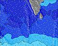 | 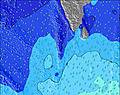 | 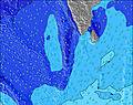 | 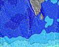 | 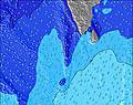 | 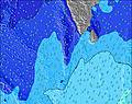 | 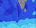 | 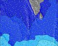 | |||||||||||||||
Onda Altezza (m) Direzione Periodo (s) | S 11 | SSW 15 | SW 15 | SW 15 | SW 16 | SW 16 | SW 16 | SW 15 | SW 15 | SW 14 | SW 14 | SW 14 | SW 14 | SW 14 | SW 14 | SW 14 | SW 14 | SW 14 | SW 14 | SW 14 | SSE 10 | SW 14 | SW 14 | SW 14 |
Grafico delle onde | ||||||||||||||||||||||||
281 | 451 | 269 | 273 | 358 | 362 | 362 | 314 | 309 | 305 | 305 | 305 | 288 | 241 | 245 | 248 | 305 | 305 | 251 | 238 | 214 | 197 | 191 | 200 | |
Vento (km/h) | ||||||||||||||||||||||||
Stato del vento onshore cross-onshore cross-shore cross-offshore offshore piatto | cross-off | cross-off | cross-off | cross-off | cross-off | cross-off | cross-off | off | cross-off | off | off | off | cross-off | cross-off | off | off | cross-off | cross-off | cross-off | cross-off | cross-off | cross-off | cross-off | cross-off |
Alta Marea | 1:07AM0.66m | 2:08PM0.97m | 1:56AM0.71m | 2:40PM0.97m | 2:43AM0.75m | 3:10PM0.95m | ||||||||||||||||||
Basso Marea | 7:53PM0.29m | 7:13AM0.03m | 8:24PM0.24m | 7:56AM0.06m | 8:56PM0.20m | 8:35AM0.11m | ||||||||||||||||||
— | — | — | 6:01 | — | — | — | — | — | — | — | 6:01 | — | — | — | — | — | — | — | 6:01 | — | — | — | — | |
— | — | — | — | — | — | — | 6:22 | — | — | — | — | — | — | — | 6:22 | — | — | — | — | — | — | — | 6:22 | |
mm | — | — | — | — | — | — | — | — | — | — | — | — | — | — | — | — | — | — | — | — | — | — | — | — |
Temp. °C | 28 | 28 | 27 | 27 | 27 | 27 | 28 | 28 | 28 | 27 | 27 | 27 | 27 | 27 | 27 | 27 | 27 | 27 | 27 | 27 | 27 | 27 | 27 | 27 |
Gelo °C | 30 | 30 | 28 | 28 | 28 | 28 | 30 | 29 | 29 | 28 | 29 | 29 | 29 | 29 | 28 | 29 | 29 | 29 | 29 | 28 | 29 | 29 | 29 | 28 |
Onda 1 Altezza (m) Direzione Periodo (s) | S 11 | S 11 | S 10 | S 10 | S 10 | SSE 10 | S 10 | SSE 10 | SSE 10 | SSE 10 | SSE 10 | SSE 10 | SSE 10 | SSE 10 | SSE 10 | SSE 10 | SSE 10 | SSE 10 | SSE 10 | SSE 10 | SSE 10 | SSE 9 | SSE 9 | SSE 9 |
281 | 229 | 221 | 221 | 212 | 218 | 216 | 236 | 236 | 222 | 218 | 218 | 214 | 223 | 223 | 218 | 218 | 214 | 214 | 179 | 214 | 164 | 149 | 143 | |
Onda 2 Altezza (m) Direzione Periodo (s) | NW 7 | SSW 15 | NW 7 | NW 7 | NW 7 | SW 16 | SW 16 | SW 15 | SW 15 | SW 14 | SW 14 | SW 14 | SW 14 | SW 14 | SW 14 | SW 14 | SW 14 | SW 14 | SW 14 | SW 14 | SW 14 | WNW 10 | WNW 10 | WNW 10 |
65 | 451 | 67 | 67 | 67 | 362 | 362 | 314 | 309 | 305 | 305 | 305 | 288 | 241 | 245 | 248 | 305 | 305 | 251 | 238 | 197 | 122 | 122 | 148 | |
Onda 3 Altezza (m) Direzione Periodo (s) | SW 16 | NW 7 | SW 15 | SW 15 | SW 16 | NW 7 | NW 7 | NW 7 | NW 7 | NW 7 | NW 7 | NW 7 | NW 7 | NW 7 | NW 7 | NW 7 | NW 7 | NW 9 | NW 9 | NW 9 | NW 10 | SW 14 | SW 14 | SW 14 |
255 | 65 | 269 | 273 | 358 | 67 | 55 | 55 | 55 | 45 | 38 | 57 | 49 | 49 | 49 | 49 | 49 | 84 | 86 | 90 | 96 | 197 | 191 | 200 | |
onde vento Altezza (m) Direzione Periodo (s) | W 6 | — | — | — | — | — | — | — | — | — | — | — | — | — | — | WNW 2 | WNW 3 | — | W 2 | W 3 | W 3 | W 3 | — | WSW 3 |
20 | — | — | — | — | — | — | — | — | — | — | — | — | — | — | 1 | 1 | — | 1 | 1 | 1 | 1 | — | 1 | |
Il più vicino Offshore or Glassy | ||||||||||||||||||||||||
Distanza (km) | 247 | 247 | 247 | 247 | 247 | 247 | 247 | 0 | 10 | 0 | 0 | 0 | 0 | 0 | 0 | 0 | 0 | 0 | 0 | 247 | 0 | 30 | 247 | 247 |
Migliori previsioni per le condizioni d'onda in North Male Atoll | ||||||||||||||||||||||||
Migliori previsioni per le condizioni d'onda in Maldives | ||||||||||||||||||||||||
Trova Onde Globale | ||||||||||||||||||||||||
- Map Icons:
 Break
Break Live Wave Height (m)
 Live Wind Speed (km/h)
 Surf Rating (10 Max)
 Ocean Swells (m)
- Wind Speed (km/h)
Widget Free Surf-Forecast.com per il tuo sito
La relazione di surf / widget meteo è disponibile qui sotto per incorporare su siti esterni a titolo gratuito e fornisce una sintesi delle nostre Furana previsione surf. Basta prendere il frammento di codice html da noi fornito e copiarlo nel proprio sito. È possibile scegliere la lingua preferita e unità metriche / imperiali per il feed delle previsioni surf per soddisfare le esigenze degli utenti del vostro sito .... Clicca qui per ottenere il codice.
 Nearest