
Previsioni:

Previsione a breve terminePioggia abbondante (Totale 25mm), più pesante durante lunedì notte. Warm (Max 30°C Domenica mattina, Min 28°C Sabato mattina). Vento sarà generalmente leggero. | |||||||||||||||||||||||
Sabato 25 | Domenica 26 | Lunedì 27 | |||||||||||||||||||||
5 AM | 8 AM | 11 AM | 2 PM | 5 PM | 8 PM | 11 PM | 2 AM | 5 AM | 8 AM | 11 AM | 2 PM | 5 PM | 8 PM | 11 PM | 2 AM | 5 AM | 8 AM | 11 AM | 2 PM | 5 PM | 8 PM | 11 PM | |
Mappa dell'altezza del moto ondoso |  | 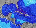 | 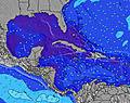 | 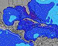 | 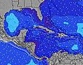 | 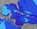 | 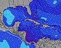 | 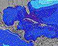 | 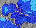 | ||||||||||||||
Onda Altezza (m) Direzione Periodo (s) | E 8 | E 8 | E 8 | E 8 | E 8 | E 8 | E 8 | E 8 | E 8 | E 8 | E 8 | E 8 | E 8 | E 8 | ESE 8 | E 8 | E 8 | E 8 | E 8 | E 8 | E 8 | E 8 | ESE 8 |
Grafico delle onde | |||||||||||||||||||||||
142 | 115 | 115 | 90 | 90 | 93 | 95 | 99 | 100 | 98 | 76 | 76 | 76 | 76 | 81 | 60 | 60 | 60 | 60 | 45 | 46 | 46 | 67 | |
Vento (km/h) | |||||||||||||||||||||||
Stato del vento onshore cross-onshore cross-shore cross-offshore offshore piatto | cross-on | cross-on | cross-on | cross-on | cross-on | cross-on | cross-on | cross | cross | cross | cross | cross-off | cross-off | cross | cross | cross | cross | cross | cross-off | cross-off | cross-off | cross | cross |
Alta Marea | 5:09AM0.61m | 5:58PM0.92m | 5:58AM0.62m | 6:43PM0.94m | 6:45AM0.64m | 7:25PM0.96m | |||||||||||||||||
Basso Marea | 11:00AM0.18m | 00:29AM0.27m | 11:47AM0.17m | 1:13AM0.26m | 12:33PM0.15m | ||||||||||||||||||
6:28 | — | — | — | — | — | — | — | 6:28 | — | — | — | — | — | — | — | 6:30 | — | — | — | — | — | — | |
— | — | — | — | 7:59 | — | — | — | — | — | — | — | 7:58 | — | — | — | — | — | — | — | 7:58 | — | — | |
mm | — | — | 1 | 1 | 2 | 1 | — | — | — | — | — | 3 | 3 | — | — | 1 | — | 2 | 3 | — | — | — | — |
Temp. °C | 28 | 28 | 28 | 28 | 29 | 29 | 28 | 28 | 28 | 28 | 29 | 30 | 30 | 30 | 28 | 28 | 28 | 28 | 30 | 30 | 30 | 29 | 28 |
Gelo °C | 32 | 31 | 30 | 30 | 33 | 33 | 31 | 31 | 30 | 31 | 31 | 32 | 33 | 33 | 29 | 30 | 30 | 30 | 31 | 31 | 31 | 31 | 29 |
Onda 1 Altezza (m) Direzione Periodo (s) | E 8 | E 8 | E 8 | E 8 | E 8 | E 8 | E 8 | E 8 | E 8 | E 8 | E 8 | E 8 | E 8 | E 8 | ESE 8 | E 8 | E 8 | E 8 | E 8 | E 8 | E 8 | E 8 | ESE 8 |
142 | 115 | 115 | 90 | 90 | 93 | 95 | 99 | 100 | 98 | 76 | 76 | 76 | 76 | 81 | 60 | 60 | 60 | 60 | 45 | 46 | 46 | 67 | |
Onda 2 Altezza (m) Direzione Periodo (s) | — | — | — | — | — | — | — | — | — | — | — | — | — | — | N 6 | N 6 | N 6 | N 6 | N 6 | SSE 4 | SE 4 | SE 4 | N 7 |
— | — | — | — | — | — | — | — | — | — | — | — | — | — | 1 | 1 | 1 | 1 | 1 | 3 | 3 | 3 | 1 | |
Onda 3 Altezza (m) Direzione Periodo (s) | — | — | — | — | — | — | — | — | — | — | — | — | — | — | — | — | — | — | — | ESE 5 | N 6 | N 7 | NW 5 |
— | — | — | — | — | — | — | — | — | — | — | — | — | — | — | — | — | — | — | 2 | 1 | 1 | 1 | |
onde vento Altezza (m) Direzione Periodo (s) | — | — | — | — | — | — | — | — | — | — | SSW 3 | SW 3 | SW 3 | SSW 3 | SW 3 | SW 3 | SSW 3 | SSW 3 | SSW 3 | SW 3 | SW 3 | SSW 3 | SW 4 |
— | — | — | — | — | — | — | — | — | — | 1 | 2 | 2 | 2 | 3 | 2 | 4 | 6 | 7 | 4 | 6 | 5 | 3 | |
Il più vicino Offshore or Glassy | |||||||||||||||||||||||
Distanza (km) | 26 | 26 | 127 | 121 | 121 | 127 | 127 | 5 | 121 | 142 | 4 | 0 | 0 | 3 | 137 | 142 | 137 | 137 | 121 | 121 | 121 | 121 | 121 |
Migliori previsioni per le condizioni d'onda in Great Abaco - Bahamas | |||||||||||||||||||||||
Migliori previsioni per le condizioni d'onda in Bahamas | |||||||||||||||||||||||
Trova Onde Globale | |||||||||||||||||||||||
- Map Icons:
 Break
Break Live Wave Height (m)
 Live Wind Speed (km/h)
 Surf Rating (10 Max)
 Ocean Swells (m)
- Wind Speed (km/h)
Widget Free Surf-Forecast.com per il tuo sito
La relazione di surf / widget meteo è disponibile qui sotto per incorporare su siti esterni a titolo gratuito e fornisce una sintesi delle nostre Garbanzo previsione surf. Basta prendere il frammento di codice html da noi fornito e copiarlo nel proprio sito. È possibile scegliere la lingua preferita e unità metriche / imperiali per il feed delle previsioni surf per soddisfare le esigenze degli utenti del vostro sito .... Clicca qui per ottenere il codice.
 Nearest