
Previsioni:

Previsione a breve termineper lo più asciutto. Very mild (Max 17°C Venerdì mattina, Min 11°C giovedì notte). Vento sarà generalmente leggero. | ||||||||||||||||||||||||
Mercoledì 15 | Giovedì 16 | Venerdì 17 | 18 | |||||||||||||||||||||
8 AM | 11 AM | 2 PM | 5 PM | 8 PM | 11 PM | 2 AM | 5 AM | 8 AM | 11 AM | 2 PM | 5 PM | 8 PM | 11 PM | 2 AM | 5 AM | 8 AM | 11 AM | 2 PM | 5 PM | 8 PM | 11 PM | 2 AM | 5 AM | |
Mappa dell'altezza del moto ondoso |  |  |  | 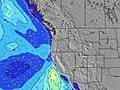 |  |  |  | 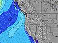 |  | |||||||||||||||
Onda Altezza (m) Direzione Periodo (s) | WNW 10 | WNW 10 | SW 18 | WNW 20 | WNW 19 | WNW 19 | WNW 19 | WNW 19 | WNW 19 | WNW 19 | WNW 18 | WNW 18 | WNW 18 | WNW 17 | WNW 17 | WNW 17 | WNW 17 | WNW 17 | WNW 16 | WNW 16 | WNW 16 | WNW 16 | NW 11 | WNW 16 |
Grafico delle onde | ||||||||||||||||||||||||
131 | 160 | 152 | 132 | 125 | 210 | 205 | 199 | 201 | 201 | 263 | 249 | 318 | 394 | 390 | 423 | 419 | 486 | 376 | 371 | 366 | 366 | 423 | 441 | |
Vento (km/h) | ||||||||||||||||||||||||
Stato del vento onshore cross-onshore cross-shore cross-offshore offshore piatto | cross | cross-on | cross-on | cross | cross | cross-on | cross-on | glassy | glassy | cross-on | cross-on | cross-on | on | glassy | glassy | glassy | glassy | cross-on | cross-on | cross-on | cross | cross | cross-off | cross-off |
Alta Marea | 3:15PM1.61m | 2:19AM2.08m | 3:56PM1.66m | 3:11AM1.94m | 4:37PM1.70m | 4:05AM1.74m | ||||||||||||||||||
Basso Marea | 9:03AM-0.42m | 8:53PM0.48m | 9:47AM-0.36m | 9:49PM0.43m | 10:29AM-0.25m | 10:46PM0.38m | ||||||||||||||||||
5:43 | — | — | — | — | — | — | 5:43 | — | — | — | — | — | — | — | 5:45 | — | — | — | — | — | — | — | 5:46 | |
— | — | — | — | 8:59 | — | — | — | — | — | — | — | 8:59 | — | — | — | — | — | — | — | 8:58 | — | — | 8:57 | |
mm | — | — | — | — | — | — | — | — | — | — | — | — | — | — | — | — | — | — | — | — | — | — | — | — |
Temp. °C | 12 | 16 | 16 | 16 | 14 | 13 | 13 | 13 | 14 | 15 | 16 | 16 | 15 | 13 | 12 | 11 | 13 | 17 | 17 | 17 | 15 | 13 | 12 | 12 |
Gelo °C | 11 | 14 | 13 | 13 | 12 | 12 | 13 | 13 | 14 | 14 | 13 | 14 | 14 | 13 | 12 | 10 | 13 | 16 | 15 | 15 | 14 | 12 | 11 | 11 |
Onda 1 Altezza (m) Direzione Periodo (s) | WNW 10 | WNW 10 | WNW 10 | WNW 9 | WNW 9 | WNW 9 | WNW 9 | NW 5 | NW 8 | WNW 8 | WNW 8 | WNW 7 | WNW 7 | WNW 7 | WNW 7 | WNW 8 | NW 8 | NW 8 | NW 8 | NW 8 | NW 7 | NW 7 | NW 11 | NW 10 |
131 | 160 | 120 | 113 | 110 | 86 | 84 | 25 | 132 | 147 | 131 | 134 | 114 | 114 | 114 | 117 | 133 | 136 | 133 | 143 | 121 | 121 | 423 | 441 | |
Onda 2 Altezza (m) Direzione Periodo (s) | WNW 13 | WSW 18 | SW 18 | WSW 18 | WNW 19 | WNW 19 | NW 5 | WNW 9 | WNW 19 | WNW 19 | WNW 18 | WNW 18 | WNW 18 | WNW 17 | WNW 17 | WNW 17 | WNW 17 | WNW 17 | WNW 16 | WNW 16 | WNW 16 | WNW 16 | WNW 16 | WNW 16 |
58 | 121 | 152 | 120 | 125 | 210 | 23 | 61 | 201 | 201 | 263 | 249 | 318 | 394 | 390 | 423 | 419 | 486 | 376 | 371 | 366 | 366 | 362 | 362 | |
Onda 3 Altezza (m) Direzione Periodo (s) | SW 18 | WNW 13 | WNW 20 | WNW 20 | SW 18 | SW 17 | WNW 19 | WNW 19 | SW 16 | SW 16 | SW 16 | SW 16 | SW 16 | SW 16 | SW 16 | SW 16 | SW 16 | SW 15 | WNW 12 | NW 12 | WNW 11 | WNW 11 | SW 14 | SW 14 |
79 | 60 | 132 | 132 | 78 | 75 | 205 | 199 | 65 | 125 | 125 | 124 | 124 | 124 | 122 | 121 | 118 | 110 | 98 | 140 | 166 | 157 | 74 | 73 | |
onde vento Altezza (m) Direzione Periodo (s) | NW 6 | NNW 6 | NNW 6 | NW 4 | NW 4 | NW 5 | — | — | — | — | — | — | — | — | — | — | — | — | — | — | — | — | — | — |
15 | 21 | 20 | 15 | 19 | 22 | — | — | — | — | — | — | — | — | — | — | — | — | — | — | — | — | — | — | |
Il più vicino Offshore or Glassy | ||||||||||||||||||||||||
Distanza (km) | 16 | 390 | 898 | 897 | 228 | 97 | 97 | 5 | 5 | 225 | 225 | 225 | 225 | 5 | 5 | 5 | 5 | 187 | 226 | 571 | 275 | 16 | 5 | 5 |
Migliori previsioni per le condizioni d'onda in North Oregon | ||||||||||||||||||||||||
Migliori previsioni per le condizioni d'onda in United States | ||||||||||||||||||||||||
Trova Onde Globale | ||||||||||||||||||||||||
- Map Icons:
 Break
Break Live Wave Height (m)
 Live Wind Speed (km/h)
 Surf Rating (10 Max)
 Ocean Swells (m)
- Wind Speed (km/h)
Widget Free Surf-Forecast.com per il tuo sito
La relazione di surf / widget meteo è disponibile qui sotto per incorporare su siti esterni a titolo gratuito e fornisce una sintesi delle nostre Gleneden Beach previsione surf. Basta prendere il frammento di codice html da noi fornito e copiarlo nel proprio sito. È possibile scegliere la lingua preferita e unità metriche / imperiali per il feed delle previsioni surf per soddisfare le esigenze degli utenti del vostro sito .... Clicca qui per ottenere il codice.
 Nearest