
Previsioni:

Previsione a breve terminePioggia abbondante (Totale 22mm), più pesante durante domenica pomeriggio. Warm (Max 28°C Lunedì pomeriggio, Min 26°C Sabato mattina). Vento sarà generalmente leggero. | ||||||||||||||||||||||||
Sabato 18 | Domenica 19 | Lunedì 20 | ||||||||||||||||||||||
2 AM | 5 AM | 8 AM | 11 AM | 2 PM | 5 PM | 8 PM | 11 PM | 2 AM | 5 AM | 8 AM | 11 AM | 2 PM | 5 PM | 8 PM | 11 PM | 2 AM | 5 AM | 8 AM | 11 AM | 2 PM | 5 PM | 8 PM | 11 PM | |
Mappa dell'altezza del moto ondoso | 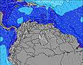 | 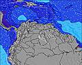 |  | 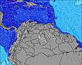 | 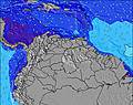 |  | 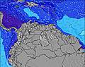 | 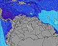 | 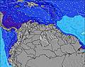 | |||||||||||||||
Onda Altezza (m) Direzione Periodo (s) | ENE 7 | ENE 7 | ENE 8 | ENE 8 | ENE 8 | ENE 8 | ENE 8 | ENE 8 | ENE 8 | ENE 8 | ENE 8 | ENE 8 | ENE 8 | ENE 8 | ENE 8 | ENE 8 | ENE 8 | ENE 8 | ENE 8 | ENE 8 | ENE 8 | ENE 8 | ENE 8 | ENE 7 |
Grafico delle onde | ||||||||||||||||||||||||
415 | 469 | 588 | 620 | 599 | 561 | 575 | 523 | 511 | 449 | 449 | 404 | 394 | 394 | 438 | 427 | 416 | 375 | 375 | 316 | 308 | 308 | 300 | 259 | |
Vento (km/h) | ||||||||||||||||||||||||
Stato del vento onshore cross-onshore cross-shore cross-offshore offshore piatto | cross-on | cross-on | cross-on | cross-on | cross-on | cross-on | cross-on | cross-on | cross-on | cross-on | cross-on | cross-on | cross | cross | cross-on | cross-on | cross-on | cross-on | cross-on | cross | cross | cross | cross-on | cross-on |
Alta Marea | 6:01AM0.85m | 6:50PM0.78m | 6:52AM0.76m | 7:30PM0.78m | 7:47AM0.67m | 8:12PM0.76m | ||||||||||||||||||
Basso Marea | 11:52PM0.29m | 12:28PM0.17m | 00:49AM0.29m | 1:06PM0.24m | 1:51AM0.30m | 1:45PM0.31m | ||||||||||||||||||
— | 5:48 | — | — | — | — | — | — | — | 5:50 | — | — | — | — | — | — | — | 5:50 | — | — | — | — | — | — | |
— | — | — | — | — | 6:30 | — | — | — | — | — | — | — | 6:30 | — | — | — | — | — | — | — | 6:30 | — | — | |
mm | 2 | 2 | 1 | — | 1 | 1 | 1 | 1 | 1 | 1 | 2 | 2 | 3 | 2 | 1 | 1 | 1 | 1 | — | 1 | — | — | — | — |
Temp. °C | 26 | 26 | 26 | 27 | 27 | 26 | 26 | 26 | 26 | 26 | 26 | 27 | 27 | 26 | 26 | 26 | 26 | 26 | 27 | 27 | 28 | 27 | 26 | 26 |
Gelo °C | 27 | 26 | 26 | 27 | 28 | 27 | 27 | 27 | 27 | 27 | 27 | 28 | 28 | 27 | 27 | 27 | 27 | 27 | 28 | 28 | 29 | 28 | 28 | 27 |
Onda 1 Altezza (m) Direzione Periodo (s) | N 9 | N 9 | N 9 | — | — | N 8 | N 8 | N 8 | — | — | — | — | — | — | — | — | — | — | — | — | — | — | — | — |
2 | 2 | 2 | — | — | 1 | 1 | 1 | — | — | — | — | — | — | — | — | — | — | — | — | — | — | — | — | |
Onda 2 Altezza (m) Direzione Periodo (s) | — | — | — | — | — | — | — | — | — | — | — | — | — | — | — | — | — | — | — | — | — | — | — | — |
— | — | — | — | — | — | — | — | — | — | — | — | — | — | — | — | — | — | — | — | — | — | — | — | |
Onda 3 Altezza (m) Direzione Periodo (s) | — | — | — | — | — | — | — | — | — | — | — | — | — | — | — | — | — | — | — | — | — | — | — | — |
— | — | — | — | — | — | — | — | — | — | — | — | — | — | — | — | — | — | — | — | — | — | — | — | |
onde vento Altezza (m) Direzione Periodo (s) | ENE 7 | ENE 7 | ENE 8 | ENE 8 | ENE 8 | ENE 8 | ENE 8 | ENE 8 | ENE 8 | ENE 8 | ENE 8 | ENE 8 | ENE 8 | ENE 8 | ENE 8 | ENE 8 | ENE 8 | ENE 8 | ENE 8 | ENE 8 | ENE 8 | ENE 8 | ENE 8 | ENE 7 |
415 | 469 | 588 | 620 | 599 | 561 | 575 | 523 | 511 | 449 | 449 | 404 | 394 | 394 | 438 | 427 | 416 | 375 | 375 | 316 | 308 | 308 | 300 | 259 | |
Il più vicino Offshore or Glassy | ||||||||||||||||||||||||
Distanza (km) | 560 | 560 | 604 | 648 | 648 | 625 | 648 | 648 | 648 | 157 | 648 | 560 | 648 | 648 | 625 | 240 | 240 | 240 | 157 | 648 | 625 | 157 | 157 | 157 |
Migliori previsioni per le condizioni d'onda in Tobago | ||||||||||||||||||||||||
Migliori previsioni per le condizioni d'onda in Trinidad and Tobago | ||||||||||||||||||||||||
Trova Onde Globale | ||||||||||||||||||||||||
- Map Icons:
 Break
Break Live Wave Height (m)
 Live Wind Speed (km/h)
 Surf Rating (10 Max)
 Ocean Swells (m)
- Wind Speed (km/h)
Widget Free Surf-Forecast.com per il tuo sito
La relazione di surf / widget meteo è disponibile qui sotto per incorporare su siti esterni a titolo gratuito e fornisce una sintesi delle nostre Grand Rivere previsione surf. Basta prendere il frammento di codice html da noi fornito e copiarlo nel proprio sito. È possibile scegliere la lingua preferita e unità metriche / imperiali per il feed delle previsioni surf per soddisfare le esigenze degli utenti del vostro sito .... Clicca qui per ottenere il codice.
 Nearest