
Previsioni:

Previsione a breve termineper lo più asciutto. Very mild (Max 13°C Domenica mattina, Min 8°C Venerdì mattina). Vento sarà generalmente leggero. | |||||||||||||||||||
Gio 16 | Venerdì 17 | Sabato 18 | |||||||||||||||||
3 PM | 6 PM | 9 PM | 12 AM | 3 AM | 6 AM | 9 AM | 12 PM | 3 PM | 6 PM | 9 PM | 12 AM | 3 AM | 6 AM | 9 AM | 12 PM | 3 PM | 6 PM | 9 PM | |
Mappa dell'altezza del moto ondoso | 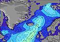 | 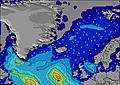 | 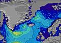 | 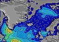 |  | 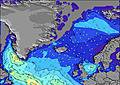 |  | ||||||||||||
Onda Altezza (m) Direzione Periodo (s) | SW 8 | SW 8 | SSW 11 | SW 8 | SW 8 | W 7 | WSW 7 | WSW 7 | WSW 7 | WSW 7 | WSW 7 | WSW 9 | WSW 8 | WSW 9 | WSW 11 | WSW 11 | WSW 11 | WSW 11 | WSW 11 |
Grafico delle onde | |||||||||||||||||||
284 | 210 | 151 | 131 | 120 | 142 | 197 | 168 | 163 | 131 | 111 | 67 | 123 | 116 | 256 | 307 | 297 | 335 | 379 | |
Vento (km/h) | |||||||||||||||||||
Stato del vento onshore cross-onshore cross-shore cross-offshore offshore piatto | cross-on | cross | cross | cross | cross-off | cross-off | cross-off | cross-off | cross-off | cross-off | cross-off | cross-off | cross-off | cross | cross-on | cross-on | cross-off | cross-off | cross |
Alta Marea | 7:46PM3.51m | 8:08AM3.04m | 8:30PM3.40m | 8:52AM2.97m | |||||||||||||||
Basso Marea | 1:25PM-0.01m | 2:04AM0.02m | 2:10PM0.02m | 2:46AM0.09m | 2:55PM0.15m | ||||||||||||||
— | — | — | — | 3:51 | — | — | — | — | — | — | — | 3:55 | — | — | — | — | — | — | |
— | — | 11:20 | — | — | — | — | — | — | — | 11:16 | — | — | — | — | — | — | — | 11:14 | |
mm | — | — | — | — | — | — | — | — | — | — | — | — | — | — | — | — | — | — | — |
Temp. °C | 10 | 10 | 9 | 9 | 9 | 9 | 8 | 10 | 11 | 11 | 11 | 11 | 10 | 11 | 12 | 11 | 10 | 10 | 10 |
Gelo °C | 5 | 6 | 5 | 5 | 4 | 4 | 4 | 6 | 7 | 6 | 8 | 7 | 8 | 9 | 10 | 8 | 6 | 6 | 8 |
Onda 1 Altezza (m) Direzione Periodo (s) | WSW 11 | WSW 7 | SSW 11 | SW 8 | SW 8 | SW 7 | S 14 | SW 8 | S 14 | S 14 | WSW 8 | WSW 6 | WSW 8 | WSW 9 | WSW 11 | WSW 11 | WSW 11 | WSW 11 | S 13 |
107 | 125 | 143 | 131 | 110 | 79 | 94 | 48 | 93 | 93 | 40 | 59 | 123 | 116 | 256 | 307 | 297 | 335 | 55 | |
Onda 2 Altezza (m) Direzione Periodo (s) | S 15 | WSW 11 | SSW 14 | SSW 15 | S 16 | S 15 | S 12 | S 15 | SW 8 | SSW 8 | SSW 14 | WSW 9 | W 8 | WSW 12 | WNW 6 | NW 5 | S 14 | S 12 | S 7 |
17 | 76 | 37 | 73 | 43 | 39 | 3 | 67 | 18 | 7 | 63 | 67 | 37 | 79 | 16 | 7 | 33 | 28 | 1 | |
Onda 3 Altezza (m) Direzione Periodo (s) | S 13 | S 15 | S 13 | S 14 | S 10 | S 11 | S 11 | S 8 | S 9 | W 14 | SW 11 | SSW 13 | W 10 | WNW 6 | SSW 13 | S 14 | S 7 | S 7 | S 7 |
3 | 17 | 3 | 4 | 2 | 2 | 2 | 1 | 1 | 4 | 5 | 59 | 28 | 12 | 33 | 35 | 1 | 1 | 1 | |
onde vento Altezza (m) Direzione Periodo (s) | SW 8 | SW 8 | WSW 7 | W 7 | W 7 | W 7 | WSW 7 | WSW 7 | WSW 7 | WSW 7 | WSW 7 | NW 6 | NW 6 | — | — | — | NW 5 | WNW 6 | WSW 11 |
284 | 210 | 151 | 117 | 120 | 142 | 197 | 168 | 163 | 131 | 111 | 15 | 15 | — | — | — | 7 | 23 | 379 | |
Il più vicino Offshore or Glassy | |||||||||||||||||||
Distanza (km) | 1098 | 54 | 54 | 54 | 54 | 54 | 54 | 54 | 2818 | 54 | 0 | 0 | 0 | 34 | 54 | 54 | 54 | 54 | 54 |
Migliori previsioni per le condizioni d'onda in Reykjanes Peninsula | |||||||||||||||||||
Migliori previsioni per le condizioni d'onda in Iceland | |||||||||||||||||||
Trova Onde Globale | |||||||||||||||||||
- Map Icons:
 Break
Break Live Wave Height (m)
 Live Wind Speed (km/h)
 Surf Rating (10 Max)
 Ocean Swells (m)
- Wind Speed (km/h)
Widget Free Surf-Forecast.com per il tuo sito
La relazione di surf / widget meteo è disponibile qui sotto per incorporare su siti esterni a titolo gratuito e fornisce una sintesi delle nostre Grindavik Antenas previsione surf. Basta prendere il frammento di codice html da noi fornito e copiarlo nel proprio sito. È possibile scegliere la lingua preferita e unità metriche / imperiali per il feed delle previsioni surf per soddisfare le esigenze degli utenti del vostro sito .... Clicca qui per ottenere il codice.
 Nearest