
Previsioni:

Previsione a breve terminepioggia leggera (Totale 3mm), per lo più che cade Domenica mattina. Warm (Max 27°C Sabato notte, Min 26°C Sabato notte). Principalmente venti freschi. | |||||||||||||||||||
25 | Domenica 26 | Lunedì 27 | |||||||||||||||||
5 PM | 8 PM | 11 PM | 2 AM | 5 AM | 8 AM | 11 AM | 2 PM | 5 PM | 8 PM | 11 PM | 2 AM | 5 AM | 8 AM | 11 AM | 2 PM | 5 PM | 8 PM | 11 PM | |
Mappa dell'altezza del moto ondoso |  |  | 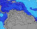 |  |  |  |  | ||||||||||||
Onda Altezza (m) Direzione Periodo (s) | ENE 7 | ENE 8 | ENE 8 | ENE 8 | ENE 8 | ENE 8 | ENE 8 | E 8 | ENE 8 | ENE 8 | ENE 8 | ENE 8 | ENE 8 | ENE 8 | ENE 8 | ENE 8 | ENE 8 | ENE 8 | ENE 8 |
Grafico delle onde | |||||||||||||||||||
292 | 300 | 300 | 300 | 273 | 273 | 273 | 265 | 232 | 202 | 202 | 173 | 143 | 147 | 131 | 123 | 127 | 127 | 127 | |
Vento (km/h) | |||||||||||||||||||
Stato del vento onshore cross-onshore cross-shore cross-offshore offshore piatto | on | on | on | on | on | on | on | on | on | on | on | on | on | on | on | on | on | on | on |
Alta Marea | 6:36PM0.32m | 7:22PM0.33m | 8:01PM0.34m | ||||||||||||||||
Basso Marea | 10:37AM0.02m | 11:23AM0.02m | |||||||||||||||||
— | — | — | — | 5:48 | — | — | — | — | — | — | — | 5:48 | — | — | — | — | — | — | |
6:49 | — | — | — | — | — | — | — | 6:47 | — | — | — | — | — | — | — | 6:47 | — | — | |
mm | — | — | — | — | — | — | — | 1 | — | — | — | — | 1 | — | — | 1 | — | — | — |
Temp. °C | 27 | 27 | 26 | 26 | 26 | 26 | 27 | 27 | 27 | 27 | 27 | 27 | 27 | 27 | 27 | 27 | 27 | 27 | 27 |
Gelo °C | 28 | 27 | 26 | 26 | 26 | 26 | 27 | 28 | 28 | 28 | 28 | 29 | 29 | 29 | 29 | 28 | 28 | 28 | 28 |
Onda 1 Altezza (m) Direzione Periodo (s) | NW 7 | N 7 | N 7 | N 7 | N 7 | N 7 | N 7 | N 7 | N 7 | N 7 | SE 9 | ENE 8 | ENE 8 | ENE 8 | ENE 8 | ENE 8 | ESE 9 | ESE 9 | ESE 9 |
2 | 1 | 1 | 1 | 1 | 1 | 1 | 1 | 1 | 1 | 3 | 173 | 143 | 147 | 131 | 123 | 8 | 8 | 8 | |
Onda 2 Altezza (m) Direzione Periodo (s) | — | — | — | — | — | — | — | — | — | — | N 7 | SE 9 | ESE 9 | SE 9 | ESE 9 | ESE 9 | ESE 9 | NE 8 | NE 8 |
— | — | — | — | — | — | — | — | — | — | 1 | 3 | 8 | 3 | 8 | 8 | 8 | 2 | 2 | |
Onda 3 Altezza (m) Direzione Periodo (s) | — | — | — | — | — | — | — | — | — | — | — | N 7 | N 7 | N 7 | — | N 7 | N 7 | N 7 | N 7 |
— | — | — | — | — | — | — | — | — | — | — | 1 | 1 | 1 | — | 1 | 1 | 1 | 1 | |
onde vento Altezza (m) Direzione Periodo (s) | ENE 7 | ENE 8 | ENE 8 | ENE 8 | ENE 8 | ENE 8 | ENE 8 | E 8 | ENE 8 | ENE 8 | ENE 8 | — | — | — | — | E 8 | ENE 8 | ENE 8 | ENE 8 |
292 | 300 | 300 | 300 | 273 | 273 | 273 | 265 | 232 | 202 | 202 | — | — | — | — | 120 | 127 | 127 | 127 | |
Il più vicino Offshore or Glassy | |||||||||||||||||||
Distanza (km) | 668 | 799 | 238 | 238 | 238 | 403 | 162 | 166 | 27 | 27 | 27 | 27 | 27 | 27 | 27 | 27 | 27 | 27 | 322 |
Migliori previsioni per le condizioni d'onda in Netherlands-Antilles - Saint Martin | |||||||||||||||||||
Migliori previsioni per le condizioni d'onda in Netherlands Antilles | |||||||||||||||||||
Trova Onde Globale | |||||||||||||||||||
- Map Icons:
 Break
Break Live Wave Height (m)
 Live Wind Speed (km/h)
 Surf Rating (10 Max)
 Ocean Swells (m)
- Wind Speed (km/h)
Widget Free Surf-Forecast.com per il tuo sito
La relazione di surf / widget meteo è disponibile qui sotto per incorporare su siti esterni a titolo gratuito e fornisce una sintesi delle nostre Guana Bay previsione surf. Basta prendere il frammento di codice html da noi fornito e copiarlo nel proprio sito. È possibile scegliere la lingua preferita e unità metriche / imperiali per il feed delle previsioni surf per soddisfare le esigenze degli utenti del vostro sito .... Clicca qui per ottenere il codice.
 Nearest