
Previsioni:

Previsione a breve terminepioggia leggera (Totale 3mm), per lo più che cade giovedì pomeriggio. Warm (Max 21°C giovedì pomeriggio, Min 19°C Venerdì notte). Venti decrescenti (venti freschi da O giovedì pomeriggio, venti deboli da SW per venerdì notte). | ||||||||||||||||||||||||
Mer 15 | Giovedì 16 | Venerdì 17 | 18 | |||||||||||||||||||||
9 AM | 12 PM | 3 PM | 6 PM | 9 PM | 12 AM | 3 AM | 6 AM | 9 AM | 12 PM | 3 PM | 6 PM | 9 PM | 12 AM | 3 AM | 6 AM | 9 AM | 12 PM | 3 PM | 6 PM | 9 PM | 12 AM | 3 AM | 6 AM | |
Mappa dell'altezza del moto ondoso |  | 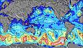 | 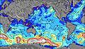 | 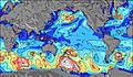 | 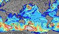 | 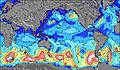 | 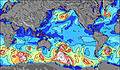 | 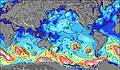 | 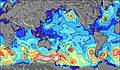 | |||||||||||||||
Onda Altezza (m) Direzione Periodo (s) | SSE 11 | SSE 11 | W 8 | WSW 12 | W 12 | W 12 | WSW 12 | WSW 12 | WSW 12 | WSW 12 | WSW 12 | W 12 | W 12 | SSE 13 | SW 12 | SW 12 | W 12 | WSW 12 | WSW 7 | W 11 | SW 8 | SW 8 | SW 9 | W 11 |
Grafico delle onde | ||||||||||||||||||||||||
193 | 190 | 313 | 228 | 678 | 800 | 847 | 847 | 985 | 872 | 976 | 1084 | 1312 | 451 | 471 | 440 | 814 | 1186 | 320 | 418 | 361 | 418 | 384 | 326 | |
Vento (km/h) | ||||||||||||||||||||||||
Stato del vento onshore cross-onshore cross-shore cross-offshore offshore piatto | cross-off | cross-off | cross-off | cross-off | cross | cross | cross-off | cross-off | cross-off | cross-off | cross-off | cross-off | cross-off | cross-off | cross-off | cross | cross | cross | cross | cross | cross-on | cross-on | cross | cross-on |
Alta Marea | 6:53AM0.87m | 7:30PM0.54m | 8:00AM0.82m | 8:56PM0.56m | 9:12AM0.78m | 10:18PM0.61m | ||||||||||||||||||
Basso Marea | 1:51PM0.20m | 1:06AM0.22m | 3:00PM0.20m | 2:32AM0.26m | 4:06PM0.18m | 4:02AM0.27m | ||||||||||||||||||
8:04 | — | — | — | — | — | — | 8:04 | — | — | — | — | — | — | — | 8:03 | — | — | — | — | — | — | — | 8:03 | |
— | — | — | 6:40 | — | — | — | — | — | — | — | 6:40 | — | — | — | — | — | — | — | 6:40 | — | — | — | 6:42 | |
mm | — | — | — | — | — | — | — | — | — | — | 1 | 1 | 1 | — | — | — | — | — | — | — | — | — | — | — |
Temp. °C | 20 | 20 | 20 | 20 | 20 | 20 | 20 | 20 | 20 | 20 | 20 | 21 | 20 | 20 | 20 | 20 | 20 | 20 | 20 | 20 | 19 | 19 | 19 | 19 |
Gelo °C | 18 | 18 | 18 | 18 | 18 | 18 | 18 | 18 | 19 | 19 | 17 | 18 | 17 | 17 | 17 | 16 | 17 | 17 | 16 | 16 | 15 | 17 | 17 | 18 |
Onda 1 Altezza (m) Direzione Periodo (s) | WNW 10 | W 8 | WSW 12 | WNW 8 | W 12 | W 12 | WSW 12 | WSW 12 | WSW 12 | WSW 12 | WSW 12 | SSE 13 | SSE 13 | SSE 13 | SW 12 | SW 12 | SW 11 | SSE 12 | WSW 12 | W 11 | SW 8 | SW 8 | SW 9 | SSW 9 |
563 | 367 | 205 | 202 | 678 | 800 | 847 | 847 | 985 | 872 | 976 | 528 | 451 | 451 | 471 | 440 | 418 | 251 | 224 | 418 | 361 | 418 | 384 | 252 | |
Onda 2 Altezza (m) Direzione Periodo (s) | SSE 11 | SSE 11 | SSE 11 | WSW 12 | SSE 15 | SSE 14 | SSE 14 | SSE 13 | SSE 13 | SSE 13 | SSE 13 | SW 13 | SW 13 | SW 13 | SSE 13 | SE 12 | SSE 12 | SW 16 | SE 12 | SSE 12 | W 11 | SE 11 | W 11 | W 11 |
193 | 190 | 154 | 228 | 568 | 663 | 607 | 669 | 581 | 581 | 572 | 503 | 418 | 405 | 444 | 353 | 255 | 86 | 205 | 177 | 240 | 126 | 185 | 326 | |
Onda 3 Altezza (m) Direzione Periodo (s) | WSW 13 | WSW 13 | SW 18 | SSE 11 | SW 17 | SW 16 | SW 16 | SW 15 | SW 15 | SW 14 | SW 14 | — | — | W 12 | W 12 | W 12 | N 10 | N 10 | SW 15 | SW 15 | SSE 12 | W 11 | SE 11 | SE 11 |
170 | 170 | 255 | 154 | 398 | 504 | 480 | 565 | 623 | 557 | 526 | — | — | 289 | 299 | 294 | 2 | 2 | 104 | 75 | 171 | 116 | 121 | 121 | |
onde vento Altezza (m) Direzione Periodo (s) | SW 6 | SW 6 | W 8 | SW 6 | SW 6 | SW 6 | — | — | — | — | — | W 12 | W 12 | W 8 | W 8 | W 8 | W 12 | WSW 12 | WSW 7 | SW 8 | — | — | — | — |
36 | 32 | 313 | 39 | 47 | 58 | — | — | — | — | — | 1084 | 1312 | 365 | 275 | 241 | 814 | 1186 | 320 | 322 | — | — | — | — | |
Il più vicino Offshore or Glassy | ||||||||||||||||||||||||
Distanza (km) | 3669 | 3666 | 3657 | 3640 | 7 | 3675 | 3672 | 3675 | 3734 | 3518 | 3554 | 3534 | 3534 | 3518 | 3518 | 3518 | 3518 | 3518 | 3518 | 3518 | 7 | 7 | 7 | 7 |
Migliori previsioni per le condizioni d'onda in Easter Island | ||||||||||||||||||||||||
Migliori previsioni per le condizioni d'onda in Chile | ||||||||||||||||||||||||
Trova Onde Globale | ||||||||||||||||||||||||
- Map Icons:
 Break
Break Live Wave Height (m)
 Live Wind Speed (km/h)
 Surf Rating (10 Max)
 Ocean Swells (m)
- Wind Speed (km/h)
Widget Free Surf-Forecast.com per il tuo sito
La relazione di surf / widget meteo è disponibile qui sotto per incorporare su siti esterni a titolo gratuito e fornisce una sintesi delle nostre Hang Nui previsione surf. Basta prendere il frammento di codice html da noi fornito e copiarlo nel proprio sito. È possibile scegliere la lingua preferita e unità metriche / imperiali per il feed delle previsioni surf per soddisfare le esigenze degli utenti del vostro sito .... Clicca qui per ottenere il codice.
 Nearest