
Previsioni:

Previsione a breve termineQualche pioggerella, più pesante durante lunedì mattina. Warm (Max 31°C Lunedì mattina, Min 25°C martedì notte). Vento sarà generalmente leggero. | ||||||||||||||||||||||
Lunedì 3 | Martedì 4 | Mercoledì 5 | ||||||||||||||||||||
6 AM | 9 AM | 12 PM | 3 PM | 6 PM | 9 PM | 12 AM | 3 AM | 6 AM | 9 AM | 12 PM | 3 PM | 6 PM | 9 PM | 12 AM | 3 AM | 6 AM | 9 AM | 12 PM | 3 PM | 6 PM | 9 PM | |
Mappa dell'altezza del moto ondoso |  |  |  | 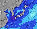 |  |  | 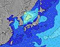 |  | ||||||||||||||
Onda Altezza (m) Direzione Periodo (s) | SE 16 | SE 16 | SE 16 | SE 16 | SE 16 | SE 17 | SE 17 | SE 17 | SE 17 | SE 19 | SE 17 | SE 17 | SE 17 | SE 16 | SE 16 | SE 17 | SE 17 | SE 17 | SE 17 | SE 17 | SE 17 | SE 16 |
Grafico delle onde | ||||||||||||||||||||||
261 | 390 | 371 | 508 | 602 | 834 | 874 | 1597 | 1757 | 1005 | 2191 | 2653 | 3038 | 3386 | 3865 | 5009 | 5808 | 6451 | 7051 | 8642 | 9884 | 9903 | |
Vento (km/h) | ||||||||||||||||||||||
Stato del vento onshore cross-onshore cross-shore cross-offshore offshore piatto | cross-on | cross-on | cross-off | cross-off | cross-off | cross-off | cross-off | cross-off | cross-off | cross-off | cross-off | cross-off | cross-off | cross-off | cross-off | glassy | cross | on | on | cross-on | glassy | cross-on |
Alta Marea | 8:35AM1.79m | 8:56PM1.82m | 9:22AM1.66m | 9:26PM1.77m | 10:22AM1.52m | |||||||||||||||||
Basso Marea | 2:42PM0.63m | 3:14AM0.65m | 3:15PM0.81m | 4:03AM0.67m | 3:50PM1.00m | |||||||||||||||||
5:13 | — | — | — | — | — | — | 5:15 | — | — | — | — | — | — | — | 5:15 | — | — | — | — | — | — | |
— | — | — | — | 7:00 | — | — | — | — | — | — | — | 7:00 | — | — | — | — | — | — | — | 6:59 | — | |
mm | — | — | 1 | — | — | — | — | — | — | — | — | — | — | — | — | — | — | — | — | — | — | — |
Temp. °C | 28 | 31 | 30 | 30 | 28 | 27 | 27 | 26 | 26 | 26 | 29 | 29 | 27 | 26 | 26 | 25 | 25 | 29 | 30 | 31 | 30 | 27 |
Gelo °C | 32 | 36 | 34 | 34 | 32 | 31 | 31 | 29 | 30 | 30 | 32 | 31 | 29 | 29 | 29 | 29 | 27 | 31 | 32 | 33 | 33 | 30 |
Onda 1 Altezza (m) Direzione Periodo (s) | SE 16 | SE 16 | SE 16 | SE 16 | SE 16 | SE 17 | SE 17 | SE 17 | SE 17 | ESE 16 | SE 17 | SE 17 | SE 17 | SE 16 | SE 16 | SE 17 | SE 17 | SE 17 | SE 17 | SE 17 | SE 17 | SE 16 |
261 | 390 | 371 | 508 | 602 | 834 | 874 | 1597 | 1757 | 921 | 2191 | 2653 | 3038 | 3386 | 3865 | 5009 | 5808 | 6451 | 7051 | 8642 | 9884 | 9903 | |
Onda 2 Altezza (m) Direzione Periodo (s) | SE 10 | SSE 10 | SE 6 | ESE 22 | SSE 9 | SE 6 | SE 6 | S 7 | S 7 | SE 19 | — | — | — | SE 5 | — | — | — | — | — | — | — | — |
15 | 9 | 9 | 47 | 7 | 72 | 66 | 1 | 1 | 1005 | — | — | — | 47 | — | — | — | — | — | — | — | — | |
Onda 3 Altezza (m) Direzione Periodo (s) | ESE 9 | SSW 8 | SSE 10 | S 8 | S 8 | S 7 | S 7 | S 7 | S 7 | S 7 | — | — | — | — | — | — | — | — | — | — | — | — |
8 | 6 | 9 | 1 | 4 | 1 | 1 | 1 | 1 | 1 | — | — | — | — | — | — | — | — | — | — | — | — | |
onde vento Altezza (m) Direzione Periodo (s) | N 3 | ESE 5 | ESE 6 | SE 6 | SE 8 | — | SE 5 | — | — | — | — | — | SE 5 | — | — | — | — | — | — | — | — | — |
1 | 14 | 62 | 47 | 109 | — | 30 | — | — | — | — | — | 38 | — | — | — | — | — | — | — | — | — | |
Il più vicino Offshore or Glassy | ||||||||||||||||||||||
Distanza (km) | 3 | 21 | 0 | 0 | 0 | 0 | 0 | 0 | 0 | 0 | 0 | 0 | 0 | 0 | 0 | 0 | 3 | 3 | 3 | 491 | 0 | 75 |
Migliori previsioni per le condizioni d'onda in Shikoku | ||||||||||||||||||||||
Migliori previsioni per le condizioni d'onda in Japan | ||||||||||||||||||||||
Trova Onde Globale | ||||||||||||||||||||||
- Map Icons:
 Break
Break Live Wave Height (m)
 Live Wind Speed (km/h)
 Surf Rating (10 Max)
 Ocean Swells (m)
- Wind Speed (km/h)
Widget Free Surf-Forecast.com per il tuo sito
La relazione di surf / widget meteo è disponibile qui sotto per incorporare su siti esterni a titolo gratuito e fornisce una sintesi delle nostre Hashikui Bay previsione surf. Basta prendere il frammento di codice html da noi fornito e copiarlo nel proprio sito. È possibile scegliere la lingua preferita e unità metriche / imperiali per il feed delle previsioni surf per soddisfare le esigenze degli utenti del vostro sito .... Clicca qui per ottenere il codice.
 Nearest