

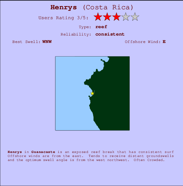
Henrys Surf Guide
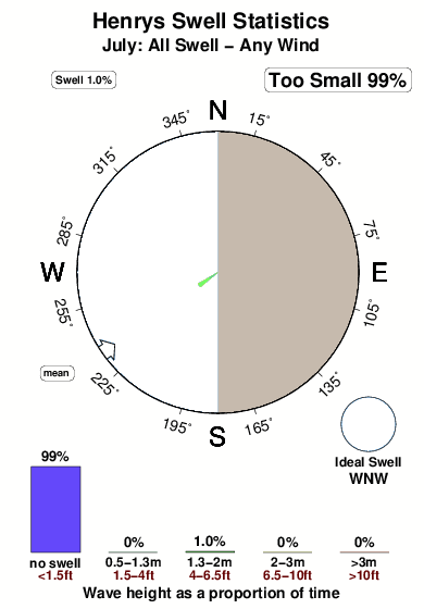
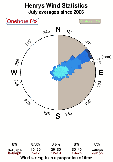
Henrys in Guanacaste is an exposed reef break that has consistent surf Offshore winds are from the east. Tends to receive distant groundswells and the ideal swell direction is from the west northwest.. Often Crowded. Beware of .
Henrys Spot Info
| Type: | Rating: | Reliability: | Todays Sea Temp*: |
|---|---|---|---|
| consistent | 30.0°C*ocean temperature recorded from satellite |
Surfing Henrys:
The best conditions reported for surf at Henrys occur when a West-northwest swell combines with an offshore wind direction from the East.

Previsioni Energia d'onda (Potenza): 12hrs


Henrys Surf:
Thursday, 16 July 2026, 00:31 Local time| Mercoledì 15 | Gio | |||
| 3PM | 6PM | 9PM | 0AM | |
| Wave (m) | ||||
| Periodo (s) | 16 | 16 | 16 | 16 |
| Vento (km/h) | ||||
| Stato del vento | glass | cross- on |
off | cross- off |
- /breaks/Henrys/forecasts/latest
Henrys Surf Guide
Henrys in Guanacaste is an exposed reef break that has consistent surf Offshore winds are from the east. Tends to receive distant groundswells and the ideal swell direction is from the west northwest.. Often Crowded. Beware of .
Henrys Spot Info
Type: Rating: Reliability: Todays Sea Temp*:  Reef
Reef 3
3consistent 30.0°C*ocean temperature recorded from satelliteSurfing Henrys:
The best conditions reported for surf at Henrys occur when a West-northwest swell combines with an offshore wind direction from the East.
Previsioni Energia d'onda (Potenza): 12hrs
Utilizzare la scheda di navigazione in alto per visualizzare Henrys temperatura del mare, Henrys fotografie, Henrys dettagliate previsioni onde, il vento e le previsioni meteo, Henrys webcam, vento corrente da Guanacaste stazioni meteo e Henrys previsioni marea. Il link Costa Rica mappe maree apre l'immagine grande, che mostra Costa Rica e dei mari circostanti. Queste mappe possono essere animate per mostrare le diverse componenti del moto ondoso, energia delle onde, periodo d'onda, altezza delle onde, insieme con le previsioni del vento e meteo, meteo corrente e osservazioni sullo stato del mare dal Costa Rica onda-boe, le navi passanti e stazioni meteo costiere. Ciascuna delle pagine di previsioni per questo surf break rappresenta uno strumento di wavefinder globale e regionale per individuare le migliori condizioni di surf nella zona intorno Henrys.
Henrys Surf:
Thursday, 16 July 2026, 00:31 Local timeMercoledì 15 Gio 3PM 6PM 9PM 0AM Wave (m) Periodo (s) 16 16 16 16 Vento (km/h) Stato del vento glass cross-
onoff cross-
off- /breaks/Henrys/forecasts/latest
- /breaks/Henrys/forecasts/latest/six_day
Henrys Surf Guide
Henrys in Guanacaste is an exposed reef break that has consistent surf Offshore winds are from the east. Tends to receive distant groundswells and the ideal swell direction is from the west northwest.. Often Crowded. Beware of .
Henrys Spot Info
Type: Rating: Reliability: Todays Sea Temp*: Reef3consistent 30.0°C*ocean temperature recorded from satelliteSurfing Henrys:
The best conditions reported for surf at Henrys occur when a West-northwest swell combines with an offshore wind direction from the East.
Previsioni Energia d'onda (Potenza): 12hrs
Utilizzare la scheda di navigazione in alto per visualizzare Henrys temperatura del mare, Henrys fotografie, Henrys dettagliate previsioni onde, il vento e le previsioni meteo, Henrys webcam, vento corrente da Guanacaste stazioni meteo e Henrys previsioni marea. Il link Costa Rica mappe maree apre l'immagine grande, che mostra Costa Rica e dei mari circostanti. Queste mappe possono essere animate per mostrare le diverse componenti del moto ondoso, energia delle onde, periodo d'onda, altezza delle onde, insieme con le previsioni del vento e meteo, meteo corrente e osservazioni sullo stato del mare dal Costa Rica onda-boe, le navi passanti e stazioni meteo costiere. Ciascuna delle pagine di previsioni per questo surf break rappresenta uno strumento di wavefinder globale e regionale per individuare le migliori condizioni di surf nella zona intorno Henrys.
Henrys Surf:
Thursday, 16 July 2026, 00:31 Local timeMercoledì 15 Gio 3PM 6PM 9PM 0AM Wave (m) Periodo (s) 16 16 16 16 Vento (km/h) Stato del vento glass cross-
onoff cross-
off- /breaks/Henrys/forecasts/latest
Henrys Surf Guide
Henrys in Guanacaste is an exposed reef break that has consistent surf Offshore winds are from the east. Tends to receive distant groundswells and the ideal swell direction is from the west northwest.. Often Crowded. Beware of .
Henrys Spot Info
Type: Rating: Reliability: Todays Sea Temp*: Reef3consistent 30.0°C*ocean temperature recorded from satelliteSurfing Henrys:
The best conditions reported for surf at Henrys occur when a West-northwest swell combines with an offshore wind direction from the East.
Previsioni Energia d'onda (Potenza): 12hrs
Utilizzare la scheda di navigazione in alto per visualizzare Henrys temperatura del mare, Henrys fotografie, Henrys dettagliate previsioni onde, il vento e le previsioni meteo, Henrys webcam, vento corrente da Guanacaste stazioni meteo e Henrys previsioni marea. Il link Costa Rica mappe maree apre l'immagine grande, che mostra Costa Rica e dei mari circostanti. Queste mappe possono essere animate per mostrare le diverse componenti del moto ondoso, energia delle onde, periodo d'onda, altezza delle onde, insieme con le previsioni del vento e meteo, meteo corrente e osservazioni sullo stato del mare dal Costa Rica onda-boe, le navi passanti e stazioni meteo costiere. Ciascuna delle pagine di previsioni per questo surf break rappresenta uno strumento di wavefinder globale e regionale per individuare le migliori condizioni di surf nella zona intorno Henrys.
Henrys Surf:
Thursday, 16 July 2026, 00:31 Local timeMercoledì 15 Gio 3PM 6PM 9PM 0AM Wave (m) Periodo (s) 16 16 16 16 Vento (km/h) Stato del vento glass cross-
onoff cross-
offTide Times:
A Diria (0 km).
PROSSIMA È ALLE (ora locale) rimanente alta marea bassa marea Henrys Tide Times and Tide Chart
Live Weather:
At Liberia/Tomas Guardia Airport, 45 km from Henrys.
light winds from the WNW
(km/h)Air temperature
A2979°COverall Henrys Surf Consistency and Wind Distribution in Luglio
foto dall' album
Contorni: Strade e fiumi: seleziona un surf break dal menu 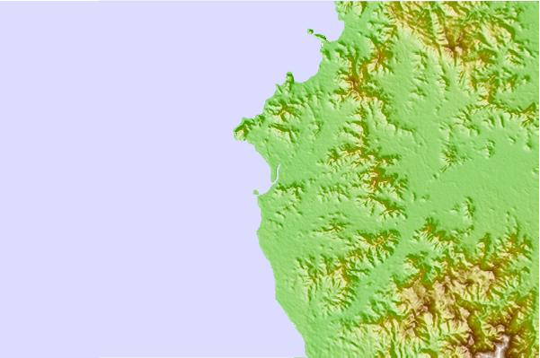
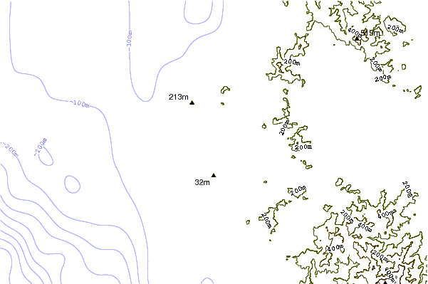
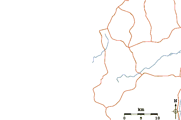
Utilizzare questa mappa sollievo per navigare Guanacaste surf breaks e stazioni di marea che si trovano nella zona diHenrys
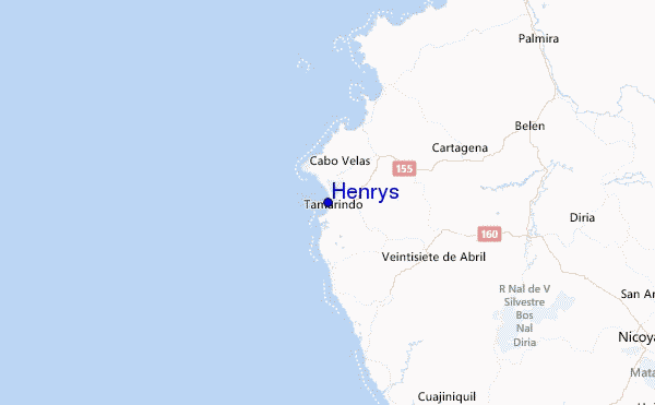
Altri surf breaks più vicini al Henrys:
(clicca sul nome del luogo per maggiori informazioni)- Closest località surf0 mi
- Second closest località surf1 mi
- Third closest località surf1 mi
- Fourth closest località surf1 mi
- Fifth closest località surf1 mi
Onda boe più vicina a Henrys:
- Closest Onda boa536 mi
- Second closest Onda boa663 mi
- Third closest Onda boa975 mi
- Fourth closest Onda boa1073 mi
- Fifth closest Onda boa1083 mi
Stazioni di marea più vicina alla Henrys:
- Closest marea stazioneSan Juan del Sur65 mi
- Second closest marea stazionePunta Arenas73 mi
- Third closest marea stazioneChacarita76 mi
- Fourth closest marea stazioneMasachapa112 mi
- Fifth closest marea stazioneSan Juan del Norte (Greytown)152 mi
Airports
- The closest passenger airport to Henrys is Nosara Airport (NOB) in Costa Rica, which is 43 km (27 miles) away (directly).
- The second nearest airport to Henrys is Daniel Oduber Quiros International (Liberia) Airport (LIR), also in Costa Rica, 45 km (28 miles) away.
- The third closest airport is Juan Santamaria International Airport (SJO), also in Costa Rica, 182 km (113 miles) away.
- /breaks/Henrys/forecasts/latest


 Nearest