

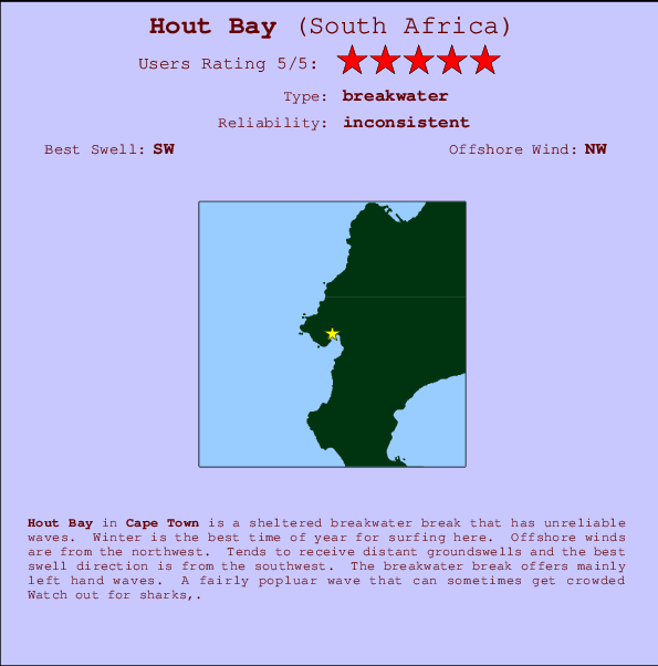
Hout Bay Surf Guide
Hout Bay in Cape Peninsula is a sheltered beach break that does not work very often. Winter is the optimum time of year for surfing here. The best wind direction is from the northwest. Groundswells more frequent than windswells and the optimum swell angle is from the southwest. The beach breaks offer lefts and rights. Sometimes crowded. Hazards include sharks,.
Hout Bay Spot Info
| Type: | Rating: | Reliability: | Todays Sea Temp*: |
|---|---|---|---|
| inconsistent | 14.5°C*ocean temperature recorded from satellite |
Surfing Hout Bay:
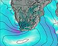
The best conditions reported for surf at Hout Bay occur when a Southwest swell combines with an offshore wind direction from the Northwest.
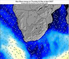
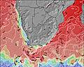
Previsioni Energia d'onda (Potenza): 12hrs

Hout Bay Surf:
Tuesday, 28 July 2026, 22:10 Local time| Mar | Mercoledì 29 | |||
| 11PM | 2AM | 5AM | 8AM | |
| Wave (m) | ||||
| Periodo (s) | 14 | 13 | 13 | 13 |
| Vento (km/h) | ||||
| Stato del vento | on | on | cross- on |
cross- on |
- /breaks/Hout-Bay/forecasts/latest
Hout Bay Surf Guide
Hout Bay in Cape Peninsula is a sheltered beach break that does not work very often. Winter is the optimum time of year for surfing here. The best wind direction is from the northwest. Groundswells more frequent than windswells and the optimum swell angle is from the southwest. The beach breaks offer lefts and rights. Sometimes crowded. Hazards include sharks,.
Hout Bay Spot Info
Type: Rating: Reliability: Todays Sea Temp*:  Breakwater
 5
5inconsistent 14.5°C*ocean temperature recorded from satelliteSurfing Hout Bay:
The best conditions reported for surf at Hout Bay occur when a Southwest swell combines with an offshore wind direction from the Northwest.
Previsioni Energia d'onda (Potenza): 12hrs
Utilizzare la scheda di navigazione in alto per visualizzare Hout Bay temperatura del mare, Hout Bay fotografie, Hout Bay dettagliate previsioni onde, il vento e le previsioni meteo, Hout Bay webcam, vento corrente da Cape Town stazioni meteo e Hout Bay previsioni marea. Il link South Africa mappe maree apre l'immagine grande, che mostra South Africa e dei mari circostanti. Queste mappe possono essere animate per mostrare le diverse componenti del moto ondoso, energia delle onde, periodo d'onda, altezza delle onde, insieme con le previsioni del vento e meteo, meteo corrente e osservazioni sullo stato del mare dal South Africa onda-boe, le navi passanti e stazioni meteo costiere. Ciascuna delle pagine di previsioni per questo surf break rappresenta uno strumento di wavefinder globale e regionale per individuare le migliori condizioni di surf nella zona intorno Hout Bay.
Hout Bay Surf:
Tuesday, 28 July 2026, 22:10 Local timeMar Mercoledì 29 11PM 2AM 5AM 8AM Wave (m) Periodo (s) 14 13 13 13 Vento (km/h) Stato del vento on on cross-
oncross-
on- /breaks/Hout-Bay/forecasts/latest
- /breaks/Hout-Bay/forecasts/latest/six_day
Hout Bay Surf Guide
Hout Bay in Cape Peninsula is a sheltered beach break that does not work very often. Winter is the optimum time of year for surfing here. The best wind direction is from the northwest. Groundswells more frequent than windswells and the optimum swell angle is from the southwest. The beach breaks offer lefts and rights. Sometimes crowded. Hazards include sharks,.
Hout Bay Spot Info
Type: Rating: Reliability: Todays Sea Temp*: Breakwater5inconsistent 14.5°C*ocean temperature recorded from satelliteSurfing Hout Bay:
The best conditions reported for surf at Hout Bay occur when a Southwest swell combines with an offshore wind direction from the Northwest.
Previsioni Energia d'onda (Potenza): 12hrs
Utilizzare la scheda di navigazione in alto per visualizzare Hout Bay temperatura del mare, Hout Bay fotografie, Hout Bay dettagliate previsioni onde, il vento e le previsioni meteo, Hout Bay webcam, vento corrente da Cape Town stazioni meteo e Hout Bay previsioni marea. Il link South Africa mappe maree apre l'immagine grande, che mostra South Africa e dei mari circostanti. Queste mappe possono essere animate per mostrare le diverse componenti del moto ondoso, energia delle onde, periodo d'onda, altezza delle onde, insieme con le previsioni del vento e meteo, meteo corrente e osservazioni sullo stato del mare dal South Africa onda-boe, le navi passanti e stazioni meteo costiere. Ciascuna delle pagine di previsioni per questo surf break rappresenta uno strumento di wavefinder globale e regionale per individuare le migliori condizioni di surf nella zona intorno Hout Bay.
Hout Bay Surf:
Tuesday, 28 July 2026, 22:10 Local timeMar Mercoledì 29 11PM 2AM 5AM 8AM Wave (m) Periodo (s) 14 13 13 13 Vento (km/h) Stato del vento on on cross-
oncross-
on- /breaks/Hout-Bay/forecasts/latest
Hout Bay Surf Guide
Hout Bay in Cape Peninsula is a sheltered beach break that does not work very often. Winter is the optimum time of year for surfing here. The best wind direction is from the northwest. Groundswells more frequent than windswells and the optimum swell angle is from the southwest. The beach breaks offer lefts and rights. Sometimes crowded. Hazards include sharks,.
Hout Bay Spot Info
Type: Rating: Reliability: Todays Sea Temp*: Breakwater5inconsistent 14.5°C*ocean temperature recorded from satelliteSurfing Hout Bay:
The best conditions reported for surf at Hout Bay occur when a Southwest swell combines with an offshore wind direction from the Northwest.
Previsioni Energia d'onda (Potenza): 12hrs
Utilizzare la scheda di navigazione in alto per visualizzare Hout Bay temperatura del mare, Hout Bay fotografie, Hout Bay dettagliate previsioni onde, il vento e le previsioni meteo, Hout Bay webcam, vento corrente da Cape Town stazioni meteo e Hout Bay previsioni marea. Il link South Africa mappe maree apre l'immagine grande, che mostra South Africa e dei mari circostanti. Queste mappe possono essere animate per mostrare le diverse componenti del moto ondoso, energia delle onde, periodo d'onda, altezza delle onde, insieme con le previsioni del vento e meteo, meteo corrente e osservazioni sullo stato del mare dal South Africa onda-boe, le navi passanti e stazioni meteo costiere. Ciascuna delle pagine di previsioni per questo surf break rappresenta uno strumento di wavefinder globale e regionale per individuare le migliori condizioni di surf nella zona intorno Hout Bay.
Hout Bay Surf:
Tuesday, 28 July 2026, 22:10 Local timeMar Mercoledì 29 11PM 2AM 5AM 8AM Wave (m) Periodo (s) 14 13 13 13 Vento (km/h) Stato del vento on on cross-
oncross-
onTide Times:
A Hout Bay (0 km).
PROSSIMA È ALLE (ora locale) rimanente alta marea bassa marea Hout Bay Tide Times and Tide Chart
Live Weather:
At Meadowridge wx, 9 km from Hout Bay.
calm
(km/h)Air temperature
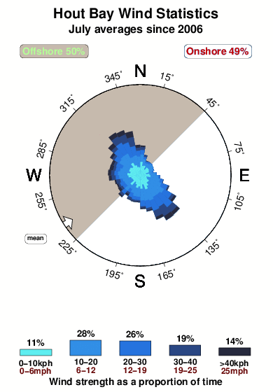
17°COverall Hout Bay Surf Consistency and Wind Distribution in Luglio
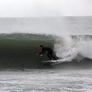
foto dall' album
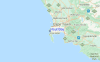
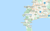
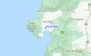
Contorni: Strade e fiumi: seleziona un surf break dal menu 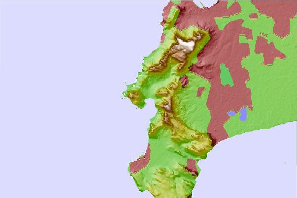
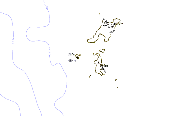
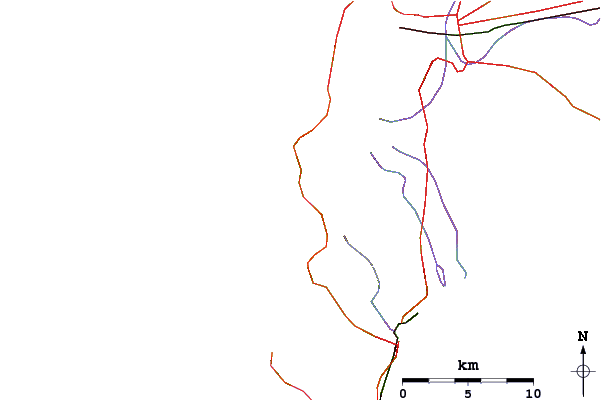
Utilizzare questa mappa sollievo per navigare Cape Town surf breaks e stazioni di marea che si trovano nella zona diHout Bay
Onda boe più vicina a Hout Bay:
- Closest Onda boa2637 mi
- Second closest Onda boa3903 mi
- Third closest Onda boa5122 mi
- Fourth closest Onda boa5161 mi
- Fifth closest Onda boa5195 mi
Stazioni di marea più vicina alla Hout Bay:
- Closest marea stazioneCape Town11 mi
- Second closest marea stazioneKhayelitsha18 mi
- Third closest marea stazioneHermanus57 mi
- Fourth closest marea stazioneSaldanha75 mi
- Fifth closest marea stazioneMosselbaai218 mi
Airports
- The nearest passenger airport to Hout Bay is Cape Town International Airport (CPT) in South Africa, which is 25 km (16 miles) away (directly).
- The second closest airport to Hout Bay is Oudtshoorn Airport (DUH), also in South Africa, 358 km (222 miles) away.
- /breaks/Hout-Bay/forecasts/latest


 Nearest