
Previsioni:

Previsione a breve terminePioggia abbondante (Totale 50mm), più pesante durante domenica notte. Warm (Max 21°C Sabato mattina, Min 17°C Domenica mattina). Venti in aumento (venti deboli da S Sabato notte, bufere nelle prossimità da S per lunedì mattina). | |||||||||||||||||||||||
Sabato 1 | Domenica 2 | Lunedì 3 | |||||||||||||||||||||
3 AM | 6 AM | 9 AM | 12 PM | 3 PM | 6 PM | 9 PM | 12 AM | 3 AM | 6 AM | 9 AM | 12 PM | 3 PM | 6 PM | 9 PM | 12 AM | 3 AM | 6 AM | 9 AM | 12 PM | 3 PM | 6 PM | 9 PM | |
Mappa dell'altezza del moto ondoso |  | 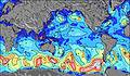 | 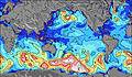 | 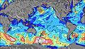 | 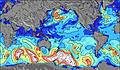 | 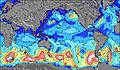 | 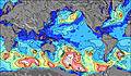 | 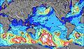 | 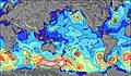 | ||||||||||||||
Onda Altezza (m) Direzione Periodo (s) | WSW 11 | WSW 11 | WSW 11 | WSW 11 | WSW 11 | WSW 11 | W 12 | W 12 | W 13 | W 12 | WSW 12 | SSW 12 | SW 12 | WSW 12 | SW 11 | SSW 14 | SW 16 | SW 16 | SW 17 | S 16 | SW 16 | SW 16 | SW 16 |
Grafico delle onde | |||||||||||||||||||||||
814 | 718 | 1390 | 1230 | 1602 | 1452 | 1672 | 1459 | 1423 | 1027 | 847 | 887 | 660 | 521 | 360 | 342 | 964 | 1318 | 1638 | 10400 | 3455 | 3412 | 3369 | |
Vento (km/h) | |||||||||||||||||||||||
Stato del vento onshore cross-onshore cross-shore cross-offshore offshore piatto | off | off | off | off | off | off | off | cross-off | cross-on | on | on | cross | off | cross-off | on | cross-off | cross-off | cross | cross-on | cross-on | cross-on | on | on |
Alta Marea | 8:38AM0.63m | 10:01PM0.50m | 9:49AM0.61m | 11:01PM0.57m | 10:51AM0.60m | ||||||||||||||||||
Basso Marea | 1:34AM0.37m | 3:52PM0.31m | 3:23AM0.37m | 4:39PM0.29m | 4:51AM0.35m | 5:16PM0.26m | |||||||||||||||||
— | 7:56 | — | — | — | — | — | — | — | 7:56 | — | — | — | — | — | — | — | 7:56 | — | — | — | — | — | |
— | — | — | — | — | 6:49 | — | — | — | — | — | — | — | 6:50 | — | — | — | — | — | — | — | 6:50 | — | |
mm | — | — | — | — | — | — | — | 2 | 4 | 5 | 1 | 1 | 1 | 3 | 10 | 8 | 4 | 1 | 3 | — | 1 | 2 | 3 |
Temp. °C | 20 | 20 | 21 | 21 | 21 | 21 | 21 | 20 | 19 | 19 | 19 | 19 | 21 | 20 | 17 | 19 | 19 | 19 | 17 | 18 | 18 | 17 | 17 |
Gelo °C | 16 | 15 | 17 | 16 | 17 | 18 | 18 | 18 | 20 | 19 | 18 | 19 | 18 | 18 | 12 | 13 | 13 | 18 | 7 | 12 | 13 | 11 | 10 |
Onda 1 Altezza (m) Direzione Periodo (s) | WSW 11 | WSW 11 | SE 12 | WSW 11 | SE 12 | SSW 13 | WSW 11 | SW 13 | W 13 | W 12 | WSW 12 | SSW 12 | SW 12 | SW 11 | SW 11 | SW 11 | SW 13 | ESE 7 | SW 13 | NNW 7 | SW 16 | SW 16 | SW 16 |
814 | 718 | 96 | 1230 | 114 | 479 | 1316 | 936 | 1423 | 1027 | 847 | 887 | 660 | 521 | 360 | 278 | 841 | 273 | 1147 | 176 | 3455 | 3412 | 3369 | |
Onda 2 Altezza (m) Direzione Periodo (s) | SE 13 | SW 13 | N 13 | SE 12 | N 13 | SE 12 | SW 13 | SE 12 | SW 12 | SW 12 | SSW 12 | W 12 | W 12 | WSW 12 | WSW 11 | SSW 14 | SW 16 | SW 13 | SW 17 | WSW 11 | NNW 8 | NNW 8 | NNW 8 |
28 | 242 | 14 | 118 | 14 | 112 | 700 | 110 | 864 | 850 | 816 | 650 | 480 | 415 | 320 | 342 | 964 | 981 | 1638 | 40 | 186 | 170 | 107 | |
Onda 3 Altezza (m) Direzione Periodo (s) | SE 10 | SE 13 | N 13 | NNW 11 | NNW 10 | N 13 | SE 12 | N 13 | SE 12 | SE 12 | SE 11 | SE 11 | SE 11 | SW 18 | SW 18 | WSW 11 | W 11 | SW 16 | SE 7 | N 11 | WSW 11 | WSW 11 | NNW 10 |
14 | 80 | 14 | 11 | 10 | 12 | 112 | 13 | 108 | 130 | 127 | 125 | 101 | 252 | 323 | 217 | 154 | 1318 | 176 | 21 | 23 | 12 | 20 | |
onde vento Altezza (m) Direzione Periodo (s) | NW 4 | NW 5 | WSW 11 | NW 5 | WSW 11 | WSW 11 | W 12 | W 12 | — | — | — | — | SE 4 | SSE 11 | SSE 5 | SE 6 | ESE 6 | N 5 | NNW 6 | S 16 | SSE 9 | SSE 8 | SE 9 |
37 | 65 | 1390 | 49 | 1602 | 1452 | 1672 | 1459 | — | — | — | — | 26 | 466 | 147 | 259 | 330 | 8 | 184 | 10400 | 2201 | 1320 | 1793 | |
Il più vicino Offshore or Glassy | |||||||||||||||||||||||
Distanza (km) | 3633 | 3633 | 3648 | 3664 | 3663 | 3674 | 3674 | 3607 | 8 | 8 | 8 | 2 | 3633 | 3632 | 3586 | 3574 | 3574 | 9 | 3539 | 3523 | 3523 | 3523 | 3523 |
Migliori previsioni per le condizioni d'onda in Easter Island | |||||||||||||||||||||||
Migliori previsioni per le condizioni d'onda in Chile | |||||||||||||||||||||||
Trova Onde Globale | |||||||||||||||||||||||
- Map Icons:
 Break
Break Live Wave Height (m)
 Live Wind Speed (km/h)
 Surf Rating (10 Max)
 Ocean Swells (m)
- Wind Speed (km/h)
Widget Free Surf-Forecast.com per il tuo sito
La relazione di surf / widget meteo è disponibile qui sotto per incorporare su siti esterni a titolo gratuito e fornisce una sintesi delle nostre Huareva previsione surf. Basta prendere il frammento di codice html da noi fornito e copiarlo nel proprio sito. È possibile scegliere la lingua preferita e unità metriche / imperiali per il feed delle previsioni surf per soddisfare le esigenze degli utenti del vostro sito .... Clicca qui per ottenere il codice.
 Nearest