
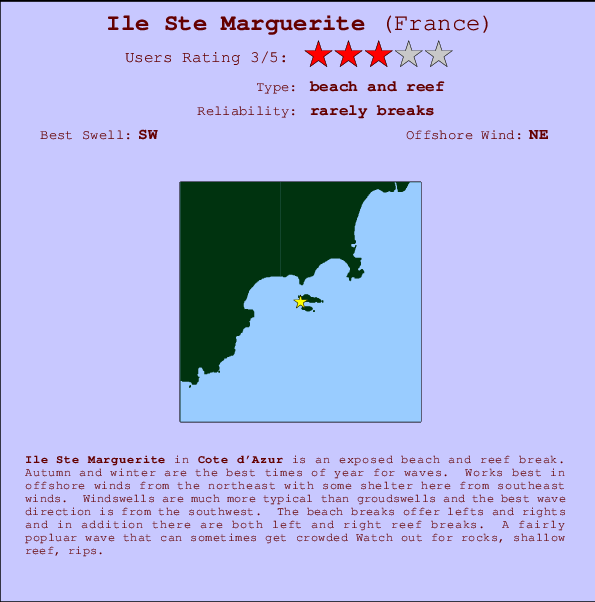
Ile Ste Marguerite Surf Guide
Ile Ste Marguerite in Cote d'Azur is an exposed beach and reef break. Autumn and winter are the optimum times of year for waves. Offshore winds blow from the northeast with some shelter here from southeast winds. Most of the surf comes fis in the form of windswells and the best wave direction is from the southwest. The beach break provides left and right handers together with both left and right hand reef breaks offshore. Sometimes crowded. Take care of rocks, shallow reef, rips.
Ile Ste Marguerite Spot Info
| Type: | Rating: | Reliability: | Todays Sea Temp*: |
|---|---|---|---|
| rarely breaks | 27.0°C*ocean temperature recorded from satellite |
Surfing Ile Ste Marguerite:
The best conditions reported for surf at Ile Ste Marguerite occur when a Southwest swell combines with an offshore wind direction from the Northeast.
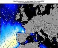
Previsioni Energia d'onda (Potenza): 12hrs


Ile Ste Marguerite Surf:
Thursday, 16 July 2026, 05:29 Local time| Mer | Giovedì 16 | |||
| 11PM | 2AM | 5AM | 8AM | |
| Wave (m) | ||||
| Periodo (s) | 4 | 4 | - | - |
| Vento (km/h) | ||||
| Stato del vento | on | cross- off |
off | cross- off |
- /breaks/Ile-Ste-Marguerite/forecasts/latest
Ile Ste Marguerite Surf Guide
Ile Ste Marguerite in Cote d'Azur is an exposed beach and reef break. Autumn and winter are the optimum times of year for waves. Offshore winds blow from the northeast with some shelter here from southeast winds. Most of the surf comes fis in the form of windswells and the best wave direction is from the southwest. The beach break provides left and right handers together with both left and right hand reef breaks offshore. Sometimes crowded. Take care of rocks, shallow reef, rips.
Ile Ste Marguerite Spot Info
Type: Rating: Reliability: Todays Sea Temp*:  Beach and reef
 3
3rarely breaks 27.0°C*ocean temperature recorded from satelliteSurfing Ile Ste Marguerite:
The best conditions reported for surf at Ile Ste Marguerite occur when a Southwest swell combines with an offshore wind direction from the Northeast.
Previsioni Energia d'onda (Potenza): 12hrs
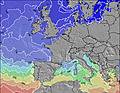
Utilizzare la scheda di navigazione in alto per visualizzare Ile Ste Marguerite temperatura del mare, Ile Ste Marguerite fotografie, Ile Ste Marguerite dettagliate previsioni onde, il vento e le previsioni meteo, Ile Ste Marguerite webcam, vento corrente da Mediterranean - Cote d'Azur stazioni meteo e Ile Ste Marguerite previsioni marea. Il link France mappe maree apre l'immagine grande, che mostra France e dei mari circostanti. Queste mappe possono essere animate per mostrare le diverse componenti del moto ondoso, energia delle onde, periodo d'onda, altezza delle onde, insieme con le previsioni del vento e meteo, meteo corrente e osservazioni sullo stato del mare dal France onda-boe, le navi passanti e stazioni meteo costiere. Ciascuna delle pagine di previsioni per questo surf break rappresenta uno strumento di wavefinder globale e regionale per individuare le migliori condizioni di surf nella zona intorno Ile Ste Marguerite.
Ile Ste Marguerite Surf:
Thursday, 16 July 2026, 05:29 Local timeMer Giovedì 16 11PM 2AM 5AM 8AM Wave (m) Periodo (s) 4 4 - - Vento (km/h) Stato del vento on cross-
offoff cross-
off- /breaks/Ile-Ste-Marguerite/forecasts/latest
- /breaks/Ile-Ste-Marguerite/forecasts/latest/six_day
Ile Ste Marguerite Surf Guide
Ile Ste Marguerite in Cote d'Azur is an exposed beach and reef break. Autumn and winter are the optimum times of year for waves. Offshore winds blow from the northeast with some shelter here from southeast winds. Most of the surf comes fis in the form of windswells and the best wave direction is from the southwest. The beach break provides left and right handers together with both left and right hand reef breaks offshore. Sometimes crowded. Take care of rocks, shallow reef, rips.
Ile Ste Marguerite Spot Info
Type: Rating: Reliability: Todays Sea Temp*: Beach and reef3rarely breaks 27.0°C*ocean temperature recorded from satelliteSurfing Ile Ste Marguerite:
The best conditions reported for surf at Ile Ste Marguerite occur when a Southwest swell combines with an offshore wind direction from the Northeast.
Previsioni Energia d'onda (Potenza): 12hrs
Utilizzare la scheda di navigazione in alto per visualizzare Ile Ste Marguerite temperatura del mare, Ile Ste Marguerite fotografie, Ile Ste Marguerite dettagliate previsioni onde, il vento e le previsioni meteo, Ile Ste Marguerite webcam, vento corrente da Mediterranean - Cote d'Azur stazioni meteo e Ile Ste Marguerite previsioni marea. Il link France mappe maree apre l'immagine grande, che mostra France e dei mari circostanti. Queste mappe possono essere animate per mostrare le diverse componenti del moto ondoso, energia delle onde, periodo d'onda, altezza delle onde, insieme con le previsioni del vento e meteo, meteo corrente e osservazioni sullo stato del mare dal France onda-boe, le navi passanti e stazioni meteo costiere. Ciascuna delle pagine di previsioni per questo surf break rappresenta uno strumento di wavefinder globale e regionale per individuare le migliori condizioni di surf nella zona intorno Ile Ste Marguerite.
Ile Ste Marguerite Surf:
Thursday, 16 July 2026, 05:29 Local timeMer Giovedì 16 11PM 2AM 5AM 8AM Wave (m) Periodo (s) 4 4 - - Vento (km/h) Stato del vento on cross-
offoff cross-
off- /breaks/Ile-Ste-Marguerite/forecasts/latest
Ile Ste Marguerite Surf Guide
Ile Ste Marguerite in Cote d'Azur is an exposed beach and reef break. Autumn and winter are the optimum times of year for waves. Offshore winds blow from the northeast with some shelter here from southeast winds. Most of the surf comes fis in the form of windswells and the best wave direction is from the southwest. The beach break provides left and right handers together with both left and right hand reef breaks offshore. Sometimes crowded. Take care of rocks, shallow reef, rips.
Ile Ste Marguerite Spot Info
Type: Rating: Reliability: Todays Sea Temp*: Beach and reef3rarely breaks 27.0°C*ocean temperature recorded from satelliteSurfing Ile Ste Marguerite:
The best conditions reported for surf at Ile Ste Marguerite occur when a Southwest swell combines with an offshore wind direction from the Northeast.
Previsioni Energia d'onda (Potenza): 12hrs
Utilizzare la scheda di navigazione in alto per visualizzare Ile Ste Marguerite temperatura del mare, Ile Ste Marguerite fotografie, Ile Ste Marguerite dettagliate previsioni onde, il vento e le previsioni meteo, Ile Ste Marguerite webcam, vento corrente da Mediterranean - Cote d'Azur stazioni meteo e Ile Ste Marguerite previsioni marea. Il link France mappe maree apre l'immagine grande, che mostra France e dei mari circostanti. Queste mappe possono essere animate per mostrare le diverse componenti del moto ondoso, energia delle onde, periodo d'onda, altezza delle onde, insieme con le previsioni del vento e meteo, meteo corrente e osservazioni sullo stato del mare dal France onda-boe, le navi passanti e stazioni meteo costiere. Ciascuna delle pagine di previsioni per questo surf break rappresenta uno strumento di wavefinder globale e regionale per individuare le migliori condizioni di surf nella zona intorno Ile Ste Marguerite.
Ile Ste Marguerite Surf:
Thursday, 16 July 2026, 05:29 Local timeMer Giovedì 16 11PM 2AM 5AM 8AM Wave (m) Periodo (s) 4 4 - - Vento (km/h) Stato del vento on cross-
offoff cross-
offTide Times:
Per Cannes, %{dist} %{km} da %{location}.
PROSSIMA È ALLE (ora locale) rimanente alta marea bassa marea Ile Ste Marguerite Tide Times and Tide Chart
Live Weather:
At Cannes/Mandelieu la Napoule Airport, 7 km from Ile Ste Marguerite.
calm
(km/h)Air temperature
Q1016°Cfoto dall' album
Contorni: Strade e fiumi: seleziona un surf break dal menu 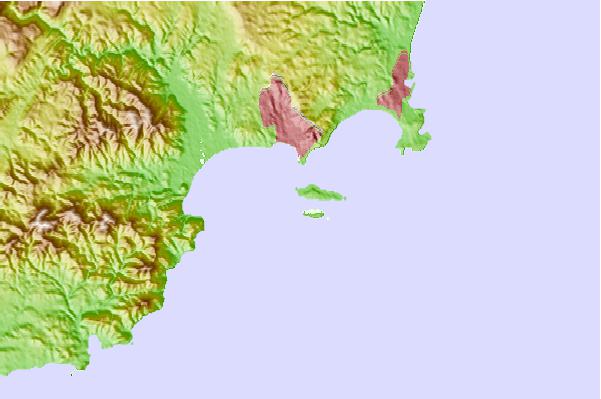
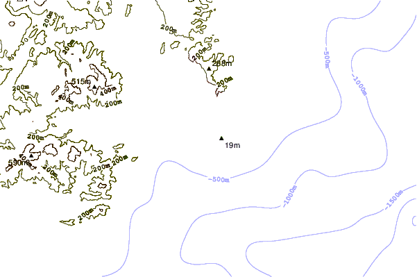
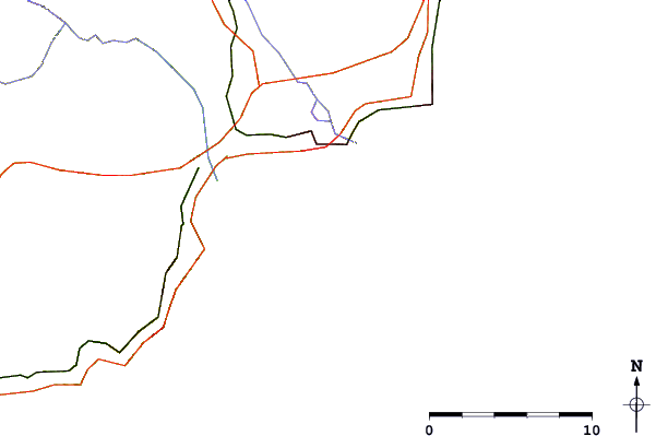
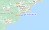
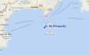
Utilizzare questa mappa sollievo per navigare Mediterranean - Cote d'Azur surf breaks e stazioni di marea che si trovano nella zona diIle Ste Marguerite
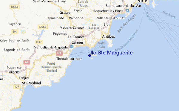
Altri surf breaks più vicini al Ile Ste Marguerite:
(clicca sul nome del luogo per maggiori informazioni)- Closest località surf1 mi
- Second closest località surf1 mi
- Third closest località surf2 mi
- Fourth closest località surf3 mi
- Fifth closest località surf5 mi
Onda boe più vicina a Ile Ste Marguerite:
- Closest Onda boa39 mi
- Second closest Onda boa154 mi
- Third closest Onda boa579 mi
- Fourth closest Onda boa579 mi
- Fifth closest Onda boa580 mi
Stazioni di marea più vicina alla Ile Ste Marguerite:
- Closest marea stazioneCannes3 mi
- Second closest marea stazioneVallauris4 mi
- Third closest marea stazioneMandelieu-la-Napoule6 mi
- Fourth closest marea stazioneAntibes6 mi
- Fifth closest marea stazioneCagnes-sur-Mer12 mi
Airports
- The closest passenger airport to Ile Ste Marguerite is Mandelieu (Cannes) Airport (CEQ) in France, 7 km (4 miles) away (directly).
- The second nearest airport to Ile Ste Marguerite is Cote D Azur (Nice) Airport (NCE), also in France, 22 km (14 miles) away.
- Third is Hyeres Airport (TLN) in France, 86 km (53 miles) away.
- Le Castellet Airport (CTT) in France is 105 km (65 miles) away.
- Albenga Airport (ALL) in Italy is the fifth nearest airport to Ile Ste Marguerite and is 106 km (66 miles) away.
- /breaks/Ile-Ste-Marguerite/forecasts/latest
 Nearest