

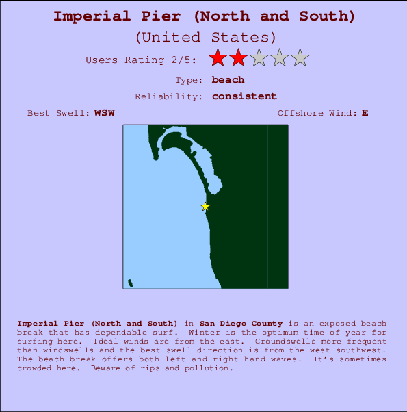
Imperial Pier (North and South) Surf Guide
Imperial Pier (North and South) in San Diego County is an exposed beach break that has consistent surf. Winter is the best time of year for surfing here. Offshore winds blow from the east. Tends to receive distant groundswells and the best swell direction is from the west southwest. The beach breaks offer lefts and rights. Sometimes crowded. Beware of rips and pollution.
Imperial Pier (North and South) Spot Info
| Type: | Rating: | Reliability: | Todays Sea Temp*: |
|---|---|---|---|
| consistent | 21.5°C*ocean temperature recorded from satellite |
Surfing Imperial Pier (North and South):
The best conditions reported for surf at Imperial Pier (North and South) occur when a West-southwest swell combines with an offshore wind direction from the East.

Previsioni Energia d'onda (Potenza): 12hrs


Imperial Pier (North and South) Surf:
Saturday, 18 July 2026, 04:11 Local time| Sabato 18 | ||||
| 2AM | 5AM | 8AM | 11AM | |
| Wave (m) | ||||
| Periodo (s) | 14 | 17 | 17 | 18 |
| Vento (km/h) | ||||
| Stato del vento | cross | cross- on |
cross- on |
cross- on |
- /breaks/Imperial-Pier/forecasts/latest
Imperial Pier (North and South) Surf Guide
Imperial Pier (North and South) in San Diego County is an exposed beach break that has consistent surf. Winter is the best time of year for surfing here. Offshore winds blow from the east. Tends to receive distant groundswells and the best swell direction is from the west southwest. The beach breaks offer lefts and rights. Sometimes crowded. Beware of rips and pollution.
Imperial Pier (North and South) Spot Info
Type: Rating: Reliability: Todays Sea Temp*:  Beach
Beach 2
2consistent 21.5°C*ocean temperature recorded from satelliteSurfing Imperial Pier (North and South):
The best conditions reported for surf at Imperial Pier (North and South) occur when a West-southwest swell combines with an offshore wind direction from the East.
Previsioni Energia d'onda (Potenza): 12hrs
Utilizzare la scheda di navigazione in alto per visualizzare Imperial Pier (North and South) temperatura del mare, Imperial Pier (North and South) fotografie, Imperial Pier (North and South) dettagliate previsioni onde, il vento e le previsioni meteo, Imperial Pier (North and South) webcam, vento corrente da CAL - San Diego County stazioni meteo e Imperial Pier (North and South) previsioni marea. Il link United States mappe maree apre l'immagine grande, che mostra United States e dei mari circostanti. Queste mappe possono essere animate per mostrare le diverse componenti del moto ondoso, energia delle onde, periodo d'onda, altezza delle onde, insieme con le previsioni del vento e meteo, meteo corrente e osservazioni sullo stato del mare dal United States onda-boe, le navi passanti e stazioni meteo costiere. Ciascuna delle pagine di previsioni per questo surf break rappresenta uno strumento di wavefinder globale e regionale per individuare le migliori condizioni di surf nella zona intorno Imperial Pier (North and South).
Imperial Pier (North and South) Surf:
Saturday, 18 July 2026, 04:11 Local timeSabato 18 2AM 5AM 8AM 11AM Wave (m) Periodo (s) 14 17 17 18 Vento (km/h) Stato del vento cross cross-
oncross-
oncross-
on- /breaks/Imperial-Pier/forecasts/latest
- /breaks/Imperial-Pier/forecasts/latest/six_day
Imperial Pier (North and South) Surf Guide
Imperial Pier (North and South) in San Diego County is an exposed beach break that has consistent surf. Winter is the best time of year for surfing here. Offshore winds blow from the east. Tends to receive distant groundswells and the best swell direction is from the west southwest. The beach breaks offer lefts and rights. Sometimes crowded. Beware of rips and pollution.
Imperial Pier (North and South) Spot Info
Type: Rating: Reliability: Todays Sea Temp*: Beach2consistent 21.5°C*ocean temperature recorded from satelliteSurfing Imperial Pier (North and South):
The best conditions reported for surf at Imperial Pier (North and South) occur when a West-southwest swell combines with an offshore wind direction from the East.
Previsioni Energia d'onda (Potenza): 12hrs
Utilizzare la scheda di navigazione in alto per visualizzare Imperial Pier (North and South) temperatura del mare, Imperial Pier (North and South) fotografie, Imperial Pier (North and South) dettagliate previsioni onde, il vento e le previsioni meteo, Imperial Pier (North and South) webcam, vento corrente da CAL - San Diego County stazioni meteo e Imperial Pier (North and South) previsioni marea. Il link United States mappe maree apre l'immagine grande, che mostra United States e dei mari circostanti. Queste mappe possono essere animate per mostrare le diverse componenti del moto ondoso, energia delle onde, periodo d'onda, altezza delle onde, insieme con le previsioni del vento e meteo, meteo corrente e osservazioni sullo stato del mare dal United States onda-boe, le navi passanti e stazioni meteo costiere. Ciascuna delle pagine di previsioni per questo surf break rappresenta uno strumento di wavefinder globale e regionale per individuare le migliori condizioni di surf nella zona intorno Imperial Pier (North and South).
Imperial Pier (North and South) Surf:
Saturday, 18 July 2026, 04:11 Local timeSabato 18 2AM 5AM 8AM 11AM Wave (m) Periodo (s) 14 17 17 18 Vento (km/h) Stato del vento cross cross-
oncross-
oncross-
on- /breaks/Imperial-Pier/forecasts/latest
Imperial Pier (North and South) Surf Guide
Imperial Pier (North and South) in San Diego County is an exposed beach break that has consistent surf. Winter is the best time of year for surfing here. Offshore winds blow from the east. Tends to receive distant groundswells and the best swell direction is from the west southwest. The beach breaks offer lefts and rights. Sometimes crowded. Beware of rips and pollution.
Imperial Pier (North and South) Spot Info
Type: Rating: Reliability: Todays Sea Temp*: Beach2consistent 21.5°C*ocean temperature recorded from satelliteSurfing Imperial Pier (North and South):
The best conditions reported for surf at Imperial Pier (North and South) occur when a West-southwest swell combines with an offshore wind direction from the East.
Previsioni Energia d'onda (Potenza): 12hrs
Utilizzare la scheda di navigazione in alto per visualizzare Imperial Pier (North and South) temperatura del mare, Imperial Pier (North and South) fotografie, Imperial Pier (North and South) dettagliate previsioni onde, il vento e le previsioni meteo, Imperial Pier (North and South) webcam, vento corrente da CAL - San Diego County stazioni meteo e Imperial Pier (North and South) previsioni marea. Il link United States mappe maree apre l'immagine grande, che mostra United States e dei mari circostanti. Queste mappe possono essere animate per mostrare le diverse componenti del moto ondoso, energia delle onde, periodo d'onda, altezza delle onde, insieme con le previsioni del vento e meteo, meteo corrente e osservazioni sullo stato del mare dal United States onda-boe, le navi passanti e stazioni meteo costiere. Ciascuna delle pagine di previsioni per questo surf break rappresenta uno strumento di wavefinder globale e regionale per individuare le migliori condizioni di surf nella zona intorno Imperial Pier (North and South).
Imperial Pier (North and South) Surf:
Saturday, 18 July 2026, 04:11 Local timeSabato 18 2AM 5AM 8AM 11AM Wave (m) Periodo (s) 14 17 17 18 Vento (km/h) Stato del vento cross cross-
oncross-
oncross-
onTide Times:
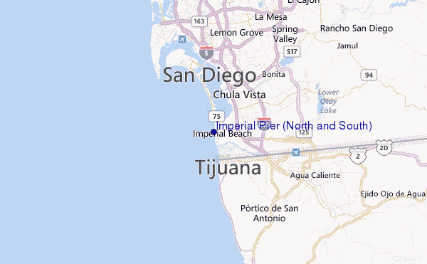
A Imperial Beach, California (0 km).
PROSSIMA È ALLE (ora locale) rimanente alta marea bassa marea Imperial Pier (North and South) Tide Times and Tide Chart
Live Weather:
At BUOY-TIXC1, 0 km from Imperial Pier (North and South).
calm
(km/h)Air temperature
20.5°COverall Imperial Pier (North and South) Surf Consistency and Wind Distribution in Luglio
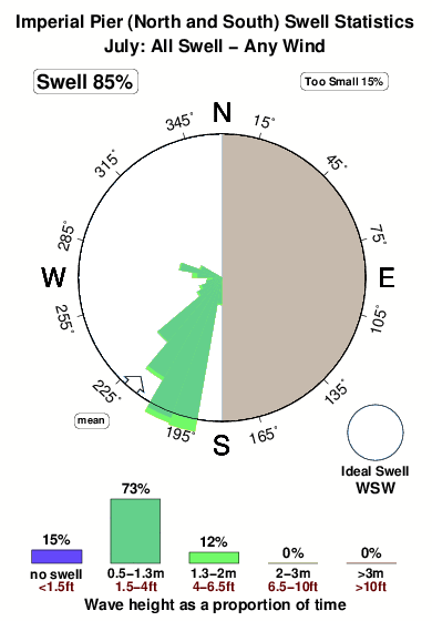


Surf stats for Imperial Pier (North and South): see the swell variation by month.
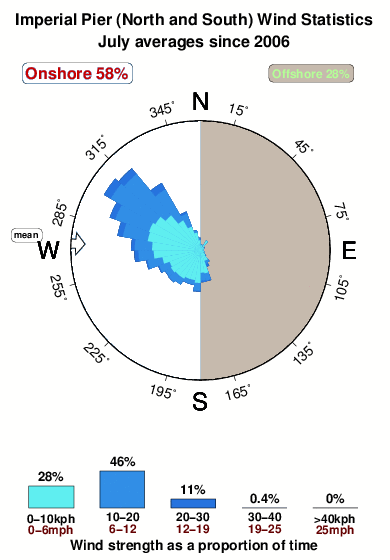
Wind stats for Imperial Pier (North and South): see the variation in direction and stength by month.
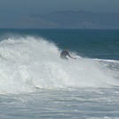
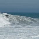
foto dall' album
Contorni: Strade e fiumi: seleziona un surf break dal menu 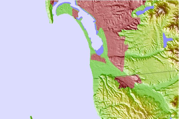
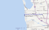
Utilizzare questa mappa sollievo per navigare CAL - San Diego County surf breaks e stazioni di marea che si trovano nella zona diImperial Pier (North and South)
Altri surf breaks più vicini al Imperial Pier (North and South):
(clicca sul nome del luogo per maggiori informazioni)- Closest località surf1 mi
- Second closest località surf2 mi
- Third closest località surf8 mi
- Fourth closest località surf8 mi
- Fifth closest località surf9 mi
Onda boe più vicina a Imperial Pier (North and South):
- Closest Onda boa2 mi
- Second closest Onda boa17 mi
- Third closest Onda boa21 mi
- Fourth closest Onda boa22 mi
- Fifth closest Onda boa24 mi
Stazioni di marea più vicina alla Imperial Pier (North and South):
- Closest marea stazioneImperial Beach0 mi
- Second closest marea stazioneChula Vista4 mi
- Third closest marea stazioneNational City, San Diego Bay6 mi
- Fourth closest marea stazioneTijuana6 mi
- Fifth closest marea stazionePoint Loma8 mi
Airports
- The closest passenger airport to Imperial Pier (North and South) is North Island Nas (San Diego) Airport (NZY) in USA, 15 km (9 miles) away (directly).
- The second nearest airport to Imperial Pier (North and South) is General Abelardo L Rodriguez International (Tijuana) Airport (TIJ) in Mexico, 16 km (10 miles) away.
- Third is San Diego International Lindbergh Fld Airport (SAN) in USA, 18 km (11 miles) away.
- Miramar Mcas Airport (NKX) in USA is 32 km (20 miles) away.
- General Alberto L Salinas C International (Ensenada) Airport (ESE) in Mexico is the fifth nearest airport to Imperial Pier (North and South) and is 101 km (63 miles) away.
- /breaks/Imperial-Pier/forecasts/latest


 Nearest