
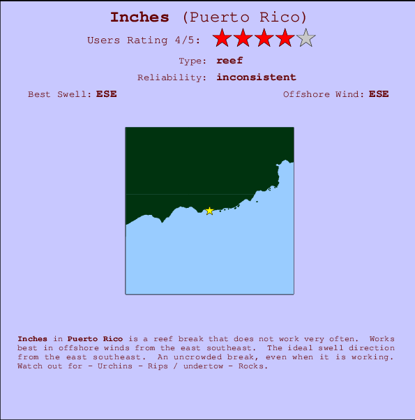
Inches Surf Guide
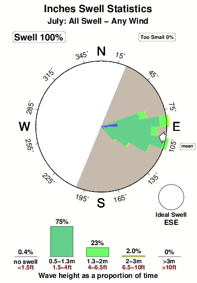
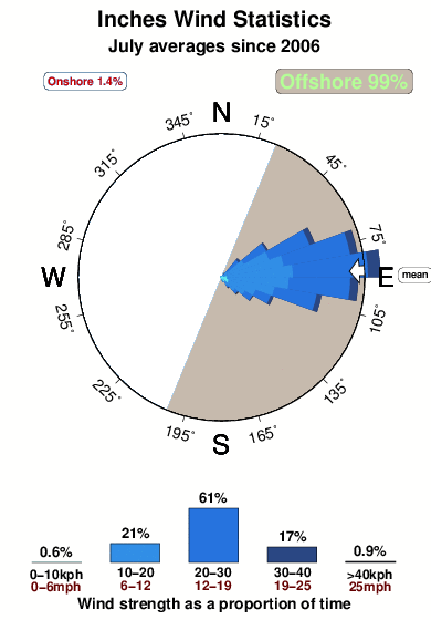
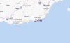
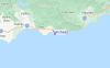
Inches in Puerto Rico is a fairly exposed reef break that has inconsistent surf. Ideal winds are from the east southeast. The best swell direction is from the east southeast. Even when the surf is up, crowds are unknown. Beware of - Urchins - Rips / undertow - Rocks.
Inches Spot Info
| Type: | Rating: | Reliability: | Todays Sea Temp*: |
|---|---|---|---|
| inconsistent | 28.6°C*ocean temperature recorded from satellite |
Surfing Inches:
The best conditions reported for surf at Inches occur when a East-southeast swell combines with an offshore wind direction from the East-southeast.

Previsioni Energia d'onda (Potenza): 12hrs


Inches Surf:
Tuesday, 21 July 2026, 04:47 Local time| Martedì 21 | ||||
| 5AM | 8AM | 11AM | 2PM | |
| Wave (m) | ||||
| Periodo (s) | 8 | 8 | 7 | 7 |
| Vento (km/h) | ||||
| Stato del vento | cross | cross | cross- off |
cross- off |
- /breaks/Inches/forecasts/latest

Inches Surf Guide
Inches in Puerto Rico is a fairly exposed reef break that has inconsistent surf. Ideal winds are from the east southeast. The best swell direction is from the east southeast. Even when the surf is up, crowds are unknown. Beware of - Urchins - Rips / undertow - Rocks.
Inches Spot Info
Type: Rating: Reliability: Todays Sea Temp*:  Reef
Reef 4
4inconsistent 28.6°C*ocean temperature recorded from satelliteSurfing Inches:
The best conditions reported for surf at Inches occur when a East-southeast swell combines with an offshore wind direction from the East-southeast.
Previsioni Energia d'onda (Potenza): 12hrs
Utilizzare la scheda di navigazione in alto per visualizzare Inches temperatura del mare, Inches fotografie, Inches dettagliate previsioni onde, il vento e le previsioni meteo, Inches webcam, vento corrente da Puerto Rico stazioni meteo e Inches previsioni marea. Il link Puerto Rico mappe maree apre l'immagine grande, che mostra Puerto Rico e dei mari circostanti. Queste mappe possono essere animate per mostrare le diverse componenti del moto ondoso, energia delle onde, periodo d'onda, altezza delle onde, insieme con le previsioni del vento e meteo, meteo corrente e osservazioni sullo stato del mare dal Puerto Rico onda-boe, le navi passanti e stazioni meteo costiere. Ciascuna delle pagine di previsioni per questo surf break rappresenta uno strumento di wavefinder globale e regionale per individuare le migliori condizioni di surf nella zona intorno Inches.
Inches Surf:
Tuesday, 21 July 2026, 04:47 Local timeMartedì 21 5AM 8AM 11AM 2PM Wave (m) Periodo (s) 8 8 7 7 Vento (km/h) Stato del vento cross cross cross-
offcross-
off- /breaks/Inches/forecasts/latest
- /breaks/Inches/forecasts/latest/six_day
Inches Surf Guide
Inches in Puerto Rico is a fairly exposed reef break that has inconsistent surf. Ideal winds are from the east southeast. The best swell direction is from the east southeast. Even when the surf is up, crowds are unknown. Beware of - Urchins - Rips / undertow - Rocks.
Inches Spot Info
Type: Rating: Reliability: Todays Sea Temp*: Reef4inconsistent 28.6°C*ocean temperature recorded from satelliteSurfing Inches:
The best conditions reported for surf at Inches occur when a East-southeast swell combines with an offshore wind direction from the East-southeast.
Previsioni Energia d'onda (Potenza): 12hrs
Utilizzare la scheda di navigazione in alto per visualizzare Inches temperatura del mare, Inches fotografie, Inches dettagliate previsioni onde, il vento e le previsioni meteo, Inches webcam, vento corrente da Puerto Rico stazioni meteo e Inches previsioni marea. Il link Puerto Rico mappe maree apre l'immagine grande, che mostra Puerto Rico e dei mari circostanti. Queste mappe possono essere animate per mostrare le diverse componenti del moto ondoso, energia delle onde, periodo d'onda, altezza delle onde, insieme con le previsioni del vento e meteo, meteo corrente e osservazioni sullo stato del mare dal Puerto Rico onda-boe, le navi passanti e stazioni meteo costiere. Ciascuna delle pagine di previsioni per questo surf break rappresenta uno strumento di wavefinder globale e regionale per individuare le migliori condizioni di surf nella zona intorno Inches.
Inches Surf:
Tuesday, 21 July 2026, 04:47 Local timeMartedì 21 5AM 8AM 11AM 2PM Wave (m) Periodo (s) 8 8 7 7 Vento (km/h) Stato del vento cross cross cross-
offcross-
off- /breaks/Inches/forecasts/latest
Inches Surf Guide
Inches in Puerto Rico is a fairly exposed reef break that has inconsistent surf. Ideal winds are from the east southeast. The best swell direction is from the east southeast. Even when the surf is up, crowds are unknown. Beware of - Urchins - Rips / undertow - Rocks.
Inches Spot Info
Type: Rating: Reliability: Todays Sea Temp*: Reef4inconsistent 28.6°C*ocean temperature recorded from satelliteSurfing Inches:
The best conditions reported for surf at Inches occur when a East-southeast swell combines with an offshore wind direction from the East-southeast.
Previsioni Energia d'onda (Potenza): 12hrs
Utilizzare la scheda di navigazione in alto per visualizzare Inches temperatura del mare, Inches fotografie, Inches dettagliate previsioni onde, il vento e le previsioni meteo, Inches webcam, vento corrente da Puerto Rico stazioni meteo e Inches previsioni marea. Il link Puerto Rico mappe maree apre l'immagine grande, che mostra Puerto Rico e dei mari circostanti. Queste mappe possono essere animate per mostrare le diverse componenti del moto ondoso, energia delle onde, periodo d'onda, altezza delle onde, insieme con le previsioni del vento e meteo, meteo corrente e osservazioni sullo stato del mare dal Puerto Rico onda-boe, le navi passanti e stazioni meteo costiere. Ciascuna delle pagine di previsioni per questo surf break rappresenta uno strumento di wavefinder globale e regionale per individuare le migliori condizioni di surf nella zona intorno Inches.
Inches Surf:
Tuesday, 21 July 2026, 04:47 Local timeMartedì 21 5AM 8AM 11AM 2PM Wave (m) Periodo (s) 8 8 7 7 Vento (km/h) Stato del vento cross cross cross-
offcross-
offTide Times:
Per Punta Tuna, Puerto Rico, %{dist} %{km} da %{location}.
PROSSIMA È ALLE (ora locale) rimanente alta marea bassa marea Inches Tide Times and Tide Chart
Live Weather:
At Guayama, 18 km from Inches.
calm
(km/h)
dryAir temperature
27°COverall Inches Surf Consistency and Wind Distribution in Luglio
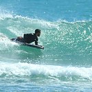
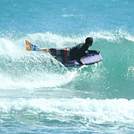
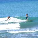
foto dall' album
Contorni: Strade e fiumi: seleziona un surf break dal menu 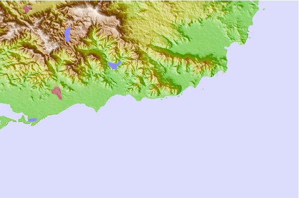
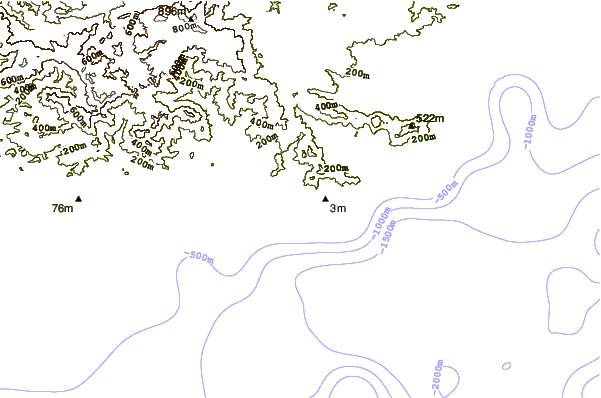
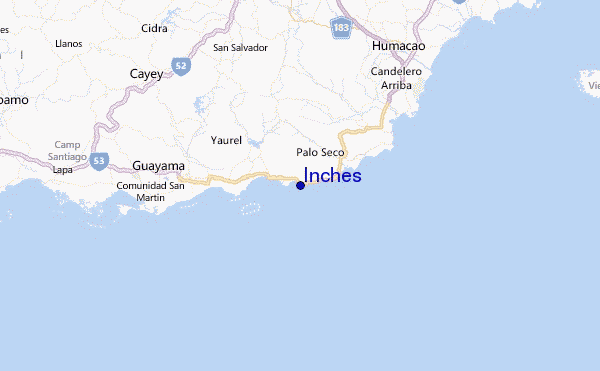
Utilizzare questa mappa sollievo per navigare Puerto Rico surf breaks e stazioni di marea che si trovano nella zona diInches
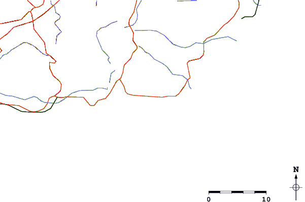
Altri surf breaks più vicini al Inches:
(clicca sul nome del luogo per maggiori informazioni)- Closest località surf5 mi
- Second closest località surf7 mi
- Third closest località surf8 mi
- Fourth closest località surf13 mi
- Fifth closest località surf14 mi
Onda boe più vicina a Inches:
- Closest Onda boa36 mi
- Second closest Onda boa37 mi
- Third closest Onda boa39 mi
- Fourth closest Onda boa81 mi
- Fifth closest Onda boa91 mi
Stazioni di marea più vicina alla Inches:
- Closest marea stazionePunta Tuna5 mi
- Second closest marea stazionePuerto Maunabo6 mi
- Third closest marea stazioneArroyo7 mi
- Fourth closest marea stazioneGuayama10 mi
- Fifth closest marea stazioneYabucoa Harbor10 mi
Airports
- The closest passenger airport to Inches is Roosevelt Roads Ns Airport (NRR) in Puerto Rico, 45 km (28 miles) away (directly).
- The second nearest airport to Inches is Diego Jimenez Torres (Fajardo) Airport (FAJ), also in Puerto Rico, 49 km (30 miles) away.
- Third is Luis Munoz Marin International (San Juan) Airport (SJU) in Puerto Rico, 52 km (32 miles) away.
- Fernando Luis Ribas Dominicci (San Juan) Airport (SIG) in Puerto Rico is 56 km (35 miles) away.
- Mercedita (Ponce) Airport (PSE), also in Puerto Rico is the fifth nearest airport to Inches and is 64 km (40 miles) away.
- /breaks/Inches/forecasts/latest


 Nearest