
Previsioni:

Previsione a breve terminepioggia leggera (Totale 4mm), per lo più che cade giovedì mattina. Very mild (Max 15°C giovedì pomeriggio, Min 12°C Sabato notte). Vento sarà generalmente leggero. | ||||||||||||||||||||||||
Giovedì 16 | Venerdì 17 | Sabato 18 | ||||||||||||||||||||||
2 AM | 5 AM | 8 AM | 11 AM | 2 PM | 5 PM | 8 PM | 11 PM | 2 AM | 5 AM | 8 AM | 11 AM | 2 PM | 5 PM | 8 PM | 11 PM | 2 AM | 5 AM | 8 AM | 11 AM | 2 PM | 5 PM | 8 PM | 11 PM | |
Mappa dell'altezza del moto ondoso |  |  |  |  | 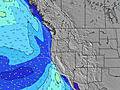 |  |  | 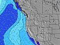 |  | |||||||||||||||
Onda Altezza (m) Direzione Periodo (s) | W 19 | W 19 | W 19 | W 19 | W 19 | W 18 | W 18 | W 17 | W 17 | W 17 | W 17 | WNW 17 | W 16 | W 16 | W 16 | W 16 | W 16 | W 16 | W 16 | W 16 | WNW 10 | WNW 9 | WSW 18 | SW 18 |
Grafico delle onde | ||||||||||||||||||||||||
186 | 184 | 184 | 186 | 182 | 232 | 225 | 212 | 287 | 290 | 287 | 367 | 257 | 251 | 254 | 251 | 251 | 248 | 245 | 242 | 231 | 217 | 204 | 246 | |
Vento (km/h) | ||||||||||||||||||||||||
Stato del vento onshore cross-onshore cross-shore cross-offshore offshore piatto | glassy | glassy | cross | cross-on | cross-on | cross-on | cross-on | cross | cross | cross-off | cross-off | cross-on | on | cross-on | cross-on | cross | cross-off | cross-off | cross-off | cross | cross-on | cross | cross | cross |
Alta Marea | 1:42AM1.95m | 3:20PM1.57m | 2:34AM1.82m | 4:01PM1.61m | 3:28AM1.65m | 4:41PM1.63m | ||||||||||||||||||
Basso Marea | 10:01AM-0.20m | 10:04PM0.24m | 10:43AM-0.14m | 11:01PM0.21m | 11:24AM-0.05m | |||||||||||||||||||
— | 5:39 | — | — | — | — | — | — | — | 5:41 | — | — | — | — | — | — | — | 5:41 | — | — | — | — | — | — | |
— | — | — | — | — | — | 9:01 | — | — | — | — | — | — | — | 9:00 | — | — | — | — | — | — | — | 9:00 | — | |
mm | — | 1 | 2 | 2 | — | — | — | — | — | — | — | — | — | — | — | — | — | — | — | — | — | — | — | — |
Temp. °C | 13 | 14 | 14 | 14 | 15 | 15 | 15 | 14 | 14 | 13 | 14 | 15 | 15 | 15 | 15 | 14 | 13 | 13 | 13 | 15 | 15 | 14 | 13 | 12 |
Gelo °C | 13 | 14 | 13 | 13 | 12 | 13 | 13 | 12 | 12 | 12 | 13 | 13 | 13 | 14 | 14 | 14 | 13 | 13 | 13 | 14 | 12 | 11 | 10 | 9 |
Onda 1 Altezza (m) Direzione Periodo (s) | WNW 9 | WNW 8 | WNW 8 | WNW 8 | WNW 8 | WNW 8 | WNW 8 | WNW 8 | WNW 8 | WNW 8 | WNW 8 | WNW 17 | WNW 8 | WNW 7 | WNW 7 | WNW 11 | WNW 10 | WNW 10 | WNW 10 | WNW 10 | WNW 10 | WNW 9 | WNW 9 | WNW 9 |
111 | 101 | 96 | 89 | 102 | 99 | 81 | 81 | 81 | 81 | 66 | 367 | 64 | 62 | 59 | 135 | 251 | 232 | 223 | 218 | 231 | 217 | 172 | 151 | |
Onda 2 Altezza (m) Direzione Periodo (s) | W 19 | W 19 | W 19 | W 19 | W 19 | W 18 | W 18 | W 17 | W 17 | W 17 | W 17 | WNW 8 | W 16 | W 16 | W 16 | WNW 7 | W 16 | W 16 | W 16 | W 16 | W 16 | W 16 | W 16 | SW 18 |
186 | 184 | 184 | 186 | 182 | 232 | 225 | 212 | 287 | 290 | 287 | 66 | 257 | 251 | 254 | 57 | 248 | 248 | 245 | 242 | 177 | 174 | 174 | 246 | |
Onda 3 Altezza (m) Direzione Periodo (s) | SW 17 | SW 16 | SW 16 | WSW 16 | WSW 16 | WSW 16 | SW 16 | SW 16 | SW 16 | SW 16 | SW 16 | WSW 16 | WNW 12 | WNW 11 | WNW 11 | W 16 | SW 19 | SW 14 | SW 14 | SW 14 | SW 14 | SW 18 | WSW 18 | W 15 |
75 | 69 | 66 | 102 | 100 | 100 | 65 | 64 | 64 | 64 | 64 | 98 | 79 | 100 | 97 | 251 | 94 | 54 | 53 | 54 | 54 | 79 | 204 | 172 | |
onde vento Altezza (m) Direzione Periodo (s) | — | — | — | — | — | — | — | — | — | — | — | — | — | — | — | — | — | — | — | — | — | — | — | — |
— | — | — | — | — | — | — | — | — | — | — | — | — | — | — | — | — | — | — | — | — | — | — | — | |
Il più vicino Offshore or Glassy | ||||||||||||||||||||||||
Distanza (km) | 2 | 2 | 69 | 107 | 107 | 107 | 107 | 21 | 6 | 2 | 2 | 69 | 108 | 465 | 159 | 21 | 2 | 2 | 2 | 37 | 465 | 465 | 448 | 247 |
Migliori previsioni per le condizioni d'onda in North Oregon | ||||||||||||||||||||||||
Migliori previsioni per le condizioni d'onda in United States | ||||||||||||||||||||||||
Trova Onde Globale | ||||||||||||||||||||||||
- Map Icons:
 Break
Break Live Wave Height (m)
 Live Wind Speed (km/h)
 Surf Rating (10 Max)
 Ocean Swells (m)
- Wind Speed (km/h)
Widget Free Surf-Forecast.com per il tuo sito
La relazione di surf / widget meteo è disponibile qui sotto per incorporare su siti esterni a titolo gratuito e fornisce una sintesi delle nostre Indian Head previsione surf. Basta prendere il frammento di codice html da noi fornito e copiarlo nel proprio sito. È possibile scegliere la lingua preferita e unità metriche / imperiali per il feed delle previsioni surf per soddisfare le esigenze degli utenti del vostro sito .... Clicca qui per ottenere il codice.
 Nearest