

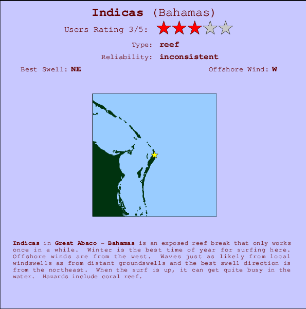
Indicas Surf Guide
Indicas in Great Abaco is an exposed reef break that only works once in a while. Winter is the best time of year for surfing here. The best wind direction is from the west. Tends to receive a mix of groundswells and windswells and the ideal swell angle is from the northeast. A reef breaks left. When it's working here, it can get crowded. Hazards include coral reef.
Indicas Spot Info
| Type: | Rating: | Reliability: | Todays Sea Temp*: |
|---|---|---|---|
| inconsistent | 30.4°C*ocean temperature recorded from satellite |
Surfing Indicas:
The best conditions reported for surf at Indicas occur when a Northeast swell combines with an offshore wind direction from the West.
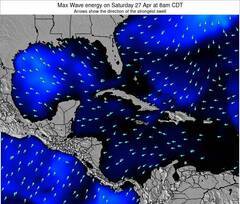
Previsioni Energia d'onda (Potenza): 12hrs

Indicas Surf:
Saturday, 18 July 2026, 01:09 Local time| Ven | Sabato 18 | |||
| 11PM | 2AM | 5AM | 8AM | |
| Wave (m) | ||||
| Periodo (s) | 8 | 8 | 8 | 8 |
| Vento (km/h) | ||||
| Stato del vento | cross- on |
cross- on |
cross- on |
cross- on |
- /breaks/Indicas/forecasts/latest
Indicas Surf Guide
Indicas in Great Abaco is an exposed reef break that only works once in a while. Winter is the best time of year for surfing here. The best wind direction is from the west. Tends to receive a mix of groundswells and windswells and the ideal swell angle is from the northeast. A reef breaks left. When it's working here, it can get crowded. Hazards include coral reef.
Indicas Spot Info
Type: Rating: Reliability: Todays Sea Temp*:  Reef
Reef 3
3inconsistent 30.4°C*ocean temperature recorded from satelliteSurfing Indicas:
The best conditions reported for surf at Indicas occur when a Northeast swell combines with an offshore wind direction from the West.
Previsioni Energia d'onda (Potenza): 12hrs
Utilizzare la scheda di navigazione in alto per visualizzare Indicas temperatura del mare, Indicas fotografie, Indicas dettagliate previsioni onde, il vento e le previsioni meteo, Indicas webcam, vento corrente da Great Abaco stazioni meteo e Indicas previsioni marea. Il link Bahamas mappe maree apre l'immagine grande, che mostra Bahamas e dei mari circostanti. Queste mappe possono essere animate per mostrare le diverse componenti del moto ondoso, energia delle onde, periodo d'onda, altezza delle onde, insieme con le previsioni del vento e meteo, meteo corrente e osservazioni sullo stato del mare dal Bahamas onda-boe, le navi passanti e stazioni meteo costiere. Ciascuna delle pagine di previsioni per questo surf break rappresenta uno strumento di wavefinder globale e regionale per individuare le migliori condizioni di surf nella zona intorno Indicas.
Indicas Surf:
Saturday, 18 July 2026, 01:09 Local timeVen Sabato 18 11PM 2AM 5AM 8AM Wave (m) Periodo (s) 8 8 8 8 Vento (km/h) Stato del vento cross-
oncross-
oncross-
oncross-
on- /breaks/Indicas/forecasts/latest
- /breaks/Indicas/forecasts/latest/six_day
Indicas Surf Guide
Indicas in Great Abaco is an exposed reef break that only works once in a while. Winter is the best time of year for surfing here. The best wind direction is from the west. Tends to receive a mix of groundswells and windswells and the ideal swell angle is from the northeast. A reef breaks left. When it's working here, it can get crowded. Hazards include coral reef.
Indicas Spot Info
Type: Rating: Reliability: Todays Sea Temp*: Reef3inconsistent 30.4°C*ocean temperature recorded from satelliteSurfing Indicas:
The best conditions reported for surf at Indicas occur when a Northeast swell combines with an offshore wind direction from the West.
Previsioni Energia d'onda (Potenza): 12hrs
Utilizzare la scheda di navigazione in alto per visualizzare Indicas temperatura del mare, Indicas fotografie, Indicas dettagliate previsioni onde, il vento e le previsioni meteo, Indicas webcam, vento corrente da Great Abaco stazioni meteo e Indicas previsioni marea. Il link Bahamas mappe maree apre l'immagine grande, che mostra Bahamas e dei mari circostanti. Queste mappe possono essere animate per mostrare le diverse componenti del moto ondoso, energia delle onde, periodo d'onda, altezza delle onde, insieme con le previsioni del vento e meteo, meteo corrente e osservazioni sullo stato del mare dal Bahamas onda-boe, le navi passanti e stazioni meteo costiere. Ciascuna delle pagine di previsioni per questo surf break rappresenta uno strumento di wavefinder globale e regionale per individuare le migliori condizioni di surf nella zona intorno Indicas.
Indicas Surf:
Saturday, 18 July 2026, 01:09 Local timeVen Sabato 18 11PM 2AM 5AM 8AM Wave (m) Periodo (s) 8 8 8 8 Vento (km/h) Stato del vento cross-
oncross-
oncross-
oncross-
on- /breaks/Indicas/forecasts/latest
Indicas Surf Guide
Indicas in Great Abaco is an exposed reef break that only works once in a while. Winter is the best time of year for surfing here. The best wind direction is from the west. Tends to receive a mix of groundswells and windswells and the ideal swell angle is from the northeast. A reef breaks left. When it's working here, it can get crowded. Hazards include coral reef.
Indicas Spot Info
Type: Rating: Reliability: Todays Sea Temp*: Reef3inconsistent 30.4°C*ocean temperature recorded from satelliteSurfing Indicas:
The best conditions reported for surf at Indicas occur when a Northeast swell combines with an offshore wind direction from the West.
Previsioni Energia d'onda (Potenza): 12hrs
Utilizzare la scheda di navigazione in alto per visualizzare Indicas temperatura del mare, Indicas fotografie, Indicas dettagliate previsioni onde, il vento e le previsioni meteo, Indicas webcam, vento corrente da Great Abaco stazioni meteo e Indicas previsioni marea. Il link Bahamas mappe maree apre l'immagine grande, che mostra Bahamas e dei mari circostanti. Queste mappe possono essere animate per mostrare le diverse componenti del moto ondoso, energia delle onde, periodo d'onda, altezza delle onde, insieme con le previsioni del vento e meteo, meteo corrente e osservazioni sullo stato del mare dal Bahamas onda-boe, le navi passanti e stazioni meteo costiere. Ciascuna delle pagine di previsioni per questo surf break rappresenta uno strumento di wavefinder globale e regionale per individuare le migliori condizioni di surf nella zona intorno Indicas.
Indicas Surf:
Saturday, 18 July 2026, 01:09 Local timeVen Sabato 18 11PM 2AM 5AM 8AM Wave (m) Periodo (s) 8 8 8 8 Vento (km/h) Stato del vento cross-
oncross-
oncross-
oncross-
onTide Times:
Per Four Rocks, %{dist} %{km} da %{location}.
PROSSIMA È ALLE (ora locale) rimanente alta marea bassa marea Indicas Tide Times and Tide Chart
Live Weather:
At ASCATB283E26N, 43 km from Indicas.
light winds from the SSE
(km/h)Air temperature
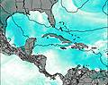
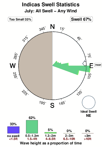
-°COverall Indicas Surf Consistency and Wind Distribution in Luglio
foto dall' album
Contorni: Strade e fiumi: seleziona un surf break dal menu 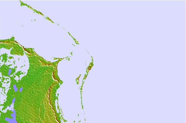
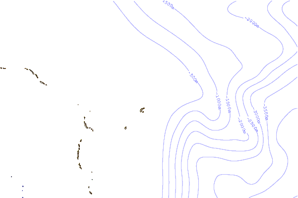
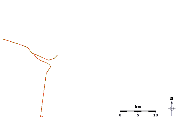
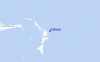
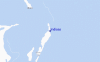
Utilizzare questa mappa sollievo per navigare Great Abaco surf breaks e stazioni di marea che si trovano nella zona diIndicas
Altri surf breaks più vicini al Indicas:
(clicca sul nome del luogo per maggiori informazioni)- Closest località surf1 mi
- Second closest località surf1 mi
- Third closest località surf2 mi
- Fourth closest località surf2 mi
- Fifth closest località surf3 mi
Onda boe più vicina a Indicas:
- Closest Onda boa188 mi
- Second closest Onda boa213 mi
- Third closest Onda boa239 mi
- Fourth closest Onda boa254 mi
- Fifth closest Onda boa264 mi
Stazioni di marea più vicina alla Indicas:
- Closest marea stazioneMarsh Harbour7 mi
- Second closest marea stazionePelican Harbour, Abaco Island11 mi
- Third closest marea stazioneGreen Turtle Cay26 mi
- Fourth closest marea stazioneCooper's Town41 mi
- Fifth closest marea stazioneEleuthera Island (west coast)98 mi
Airports
- The closest passenger airport to Indicas is Marsh Harbour Airport (MHH) in Bahamas, 13 km (8 miles) away (directly).
- The second nearest airport to Indicas is Treasure Cay Airport (TCB), also in Bahamas, 48 km (30 miles) away.
- Third is North Eleuthera Airport (ELH) in Bahamas, 122 km (76 miles) away.
- Governors Harbour (Governor's Harbor) Airport (GHB) in Bahamas is 154 km (96 miles) away.
- Chub Cay Airport (CCZ), also in Bahamas is the fifth nearest airport to Indicas and is 156 km (97 miles) away.
- /breaks/Indicas/forecasts/latest


 Nearest