

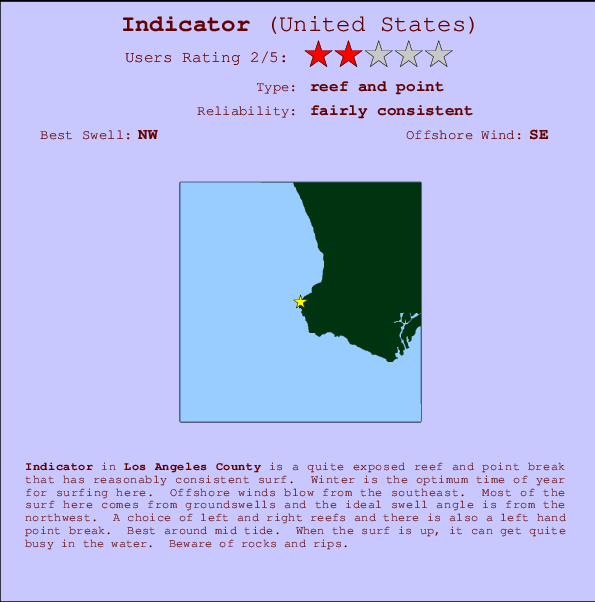
Indicator Surf Guide
Indicator in LA County is a reasonably exposed reef and point break that has reasonably consistent surf. Winter is the best time of year for surfing here. Offshore winds are from the southeast. Most of the surf here comes from groundswells and the ideal swell direction is from the northwest. Reef breaks provide lefts and rights and there is also a left hand point break. Best around mid tide. A fairly popluar wave that can sometimes get crowded Hazards include rocks and rips.
Indicator Spot Info
| Type: | Rating: | Reliability: | Todays Sea Temp*: |
|---|---|---|---|
| fairly consistent | 21.9°C*ocean temperature recorded from satellite |
Surfing Indicator:
The best conditions reported for surf at Indicator occur when a Northwest swell combines with an offshore wind direction from the Southeast.

Previsioni Energia d'onda (Potenza): 12hrs


Indicator Surf:
Tuesday, 21 July 2026, 01:34 Local time| Martedì 21 | ||||
| 2AM | 5AM | 8AM | 11AM | |
| Wave (m) | ||||
| Periodo (s) | 13 | 13 | - | 4 |
| Vento (km/h) | ||||
| Stato del vento | cross- off |
off | cross- off |
cross- off |
- /breaks/Indicator/forecasts/latest
Indicator Surf Guide
Indicator in LA County is a reasonably exposed reef and point break that has reasonably consistent surf. Winter is the best time of year for surfing here. Offshore winds are from the southeast. Most of the surf here comes from groundswells and the ideal swell direction is from the northwest. Reef breaks provide lefts and rights and there is also a left hand point break. Best around mid tide. A fairly popluar wave that can sometimes get crowded Hazards include rocks and rips.
Indicator Spot Info
Type: Rating: Reliability: Todays Sea Temp*:  Reef and point
 2
2fairly consistent 21.9°C*ocean temperature recorded from satelliteSurfing Indicator:
The best conditions reported for surf at Indicator occur when a Northwest swell combines with an offshore wind direction from the Southeast.
Previsioni Energia d'onda (Potenza): 12hrs
Utilizzare la scheda di navigazione in alto per visualizzare Indicator temperatura del mare, Indicator fotografie, Indicator dettagliate previsioni onde, il vento e le previsioni meteo, Indicator webcam, vento corrente da CAL - LA County stazioni meteo e Indicator previsioni marea. Il link United States mappe maree apre l'immagine grande, che mostra United States e dei mari circostanti. Queste mappe possono essere animate per mostrare le diverse componenti del moto ondoso, energia delle onde, periodo d'onda, altezza delle onde, insieme con le previsioni del vento e meteo, meteo corrente e osservazioni sullo stato del mare dal United States onda-boe, le navi passanti e stazioni meteo costiere. Ciascuna delle pagine di previsioni per questo surf break rappresenta uno strumento di wavefinder globale e regionale per individuare le migliori condizioni di surf nella zona intorno Indicator.
Indicator Surf:
Tuesday, 21 July 2026, 01:34 Local timeMartedì 21 2AM 5AM 8AM 11AM Wave (m) Periodo (s) 13 13 - 4 Vento (km/h) Stato del vento cross-
offoff cross-
offcross-
off- /breaks/Indicator/forecasts/latest
- /breaks/Indicator/forecasts/latest/six_day
Indicator Surf Guide
Indicator in LA County is a reasonably exposed reef and point break that has reasonably consistent surf. Winter is the best time of year for surfing here. Offshore winds are from the southeast. Most of the surf here comes from groundswells and the ideal swell direction is from the northwest. Reef breaks provide lefts and rights and there is also a left hand point break. Best around mid tide. A fairly popluar wave that can sometimes get crowded Hazards include rocks and rips.
Indicator Spot Info
Type: Rating: Reliability: Todays Sea Temp*: Reef and point2fairly consistent 21.9°C*ocean temperature recorded from satelliteSurfing Indicator:
The best conditions reported for surf at Indicator occur when a Northwest swell combines with an offshore wind direction from the Southeast.
Previsioni Energia d'onda (Potenza): 12hrs
Utilizzare la scheda di navigazione in alto per visualizzare Indicator temperatura del mare, Indicator fotografie, Indicator dettagliate previsioni onde, il vento e le previsioni meteo, Indicator webcam, vento corrente da CAL - LA County stazioni meteo e Indicator previsioni marea. Il link United States mappe maree apre l'immagine grande, che mostra United States e dei mari circostanti. Queste mappe possono essere animate per mostrare le diverse componenti del moto ondoso, energia delle onde, periodo d'onda, altezza delle onde, insieme con le previsioni del vento e meteo, meteo corrente e osservazioni sullo stato del mare dal United States onda-boe, le navi passanti e stazioni meteo costiere. Ciascuna delle pagine di previsioni per questo surf break rappresenta uno strumento di wavefinder globale e regionale per individuare le migliori condizioni di surf nella zona intorno Indicator.
Indicator Surf:
Tuesday, 21 July 2026, 01:34 Local timeMartedì 21 2AM 5AM 8AM 11AM Wave (m) Periodo (s) 13 13 - 4 Vento (km/h) Stato del vento cross-
offoff cross-
offcross-
off- /breaks/Indicator/forecasts/latest
Indicator Surf Guide
Indicator in LA County is a reasonably exposed reef and point break that has reasonably consistent surf. Winter is the best time of year for surfing here. Offshore winds are from the southeast. Most of the surf here comes from groundswells and the ideal swell direction is from the northwest. Reef breaks provide lefts and rights and there is also a left hand point break. Best around mid tide. A fairly popluar wave that can sometimes get crowded Hazards include rocks and rips.
Indicator Spot Info
Type: Rating: Reliability: Todays Sea Temp*: Reef and point2fairly consistent 21.9°C*ocean temperature recorded from satelliteSurfing Indicator:
The best conditions reported for surf at Indicator occur when a Northwest swell combines with an offshore wind direction from the Southeast.
Previsioni Energia d'onda (Potenza): 12hrs
Utilizzare la scheda di navigazione in alto per visualizzare Indicator temperatura del mare, Indicator fotografie, Indicator dettagliate previsioni onde, il vento e le previsioni meteo, Indicator webcam, vento corrente da CAL - LA County stazioni meteo e Indicator previsioni marea. Il link United States mappe maree apre l'immagine grande, che mostra United States e dei mari circostanti. Queste mappe possono essere animate per mostrare le diverse componenti del moto ondoso, energia delle onde, periodo d'onda, altezza delle onde, insieme con le previsioni del vento e meteo, meteo corrente e osservazioni sullo stato del mare dal United States onda-boe, le navi passanti e stazioni meteo costiere. Ciascuna delle pagine di previsioni per questo surf break rappresenta uno strumento di wavefinder globale e regionale per individuare le migliori condizioni di surf nella zona intorno Indicator.
Indicator Surf:
Tuesday, 21 July 2026, 01:34 Local timeMartedì 21 2AM 5AM 8AM 11AM Wave (m) Periodo (s) 13 13 - 4 Vento (km/h) Stato del vento cross-
offoff cross-
offcross-
offTide Times:
Per Palos Verdes Estates, %{dist} %{km} da %{location}.
PROSSIMA È ALLE (ora locale) rimanente alta marea bassa marea Indicator Tide Times and Tide Chart
Live Weather:
At Torrance Municipal Airport, 10 km from Indicator.
calm
(km/h)
Dry and partly cloudyAir temperature
21.5°CCurrent weather near Indicator
Buoy Data:
At San Pedro, CA, 12 miles from Indicator.
8PM 9PM 10PM 11PM Attualità dei dati 4 hr 3 hr 2 hr 1 hr Altezza delle onde (m) 


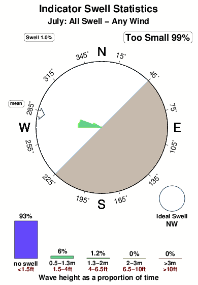
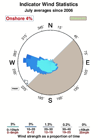
Periodo dominante (s) 13 10 17 13 Overall Indicator Surf Consistency and Wind Distribution in Luglio
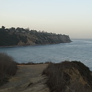
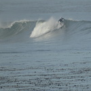
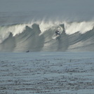
foto dall' album
Contorni: Strade e fiumi: seleziona un surf break dal menu 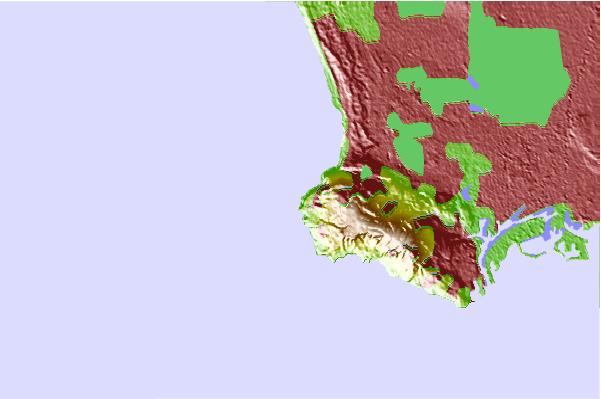
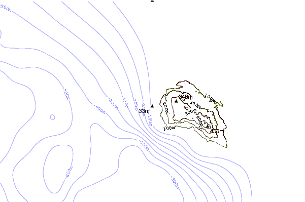
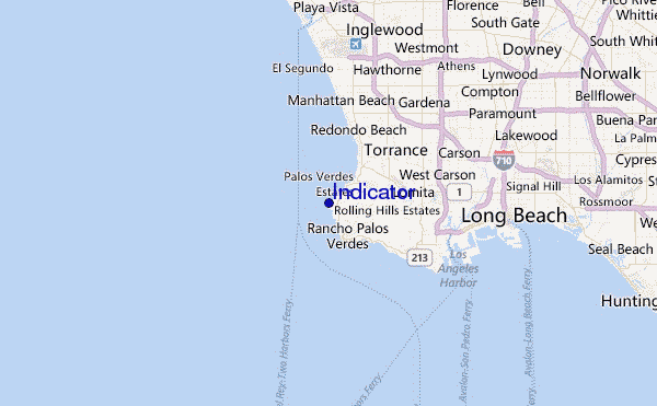
Utilizzare questa mappa sollievo per navigare CAL - LA County surf breaks e stazioni di marea che si trovano nella zona diIndicator
Altri surf breaks più vicini al Indicator:
(clicca sul nome del luogo per maggiori informazioni)- Closest località surf0 mi
- Second closest località surf1 mi
- Third closest località surf1 mi
- Fourth closest località surf1 mi
- Fifth closest località surf2 mi
Onda boe più vicina a Indicator:
- Closest Onda boa12 mi
- Second closest Onda boa13 mi
- Third closest Onda boa14 mi
- Fourth closest Onda boa20 mi
- Fifth closest Onda boa34 mi
Stazioni di marea più vicina alla Indicator:
- Closest marea stazionePalos Verdes Estates2 mi
- Second closest marea stazioneRancho Palos Verdes3 mi
- Third closest marea stazioneKing Harbor, Santa Monica Bay5 mi
- Fourth closest marea stazioneLomita6 mi
- Fifth closest marea stazioneManhattan Beach7 mi
Airports
- The closest passenger airport to Indicator is Jack Northrop Fld Hawthorne Muni Airport (HHR) in USA, 18 km (11 miles) away (directly).
- The second nearest airport to Indicator is Los Angeles International Airport (LAX), also in USA, 18 km (11 miles) away.
- Third is Long Beach Airport (LGB) in USA, 26 km (16 miles) away.
- Burbank Glendale Pasadena Airport (BUR) in USA is 47 km (29 miles) away.
- John Wayne Arpt Orange Co (Santa Ana) Airport (SNA), also in USA is the fifth nearest airport to Indicator and is 53 km (33 miles) away.
- /breaks/Indicator/forecasts/latest


 Nearest