
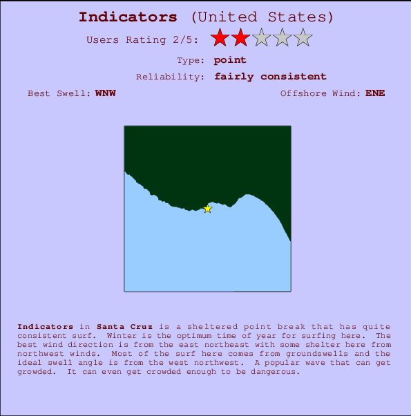
Indicators Surf Guide
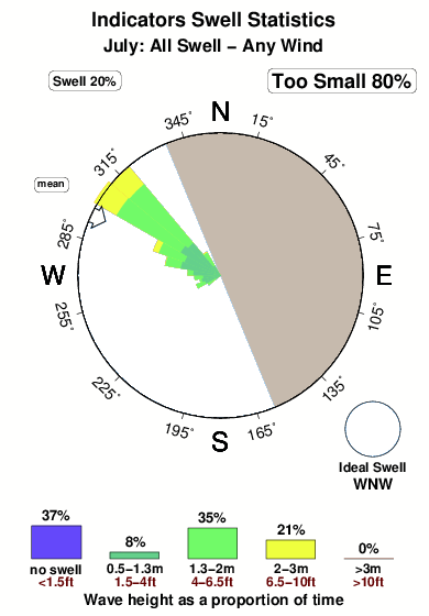
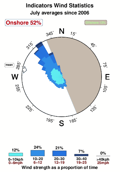
Indicators in Santa Cruz is a sheltered point break that has reasonably consistent surf. Winter is the optimum time of year for surfing here. The best wind direction is from the east northeast with some shelter here from northwest winds. Groundswells more frequent than windswells and the optimum swell angle is from the west northwest. Often Crowded. Overcrowding can even make surfing hazardous.
Indicators Spot Info
| Type: | Rating: | Reliability: | Todays Sea Temp*: |
|---|---|---|---|
| fairly consistent | 14.8°C*ocean temperature recorded from satellite |
Surfing Indicators:
The best conditions reported for surf at Indicators occur when a West-northwest swell combines with an offshore wind direction from the East-northeast.

Previsioni Energia d'onda (Potenza): 12hrs


Indicators Surf:
Sunday, 19 July 2026, 05:23 Local time| Domenica 19 | ||||
| 2AM | 5AM | 8AM | 11AM | |
| Wave (m) | ||||
| Periodo (s) | 16 | 16 | 16 | 17 |
| Vento (km/h) | ||||
| Stato del vento | glass | glass | glass | on |
- /breaks/Indicators/forecasts/latest
Indicators Surf Guide
Indicators in Santa Cruz is a sheltered point break that has reasonably consistent surf. Winter is the optimum time of year for surfing here. The best wind direction is from the east northeast with some shelter here from northwest winds. Groundswells more frequent than windswells and the optimum swell angle is from the west northwest. Often Crowded. Overcrowding can even make surfing hazardous.
Indicators Spot Info
Type: Rating: Reliability: Todays Sea Temp*:  Point
Point 2
2fairly consistent 14.8°C*ocean temperature recorded from satelliteSurfing Indicators:
The best conditions reported for surf at Indicators occur when a West-northwest swell combines with an offshore wind direction from the East-northeast.
Previsioni Energia d'onda (Potenza): 12hrs
Utilizzare la scheda di navigazione in alto per visualizzare Indicators temperatura del mare, Indicators fotografie, Indicators dettagliate previsioni onde, il vento e le previsioni meteo, Indicators webcam, vento corrente da CAL - Santa Cruz stazioni meteo e Indicators previsioni marea. Il link United States mappe maree apre l'immagine grande, che mostra United States e dei mari circostanti. Queste mappe possono essere animate per mostrare le diverse componenti del moto ondoso, energia delle onde, periodo d'onda, altezza delle onde, insieme con le previsioni del vento e meteo, meteo corrente e osservazioni sullo stato del mare dal United States onda-boe, le navi passanti e stazioni meteo costiere. Ciascuna delle pagine di previsioni per questo surf break rappresenta uno strumento di wavefinder globale e regionale per individuare le migliori condizioni di surf nella zona intorno Indicators.
Indicators Surf:
Sunday, 19 July 2026, 05:23 Local timeDomenica 19 2AM 5AM 8AM 11AM Wave (m) Periodo (s) 16 16 16 17 Vento (km/h) Stato del vento glass glass glass on - /breaks/Indicators/forecasts/latest
- /breaks/Indicators/forecasts/latest/six_day
Indicators Surf Guide
Indicators in Santa Cruz is a sheltered point break that has reasonably consistent surf. Winter is the optimum time of year for surfing here. The best wind direction is from the east northeast with some shelter here from northwest winds. Groundswells more frequent than windswells and the optimum swell angle is from the west northwest. Often Crowded. Overcrowding can even make surfing hazardous.
Indicators Spot Info
Type: Rating: Reliability: Todays Sea Temp*: Point2fairly consistent 14.8°C*ocean temperature recorded from satelliteSurfing Indicators:
The best conditions reported for surf at Indicators occur when a West-northwest swell combines with an offshore wind direction from the East-northeast.
Previsioni Energia d'onda (Potenza): 12hrs
Utilizzare la scheda di navigazione in alto per visualizzare Indicators temperatura del mare, Indicators fotografie, Indicators dettagliate previsioni onde, il vento e le previsioni meteo, Indicators webcam, vento corrente da CAL - Santa Cruz stazioni meteo e Indicators previsioni marea. Il link United States mappe maree apre l'immagine grande, che mostra United States e dei mari circostanti. Queste mappe possono essere animate per mostrare le diverse componenti del moto ondoso, energia delle onde, periodo d'onda, altezza delle onde, insieme con le previsioni del vento e meteo, meteo corrente e osservazioni sullo stato del mare dal United States onda-boe, le navi passanti e stazioni meteo costiere. Ciascuna delle pagine di previsioni per questo surf break rappresenta uno strumento di wavefinder globale e regionale per individuare le migliori condizioni di surf nella zona intorno Indicators.
Indicators Surf:
Sunday, 19 July 2026, 05:23 Local timeDomenica 19 2AM 5AM 8AM 11AM Wave (m) Periodo (s) 16 16 16 17 Vento (km/h) Stato del vento glass glass glass on - /breaks/Indicators/forecasts/latest
Indicators Surf Guide
Indicators in Santa Cruz is a sheltered point break that has reasonably consistent surf. Winter is the optimum time of year for surfing here. The best wind direction is from the east northeast with some shelter here from northwest winds. Groundswells more frequent than windswells and the optimum swell angle is from the west northwest. Often Crowded. Overcrowding can even make surfing hazardous.
Indicators Spot Info
Type: Rating: Reliability: Todays Sea Temp*: Point2fairly consistent 14.8°C*ocean temperature recorded from satelliteSurfing Indicators:
The best conditions reported for surf at Indicators occur when a West-northwest swell combines with an offshore wind direction from the East-northeast.
Previsioni Energia d'onda (Potenza): 12hrs
Utilizzare la scheda di navigazione in alto per visualizzare Indicators temperatura del mare, Indicators fotografie, Indicators dettagliate previsioni onde, il vento e le previsioni meteo, Indicators webcam, vento corrente da CAL - Santa Cruz stazioni meteo e Indicators previsioni marea. Il link United States mappe maree apre l'immagine grande, che mostra United States e dei mari circostanti. Queste mappe possono essere animate per mostrare le diverse componenti del moto ondoso, energia delle onde, periodo d'onda, altezza delle onde, insieme con le previsioni del vento e meteo, meteo corrente e osservazioni sullo stato del mare dal United States onda-boe, le navi passanti e stazioni meteo costiere. Ciascuna delle pagine di previsioni per questo surf break rappresenta uno strumento di wavefinder globale e regionale per individuare le migliori condizioni di surf nella zona intorno Indicators.
Indicators Surf:
Sunday, 19 July 2026, 05:23 Local timeDomenica 19 2AM 5AM 8AM 11AM Wave (m) Periodo (s) 16 16 16 17 Vento (km/h) Stato del vento glass glass glass on Tide Times:
Per Santa Cruz, California, %{dist} %{km} da %{location}.
PROSSIMA È ALLE (ora locale) rimanente alta marea bassa marea Indicators Tide Times and Tide Chart
Live Weather:
At Santa Cruz, 2 km from Indicators.
calm
(km/h)
dryAir temperature
13°COverall Indicators Surf Consistency and Wind Distribution in Luglio
foto dall' album
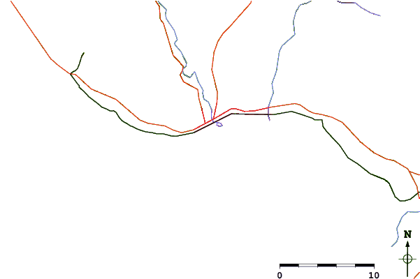
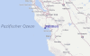
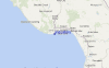
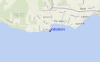
Contorni: Strade e fiumi: seleziona un surf break dal menu 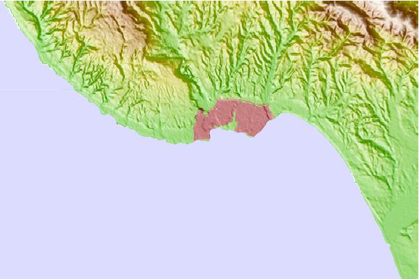
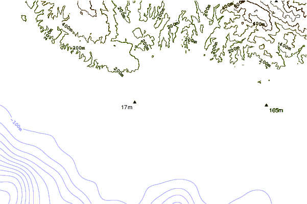
Utilizzare questa mappa sollievo per navigare CAL - Santa Cruz surf breaks e stazioni di marea che si trovano nella zona diIndicators
Altri surf breaks più vicini al Indicators:
(clicca sul nome del luogo per maggiori informazioni)- Closest località surf0 mi
- Second closest località surf0 mi
- Third closest località surf0 mi
- Fourth closest località surf1 mi
- Fifth closest località surf1 mi
Onda boe più vicina a Indicators:
- Closest Onda boa23 mi
- Second closest Onda boa24 mi
- Third closest Onda boa24 mi
- Fourth closest Onda boa42 mi
- Fifth closest Onda boa55 mi
Stazioni di marea più vicina alla Indicators:
- Closest marea stazioneSanta Cruz1 mi
- Second closest marea stazioneLive Oak3 mi
- Third closest marea stazioneRio Del Mar7 mi
- Fourth closest marea stazioneAptos7 mi
- Fifth closest marea stazioneElkhorn Slough railroad bridge16 mi
Airports
- The closest passenger airport to Indicators is Norman Y Mineta San Jose International Airport (SJC) in USA, 46 km (29 miles) away (directly).
- The second nearest airport to Indicators is Moffett Federal Afld (Mountain View) Airport (NUQ), also in USA, 52 km (32 miles) away.
- Third is San Francisco International Airport (SFO) in USA, 80 km (50 miles) away.
- Metropolitan Oakland International Airport (OAK) in USA is 87 km (54 miles) away.
- Modesto City Co Harry Sham Airport (MOD), also in USA is the fifth nearest airport to Indicators and is 121 km (75 miles) away.
- /breaks/Indicators/forecasts/latest


 Nearest