

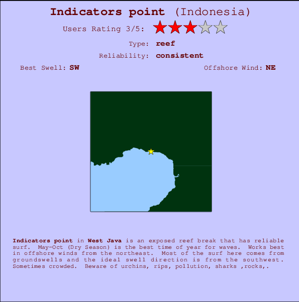
Indicators point Surf Guide
Indicators point in West Java is an exposed reef break that has reliable surf. May-Oct (Dry Season) is the best time of year for waves. Works best in offshore winds from the northeast. Tends to receive distant groundswells and the optimum swell angle is from the southwest. A reef breaks right. Sometimes crowded. Take care of urchins, rips, pollution, sharks ,rocks,.
Indicators point Spot Info
| Type: | Rating: | Reliability: | Todays Sea Temp*: |
|---|---|---|---|
| consistent | 28.0°C*ocean temperature recorded from satellite |
Surfing Indicators point:
The best conditions reported for surf at Indicators point occur when a Southwest swell combines with an offshore wind direction from the Northeast.

Previsioni Energia d'onda (Potenza): 12hrs


Indicators point Surf:
Sunday, 19 July 2026, 19:29 Local time| Domenica 19 | Lun | |||
| 4PM | 7PM | 10PM | 1AM | |
| Wave (m) | ||||
| Periodo (s) | 16 | 16 | 17 | 17 |
| Vento (km/h) | ||||
| Stato del vento | cross | cross- off |
cross- off |
cross- off |
- /breaks/Indicatorspoint/forecasts/latest
Indicators point Surf Guide
Indicators point in West Java is an exposed reef break that has reliable surf. May-Oct (Dry Season) is the best time of year for waves. Works best in offshore winds from the northeast. Tends to receive distant groundswells and the optimum swell angle is from the southwest. A reef breaks right. Sometimes crowded. Take care of urchins, rips, pollution, sharks ,rocks,.
Indicators point Spot Info
Type: Rating: Reliability: Todays Sea Temp*:  Reef
Reef 3
3consistent 28.0°C*ocean temperature recorded from satelliteSurfing Indicators point:
The best conditions reported for surf at Indicators point occur when a Southwest swell combines with an offshore wind direction from the Northeast.
Previsioni Energia d'onda (Potenza): 12hrs
Utilizzare la scheda di navigazione in alto per visualizzare Indicators point temperatura del mare, Indicators point fotografie, Indicators point dettagliate previsioni onde, il vento e le previsioni meteo, Indicators point webcam, vento corrente da Java - West stazioni meteo e Indicators point previsioni marea. Il link Indonesia mappe maree apre l'immagine grande, che mostra Indonesia e dei mari circostanti. Queste mappe possono essere animate per mostrare le diverse componenti del moto ondoso, energia delle onde, periodo d'onda, altezza delle onde, insieme con le previsioni del vento e meteo, meteo corrente e osservazioni sullo stato del mare dal Indonesia onda-boe, le navi passanti e stazioni meteo costiere. Ciascuna delle pagine di previsioni per questo surf break rappresenta uno strumento di wavefinder globale e regionale per individuare le migliori condizioni di surf nella zona intorno Indicators point.
Indicators point Surf:
Sunday, 19 July 2026, 19:29 Local timeDomenica 19 Lun 4PM 7PM 10PM 1AM Wave (m) Periodo (s) 16 16 17 17 Vento (km/h) Stato del vento cross cross-
offcross-
offcross-
off- /breaks/Indicatorspoint/forecasts/latest
- /breaks/Indicatorspoint/forecasts/latest/six_day
Indicators point Surf Guide
Indicators point in West Java is an exposed reef break that has reliable surf. May-Oct (Dry Season) is the best time of year for waves. Works best in offshore winds from the northeast. Tends to receive distant groundswells and the optimum swell angle is from the southwest. A reef breaks right. Sometimes crowded. Take care of urchins, rips, pollution, sharks ,rocks,.
Indicators point Spot Info
Type: Rating: Reliability: Todays Sea Temp*: Reef3consistent 28.0°C*ocean temperature recorded from satelliteSurfing Indicators point:
The best conditions reported for surf at Indicators point occur when a Southwest swell combines with an offshore wind direction from the Northeast.
Previsioni Energia d'onda (Potenza): 12hrs
Utilizzare la scheda di navigazione in alto per visualizzare Indicators point temperatura del mare, Indicators point fotografie, Indicators point dettagliate previsioni onde, il vento e le previsioni meteo, Indicators point webcam, vento corrente da Java - West stazioni meteo e Indicators point previsioni marea. Il link Indonesia mappe maree apre l'immagine grande, che mostra Indonesia e dei mari circostanti. Queste mappe possono essere animate per mostrare le diverse componenti del moto ondoso, energia delle onde, periodo d'onda, altezza delle onde, insieme con le previsioni del vento e meteo, meteo corrente e osservazioni sullo stato del mare dal Indonesia onda-boe, le navi passanti e stazioni meteo costiere. Ciascuna delle pagine di previsioni per questo surf break rappresenta uno strumento di wavefinder globale e regionale per individuare le migliori condizioni di surf nella zona intorno Indicators point.
Indicators point Surf:
Sunday, 19 July 2026, 19:29 Local timeDomenica 19 Lun 4PM 7PM 10PM 1AM Wave (m) Periodo (s) 16 16 17 17 Vento (km/h) Stato del vento cross cross-
offcross-
offcross-
off- /breaks/Indicatorspoint/forecasts/latest
Indicators point Surf Guide
Indicators point in West Java is an exposed reef break that has reliable surf. May-Oct (Dry Season) is the best time of year for waves. Works best in offshore winds from the northeast. Tends to receive distant groundswells and the optimum swell angle is from the southwest. A reef breaks right. Sometimes crowded. Take care of urchins, rips, pollution, sharks ,rocks,.
Indicators point Spot Info
Type: Rating: Reliability: Todays Sea Temp*: Reef3consistent 28.0°C*ocean temperature recorded from satelliteSurfing Indicators point:
The best conditions reported for surf at Indicators point occur when a Southwest swell combines with an offshore wind direction from the Northeast.
Previsioni Energia d'onda (Potenza): 12hrs
Utilizzare la scheda di navigazione in alto per visualizzare Indicators point temperatura del mare, Indicators point fotografie, Indicators point dettagliate previsioni onde, il vento e le previsioni meteo, Indicators point webcam, vento corrente da Java - West stazioni meteo e Indicators point previsioni marea. Il link Indonesia mappe maree apre l'immagine grande, che mostra Indonesia e dei mari circostanti. Queste mappe possono essere animate per mostrare le diverse componenti del moto ondoso, energia delle onde, periodo d'onda, altezza delle onde, insieme con le previsioni del vento e meteo, meteo corrente e osservazioni sullo stato del mare dal Indonesia onda-boe, le navi passanti e stazioni meteo costiere. Ciascuna delle pagine di previsioni per questo surf break rappresenta uno strumento di wavefinder globale e regionale per individuare le migliori condizioni di surf nella zona intorno Indicators point.
Indicators point Surf:
Sunday, 19 July 2026, 19:29 Local timeDomenica 19 Lun 4PM 7PM 10PM 1AM Wave (m) Periodo (s) 16 16 17 17 Vento (km/h) Stato del vento cross cross-
offcross-
offcross-
offTide Times:
Per Karang Haji - Ocean Queen Hotel, %{dist} %{km} da %{location}.
PROSSIMA È ALLE (ora locale) rimanente alta marea bassa marea Indicators point Tide Times and Tide Chart
Live Weather:
At Genteng wx, 50 km from Indicators point.
calm
(km/h)Air temperature
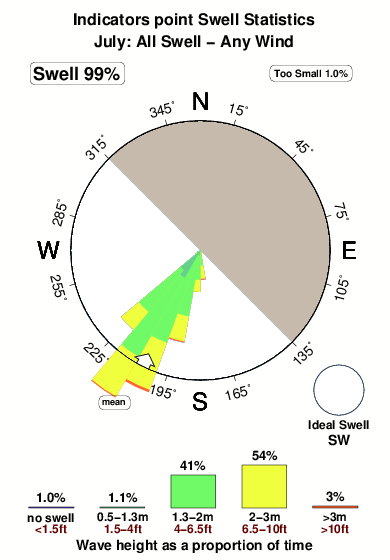
-°COverall Indicators point Surf Consistency and Wind Distribution in Luglio
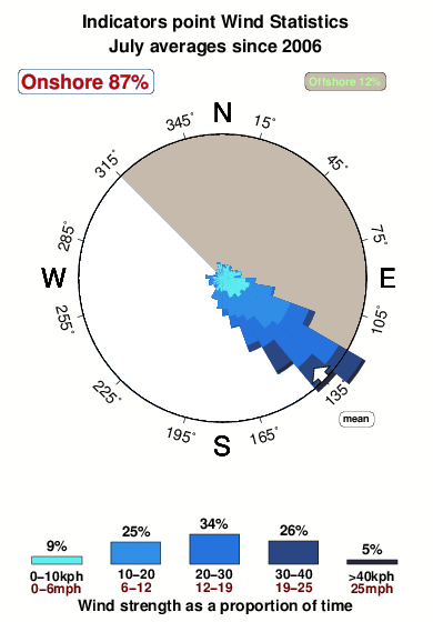


Wind stats for Indicators point: see the variation in direction and stength by month.
foto dall' album
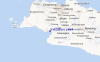
Contorni: Strade e fiumi: seleziona un surf break dal menu 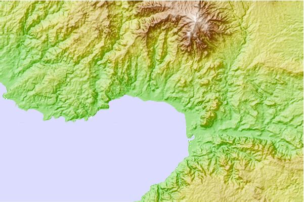
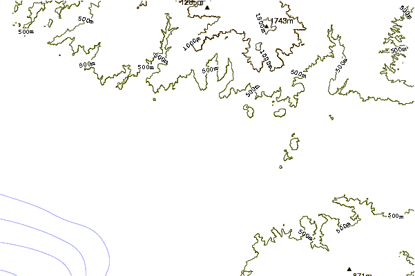
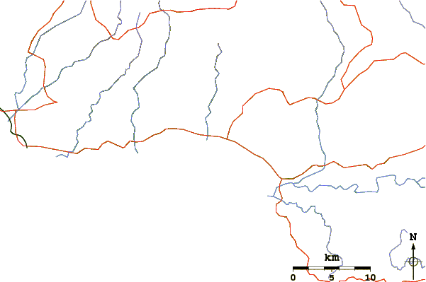
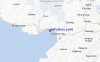
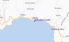
Utilizzare questa mappa sollievo per navigare Java - West surf breaks e stazioni di marea che si trovano nella zona diIndicators point
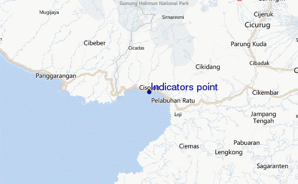
Altri surf breaks più vicini al Indicators point:
(clicca sul nome del luogo per maggiori informazioni)- Closest località surf1 mi
- Second closest località surf2 mi
- Third closest località surf4 mi
- Fourth closest località surf6 mi
- Fifth closest località surf17 mi
Onda boe più vicina a Indicators point:
- Closest Onda boa2428 mi
- Second closest Onda boa2470 mi
- Third closest Onda boa2536 mi
- Fourth closest Onda boa2700 mi
- Fifth closest Onda boa2711 mi
Stazioni di marea più vicina alla Indicators point:
- Closest marea stazionePelabuhanratu5 mi
- Second closest marea stazioneJakarta60 mi
- Third closest marea stazioneLabuhan61 mi
- Fourth closest marea stazioneTanjung Priok65 mi
- Fifth closest marea stazioneBandar Lampung132 mi
Airports
- The closest passenger airport to Indicators point is Pondok Cabe (Jakarta) Airport (PCB) in Indonesia, 76 km (47 miles) away (directly).
- The second nearest airport to Indicators point is Halim Perdanakusuma International (Jakarta) Airport (HLP), also in Indonesia, 90 km (56 miles) away.
- Third is Soekarno Hatta International (Jakarta) Airport (CGK) in Indonesia, 95 km (59 miles) away.
- Husein Sastranegara (Bandung) Airport (BDO) in Indonesia is 121 km (75 miles) away.
- Penggung (Cirebon) Airport (CBN), also in Indonesia is the fifth nearest airport to Indicators point and is 228 km (142 miles) away.
- /breaks/Indicatorspoint/forecasts/latest


 Nearest