
Previsioni:

Previsione a breve terminepioggia leggera (Totale 7mm), per lo più che cade Lunedì pomeriggio. Warm (Max 29°C Lunedì pomeriggio, Min 27°C Lunedì notte). Vento sarà generalmente leggero. | |||||||||||||||||||||
Lun 3 | Martedì 4 | Mercoledì 5 | |||||||||||||||||||
11 AM | 2 PM | 5 PM | 8 PM | 11 PM | 2 AM | 5 AM | 8 AM | 11 AM | 2 PM | 5 PM | 8 PM | 11 PM | 2 AM | 5 AM | 8 AM | 11 AM | 2 PM | 5 PM | 8 PM | 11 PM | |
Mappa dell'altezza del moto ondoso | 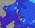 | 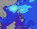 | 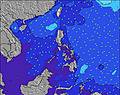 | 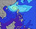 | 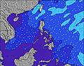 | 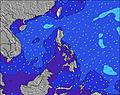 | 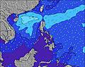 | 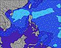 | |||||||||||||
Onda Altezza (m) Direzione Periodo (s) | ENE 15 | ENE 18 | ENE 15 | ENE 16 | ENE 16 | ENE 16 | ENE 15 | ENE 15 | ENE 20 | ENE 15 | ENE 18 | ENE 18 | ENE 17 | ENE 16 | ENE 16 | NE 19 | NE 18 | NE 18 | NE 16 | NE 16 | NE 16 |
Grafico delle onde | |||||||||||||||||||||
176 | 176 | 246 | 457 | 452 | 582 | 539 | 539 | 451 | 532 | 1274 | 1245 | 1250 | 915 | 892 | 819 | 760 | 1501 | 1318 | 906 | 871 | |
Vento (km/h) | |||||||||||||||||||||
Stato del vento onshore cross-onshore cross-shore cross-offshore offshore piatto | cross-on | cross-on | cross-off | glassy | cross-off | cross-off | off | cross-off | cross-on | on | cross-on | cross-off | off | cross-off | off | cross-off | cross-on | on | cross-on | cross-off | off |
Alta Marea | 8:42PM1.81m | 8:55AM1.65m | 9:15PM1.79m | 9:46AM1.52m | 9:54PM1.75m | ||||||||||||||||
Basso Marea | 2:25PM0.39m | 2:54AM0.50m | 2:57PM0.52m | 3:41AM0.50m | 3:34PM0.67m | ||||||||||||||||
— | — | — | — | — | — | 5:26 | — | — | — | — | — | — | — | 5:26 | — | — | — | — | — | — | |
— | — | 5:57 | — | — | — | — | — | — | — | 5:55 | — | — | — | — | — | — | — | 5:55 | — | — | |
mm | — | 1 | 2 | 1 | 1 | 1 | — | — | — | 1 | — | — | — | — | — | — | — | — | — | — | — |
Temp. °C | 29 | 29 | 29 | 28 | 28 | 27 | 27 | 27 | 28 | 29 | 29 | 28 | 28 | 27 | 27 | 27 | 28 | 29 | 29 | 28 | 28 |
Gelo °C | 33 | 33 | 33 | 33 | 32 | 31 | 31 | 31 | 32 | 33 | 33 | 32 | 33 | 31 | 31 | 31 | 32 | 32 | 33 | 31 | 33 |
Onda 1 Altezza (m) Direzione Periodo (s) | ENE 15 | ENE 14 | ENE 15 | ENE 16 | ENE 16 | ENE 16 | ENE 15 | ENE 15 | ENE 15 | ENE 15 | ENE 18 | ENE 18 | ENE 17 | ENE 16 | ENE 16 | ENE 15 | ENE 15 | NE 18 | NE 16 | NE 16 | NE 16 |
176 | 163 | 246 | 457 | 452 | 582 | 539 | 539 | 451 | 532 | 1274 | 1245 | 1250 | 915 | 892 | 730 | 600 | 1501 | 1318 | 906 | 871 | |
Onda 2 Altezza (m) Direzione Periodo (s) | SE 7 | ENE 18 | SE 7 | SE 7 | SE 8 | SE 8 | SE 8 | SE 7 | ENE 20 | ENE 20 | ESE 9 | SE 7 | SE 7 | NE 20 | NE 20 | NE 19 | NE 18 | SE 7 | SE 7 | NE 20 | NE 20 |
25 | 176 | 25 | 34 | 50 | 48 | 45 | 27 | 437 | 342 | 8 | 17 | 42 | 428 | 580 | 819 | 760 | 18 | 18 | 586 | 474 | |
Onda 3 Altezza (m) Direzione Periodo (s) | ENE 18 | SE 7 | ENE 18 | ESE 9 | NNE 9 | ESE 9 | ESE 9 | ENE 22 | SE 7 | SE 7 | ESE 9 | ESE 9 | ESE 9 | SE 8 | SE 8 | SE 7 | SE 7 | ESE 9 | ESE 9 | SE 7 | SE 8 |
127 | 24 | 180 | 8 | 7 | 9 | 8 | 181 | 25 | 17 | 9 | 9 | 8 | 45 | 46 | 27 | 18 | 8 | 8 | 19 | 40 | |
onde vento Altezza (m) Direzione Periodo (s) | — | SSE 7 | — | — | — | — | — | — | — | SSE 7 | SE 7 | — | — | — | — | — | — | — | — | — | — |
— | 102 | — | — | — | — | — | — | — | 77 | 17 | — | — | — | — | — | — | — | — | — | — | |
Il più vicino Offshore or Glassy | |||||||||||||||||||||
Distanza (km) | 7 | 7 | 0 | 0 | 0 | 0 | 0 | 0 | 7 | 33 | 7 | 0 | 0 | 0 | 0 | 0 | 33 | 33 | 7 | 0 | 0 |
Migliori previsioni per le condizioni d'onda in Surigao Del Sur | |||||||||||||||||||||
Migliori previsioni per le condizioni d'onda in Philippines | |||||||||||||||||||||
Trova Onde Globale | |||||||||||||||||||||
- Map Icons:
 Break
Break Live Wave Height (m)
 Live Wind Speed (km/h)
 Surf Rating (10 Max)
 Ocean Swells (m)
- Wind Speed (km/h)
Widget Free Surf-Forecast.com per il tuo sito
La relazione di surf / widget meteo è disponibile qui sotto per incorporare su siti esterni a titolo gratuito e fornisce una sintesi delle nostre Jelly's Point previsione surf. Basta prendere il frammento di codice html da noi fornito e copiarlo nel proprio sito. È possibile scegliere la lingua preferita e unità metriche / imperiali per il feed delle previsioni surf per soddisfare le esigenze degli utenti del vostro sito .... Clicca qui per ottenere il codice.
 Nearest