

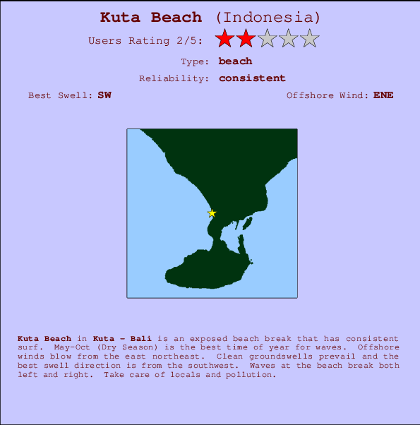
Kuta Beach Surf Guide
Kuta Beach in Bali (Kuta) is an exposed beach break that has reliable surf. May-Oct (Dry Season) is the optimum time of year for waves. The best wind direction is from the east northeast. Most of the surf here comes from groundswells and the best swell direction is from the southwest. The beach breaks offer lefts and rights. Take care of locals and pollution.
Kuta Beach Spot Info
| Type: | Rating: | Reliability: | Todays Sea Temp*: |
|---|---|---|---|
| consistent | 27.1°C*ocean temperature recorded from satellite |
Surfing Kuta Beach:
The best conditions reported for surf at Kuta Beach occur when a Southwest swell combines with an offshore wind direction from the East-northeast.

Previsioni Energia d'onda (Potenza): 12hrs


Kuta Beach Surf:
Monday, 20 July 2026, 17:28 Local time| Lunedì 20 | Mar | |||
| 5PM | 8PM | 11PM | 2AM | |
| Wave (m) | ||||
| Periodo (s) | 16 | 16 | 16 | 16 |
| Vento (km/h) | ||||
| Stato del vento | cross- off |
cross- off |
cross- off |
cross- off |
- /breaks/Kuta-Beach/forecasts/latest
Kuta Beach Surf Guide
Kuta Beach in Bali (Kuta) is an exposed beach break that has reliable surf. May-Oct (Dry Season) is the optimum time of year for waves. The best wind direction is from the east northeast. Most of the surf here comes from groundswells and the best swell direction is from the southwest. The beach breaks offer lefts and rights. Take care of locals and pollution.
Kuta Beach Spot Info
Type: Rating: Reliability: Todays Sea Temp*:  Beach
Beach 2
2consistent 27.1°C*ocean temperature recorded from satelliteSurfing Kuta Beach:
The best conditions reported for surf at Kuta Beach occur when a Southwest swell combines with an offshore wind direction from the East-northeast.
Previsioni Energia d'onda (Potenza): 12hrs
Utilizzare la scheda di navigazione in alto per visualizzare Kuta Beach temperatura del mare, Kuta Beach fotografie, Kuta Beach dettagliate previsioni onde, il vento e le previsioni meteo, Kuta Beach webcam, vento corrente da Bali - Kuta stazioni meteo e Kuta Beach previsioni marea. Il link Indonesia mappe maree apre l'immagine grande, che mostra Indonesia e dei mari circostanti. Queste mappe possono essere animate per mostrare le diverse componenti del moto ondoso, energia delle onde, periodo d'onda, altezza delle onde, insieme con le previsioni del vento e meteo, meteo corrente e osservazioni sullo stato del mare dal Indonesia onda-boe, le navi passanti e stazioni meteo costiere. Ciascuna delle pagine di previsioni per questo surf break rappresenta uno strumento di wavefinder globale e regionale per individuare le migliori condizioni di surf nella zona intorno Kuta Beach.
Kuta Beach Surf:
Monday, 20 July 2026, 17:28 Local timeLunedì 20 Mar 5PM 8PM 11PM 2AM Wave (m) Periodo (s) 16 16 16 16 Vento (km/h) Stato del vento cross-
offcross-
offcross-
offcross-
off- /breaks/Kuta-Beach/forecasts/latest
- /breaks/Kuta-Beach/forecasts/latest/six_day
Kuta Beach Surf Guide
Kuta Beach in Bali (Kuta) is an exposed beach break that has reliable surf. May-Oct (Dry Season) is the optimum time of year for waves. The best wind direction is from the east northeast. Most of the surf here comes from groundswells and the best swell direction is from the southwest. The beach breaks offer lefts and rights. Take care of locals and pollution.
Kuta Beach Spot Info
Type: Rating: Reliability: Todays Sea Temp*: Beach2consistent 27.1°C*ocean temperature recorded from satelliteSurfing Kuta Beach:
The best conditions reported for surf at Kuta Beach occur when a Southwest swell combines with an offshore wind direction from the East-northeast.
Previsioni Energia d'onda (Potenza): 12hrs
Utilizzare la scheda di navigazione in alto per visualizzare Kuta Beach temperatura del mare, Kuta Beach fotografie, Kuta Beach dettagliate previsioni onde, il vento e le previsioni meteo, Kuta Beach webcam, vento corrente da Bali - Kuta stazioni meteo e Kuta Beach previsioni marea. Il link Indonesia mappe maree apre l'immagine grande, che mostra Indonesia e dei mari circostanti. Queste mappe possono essere animate per mostrare le diverse componenti del moto ondoso, energia delle onde, periodo d'onda, altezza delle onde, insieme con le previsioni del vento e meteo, meteo corrente e osservazioni sullo stato del mare dal Indonesia onda-boe, le navi passanti e stazioni meteo costiere. Ciascuna delle pagine di previsioni per questo surf break rappresenta uno strumento di wavefinder globale e regionale per individuare le migliori condizioni di surf nella zona intorno Kuta Beach.
Kuta Beach Surf:
Monday, 20 July 2026, 17:28 Local timeLunedì 20 Mar 5PM 8PM 11PM 2AM Wave (m) Periodo (s) 16 16 16 16 Vento (km/h) Stato del vento cross-
offcross-
offcross-
offcross-
off- /breaks/Kuta-Beach/forecasts/latest
Kuta Beach Surf Guide
Kuta Beach in Bali (Kuta) is an exposed beach break that has reliable surf. May-Oct (Dry Season) is the optimum time of year for waves. The best wind direction is from the east northeast. Most of the surf here comes from groundswells and the best swell direction is from the southwest. The beach breaks offer lefts and rights. Take care of locals and pollution.
Kuta Beach Spot Info
Type: Rating: Reliability: Todays Sea Temp*: Beach2consistent 27.1°C*ocean temperature recorded from satelliteSurfing Kuta Beach:
The best conditions reported for surf at Kuta Beach occur when a Southwest swell combines with an offshore wind direction from the East-northeast.
Previsioni Energia d'onda (Potenza): 12hrs
Utilizzare la scheda di navigazione in alto per visualizzare Kuta Beach temperatura del mare, Kuta Beach fotografie, Kuta Beach dettagliate previsioni onde, il vento e le previsioni meteo, Kuta Beach webcam, vento corrente da Bali - Kuta stazioni meteo e Kuta Beach previsioni marea. Il link Indonesia mappe maree apre l'immagine grande, che mostra Indonesia e dei mari circostanti. Queste mappe possono essere animate per mostrare le diverse componenti del moto ondoso, energia delle onde, periodo d'onda, altezza delle onde, insieme con le previsioni del vento e meteo, meteo corrente e osservazioni sullo stato del mare dal Indonesia onda-boe, le navi passanti e stazioni meteo costiere. Ciascuna delle pagine di previsioni per questo surf break rappresenta uno strumento di wavefinder globale e regionale per individuare le migliori condizioni di surf nella zona intorno Kuta Beach.
Kuta Beach Surf:
Monday, 20 July 2026, 17:28 Local timeLunedì 20 Mar 5PM 8PM 11PM 2AM Wave (m) Periodo (s) 16 16 16 16 Vento (km/h) Stato del vento cross-
offcross-
offcross-
offcross-
offTide Times:
Per Airport Lefts, %{dist} %{km} da %{location}.
PROSSIMA È ALLE (ora locale) rimanente alta marea bassa marea Kuta Beach Tide Times and Tide Chart
Live Weather:
At Bali International Airport, 2 km from Kuta Beach.
fresh winds from the SE
(km/h)
Dry and partly cloudyAir temperature
28°COverall Kuta Beach Surf Consistency and Wind Distribution in Luglio
foto dall' album
Contorni: Strade e fiumi: seleziona un surf break dal menu 


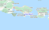
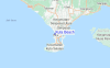
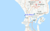
Utilizzare questa mappa sollievo per navigare Bali - Kuta surf breaks e stazioni di marea che si trovano nella zona diKuta Beach
Altri surf breaks più vicini al Kuta Beach:
(clicca sul nome del luogo per maggiori informazioni)- Closest località surf1 mi
- Second closest località surf1 mi
- Third closest località surf1 mi
- Fourth closest località surf2 mi
- Fifth closest località surf2 mi
Onda boe più vicina a Kuta Beach:
- Closest Onda boa1821 mi
- Second closest Onda boa2131 mi
- Third closest Onda boa2254 mi
- Fourth closest Onda boa2324 mi
- Fifth closest Onda boa2331 mi
Stazioni di marea più vicina alla Kuta Beach:
- Closest marea stazioneDenpasar6 mi
- Second closest marea stazioneBanjar39 mi
- Third closest marea stazioneSingaraja43 mi
- Fourth closest marea stazioneMataram66 mi
- Fifth closest marea stazioneWongsorejo73 mi
Airports
- The nearest passenger airport to Kuta Beach is Bali International (Denpasar) Airport (DPS) in Indonesia, which is 4 km (2 miles) away (directly).
- The second closest airport to Kuta Beach is Selaparang (Mataram) Airport (AMI), also in Indonesia, 104 km (65 miles) away.
- /breaks/Kuta-Beach/forecasts/latest


 Nearest