
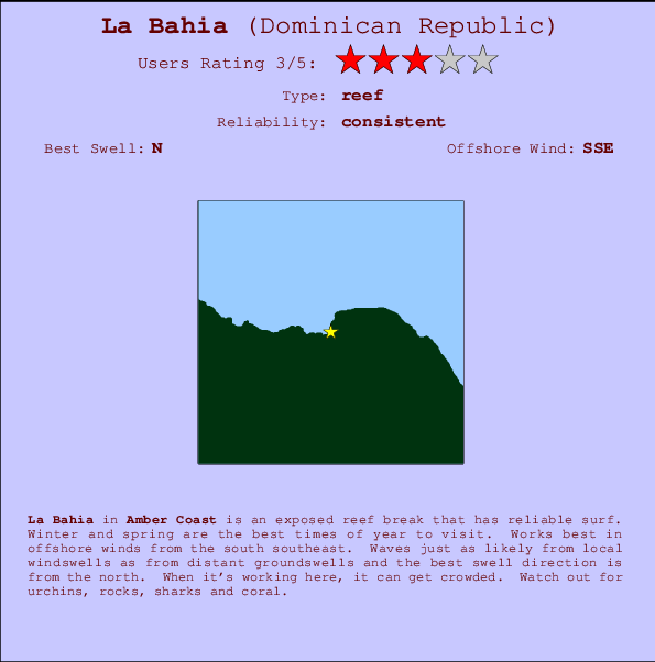
La Bahia Surf Guide
La Bahia in Amber Coast is an exposed reef break that has consistent surf. Winter and spring are the optimum times of year to visit. Offshore winds are from the south southeast. Most of the surf here comes from groundswells and the optimum swell angle is from the north. A reef breaks left. When the surf is up, it can get quite busy in the water. Beware of urchins, rocks, sharks and coral.
La Bahia Spot Info
| Type: | Rating: | Reliability: | Todays Sea Temp*: |
|---|---|---|---|
| consistent | 28.1°C*ocean temperature recorded from satellite |
Surfing La Bahia:
The best conditions reported for surf at La Bahia occur when a North swell combines with an offshore wind direction from the South-southeast.

Previsioni Energia d'onda (Potenza): 12hrs


La Bahia Surf:
Thursday, 16 July 2026, 11:23 Local time| Giovedì 16 | ||||
| 11AM | 2PM | 5PM | 8PM | |
| Wave (m) | ||||
| Periodo (s) | 7 | 7 | 7 | 7 |
| Vento (km/h) | ||||
| Stato del vento | cross- off |
cross | cross- off |
cross- off |
- /breaks/La-Bahia/forecasts/latest
La Bahia Surf Guide
La Bahia in Amber Coast is an exposed reef break that has consistent surf. Winter and spring are the optimum times of year to visit. Offshore winds are from the south southeast. Most of the surf here comes from groundswells and the optimum swell angle is from the north. A reef breaks left. When the surf is up, it can get quite busy in the water. Beware of urchins, rocks, sharks and coral.
La Bahia Spot Info
Type: Rating: Reliability: Todays Sea Temp*:  Reef
Reef 3
3consistent 28.1°C*ocean temperature recorded from satelliteSurfing La Bahia:
The best conditions reported for surf at La Bahia occur when a North swell combines with an offshore wind direction from the South-southeast.
Previsioni Energia d'onda (Potenza): 12hrs
Utilizzare la scheda di navigazione in alto per visualizzare La Bahia temperatura del mare, La Bahia fotografie, La Bahia dettagliate previsioni onde, il vento e le previsioni meteo, La Bahia webcam, vento corrente da Amber Coast stazioni meteo e La Bahia previsioni marea. Il link Dominican Republic mappe maree apre l'immagine grande, che mostra Dominican Republic e dei mari circostanti. Queste mappe possono essere animate per mostrare le diverse componenti del moto ondoso, energia delle onde, periodo d'onda, altezza delle onde, insieme con le previsioni del vento e meteo, meteo corrente e osservazioni sullo stato del mare dal Dominican Republic onda-boe, le navi passanti e stazioni meteo costiere. Ciascuna delle pagine di previsioni per questo surf break rappresenta uno strumento di wavefinder globale e regionale per individuare le migliori condizioni di surf nella zona intorno La Bahia.
La Bahia Surf:
Thursday, 16 July 2026, 11:23 Local timeGiovedì 16 11AM 2PM 5PM 8PM Wave (m) Periodo (s) 7 7 7 7 Vento (km/h) Stato del vento cross-
offcross cross-
offcross-
off- /breaks/La-Bahia/forecasts/latest
- /breaks/La-Bahia/forecasts/latest/six_day
La Bahia Surf Guide
La Bahia in Amber Coast is an exposed reef break that has consistent surf. Winter and spring are the optimum times of year to visit. Offshore winds are from the south southeast. Most of the surf here comes from groundswells and the optimum swell angle is from the north. A reef breaks left. When the surf is up, it can get quite busy in the water. Beware of urchins, rocks, sharks and coral.
La Bahia Spot Info
Type: Rating: Reliability: Todays Sea Temp*: Reef3consistent 28.1°C*ocean temperature recorded from satelliteSurfing La Bahia:
The best conditions reported for surf at La Bahia occur when a North swell combines with an offshore wind direction from the South-southeast.
Previsioni Energia d'onda (Potenza): 12hrs
Utilizzare la scheda di navigazione in alto per visualizzare La Bahia temperatura del mare, La Bahia fotografie, La Bahia dettagliate previsioni onde, il vento e le previsioni meteo, La Bahia webcam, vento corrente da Amber Coast stazioni meteo e La Bahia previsioni marea. Il link Dominican Republic mappe maree apre l'immagine grande, che mostra Dominican Republic e dei mari circostanti. Queste mappe possono essere animate per mostrare le diverse componenti del moto ondoso, energia delle onde, periodo d'onda, altezza delle onde, insieme con le previsioni del vento e meteo, meteo corrente e osservazioni sullo stato del mare dal Dominican Republic onda-boe, le navi passanti e stazioni meteo costiere. Ciascuna delle pagine di previsioni per questo surf break rappresenta uno strumento di wavefinder globale e regionale per individuare le migliori condizioni di surf nella zona intorno La Bahia.
La Bahia Surf:
Thursday, 16 July 2026, 11:23 Local timeGiovedì 16 11AM 2PM 5PM 8PM Wave (m) Periodo (s) 7 7 7 7 Vento (km/h) Stato del vento cross-
offcross cross-
offcross-
off- /breaks/La-Bahia/forecasts/latest
La Bahia Surf Guide
La Bahia in Amber Coast is an exposed reef break that has consistent surf. Winter and spring are the optimum times of year to visit. Offshore winds are from the south southeast. Most of the surf here comes from groundswells and the optimum swell angle is from the north. A reef breaks left. When the surf is up, it can get quite busy in the water. Beware of urchins, rocks, sharks and coral.
La Bahia Spot Info
Type: Rating: Reliability: Todays Sea Temp*: Reef3consistent 28.1°C*ocean temperature recorded from satelliteSurfing La Bahia:
The best conditions reported for surf at La Bahia occur when a North swell combines with an offshore wind direction from the South-southeast.
Previsioni Energia d'onda (Potenza): 12hrs
Utilizzare la scheda di navigazione in alto per visualizzare La Bahia temperatura del mare, La Bahia fotografie, La Bahia dettagliate previsioni onde, il vento e le previsioni meteo, La Bahia webcam, vento corrente da Amber Coast stazioni meteo e La Bahia previsioni marea. Il link Dominican Republic mappe maree apre l'immagine grande, che mostra Dominican Republic e dei mari circostanti. Queste mappe possono essere animate per mostrare le diverse componenti del moto ondoso, energia delle onde, periodo d'onda, altezza delle onde, insieme con le previsioni del vento e meteo, meteo corrente e osservazioni sullo stato del mare dal Dominican Republic onda-boe, le navi passanti e stazioni meteo costiere. Ciascuna delle pagine di previsioni per questo surf break rappresenta uno strumento di wavefinder globale e regionale per individuare le migliori condizioni di surf nella zona intorno La Bahia.
La Bahia Surf:
Thursday, 16 July 2026, 11:23 Local timeGiovedì 16 11AM 2PM 5PM 8PM Wave (m) Periodo (s) 7 7 7 7 Vento (km/h) Stato del vento cross-
offcross cross-
offcross-
offTide Times:
Per Sosua, %{dist} %{km} da %{location}.
PROSSIMA È ALLE (ora locale) rimanente alta marea bassa marea La Bahia Tide Times and Tide Chart
Live Weather:
At Puerto Plata IN Airport, 5 km from La Bahia.
light winds from the SE
(km/h)Air temperature
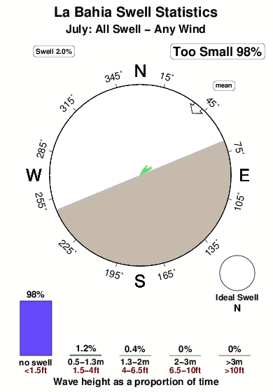
28°COverall La Bahia Surf Consistency and Wind Distribution in Luglio
foto dall' album
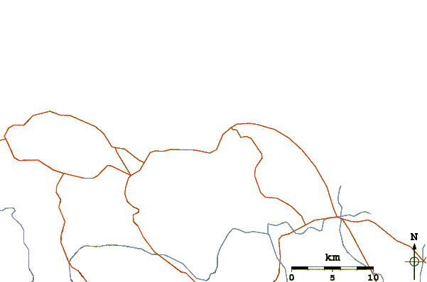
Contorni: Strade e fiumi: seleziona un surf break dal menu 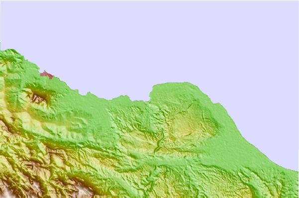
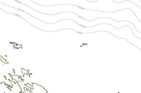
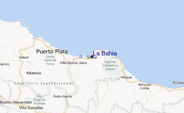
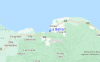
Utilizzare questa mappa sollievo per navigare Amber Coast surf breaks e stazioni di marea che si trovano nella zona diLa Bahia
Onda boe più vicina a La Bahia:
- Closest Onda boa232 mi
- Second closest Onda boa285 mi
- Third closest Onda boa293 mi
- Fourth closest Onda boa302 mi
- Fifth closest Onda boa346 mi
Stazioni di marea più vicina alla La Bahia:
- Closest marea stazioneSosua1 mi
- Second closest marea stazionePuerto Plata12 mi
- Third closest marea stazioneGaspar Hernandez18 mi
- Fourth closest marea stazioneRio San Juan29 mi
- Fifth closest marea stazioneNagua51 mi
Airports
- The closest passenger airport to La Bahia is Gregorio Luperon International (Puerto Plata) Airport (POP) in Dominican Republic, 5 km (3 miles) away (directly).
- The second nearest airport to La Bahia is Cibao International (Santiago) Airport (STI), also in Dominican Republic, 40 km (25 miles) away.
- Third is Herrera International (Santo Domingo) Airport (HEX) in Dominican Republic, 154 km (96 miles) away.
- Las Americas International (Santo Domingo) Airport (SDQ) in Dominican Republic is 173 km (107 miles) away.
- Cap Haitien Airport (CAP) in Haiti is the fifth nearest airport to La Bahia and is 175 km (109 miles) away.
- /breaks/La-Bahia/forecasts/latest


 Nearest