
Previsioni:

Previsione a breve termineper lo più asciutto. Warm (Max 24°C mercoledì pomeriggio, Min 23°C mercoledì mattina). Vento sarà generalmente leggero. | ||||||||||||||||||||||||
Mer 15 | Giovedì 16 | Venerdì 17 | 18 | |||||||||||||||||||||
10 AM | 1 PM | 4 PM | 7 PM | 10 PM | 1 AM | 4 AM | 7 AM | 10 AM | 1 PM | 4 PM | 7 PM | 10 PM | 1 AM | 4 AM | 7 AM | 10 AM | 1 PM | 4 PM | 7 PM | 10 PM | 1 AM | 4 AM | 7 AM | |
Mappa dell'altezza del moto ondoso |  | 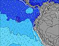 | 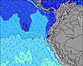 | 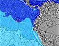 | 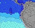 | 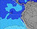 | 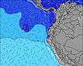 | 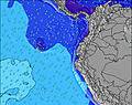 | 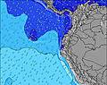 | |||||||||||||||
Onda Altezza (m) Direzione Periodo (s) | SW 13 | SW 13 | SW 13 | SW 13 | SW 13 | SW 14 | SW 12 | SW 12 | SW 12 | SW 13 | SW 13 | SW 13 | SW 13 | SW 13 | SW 13 | SW 13 | SW 13 | SW 13 | SW 13 | SW 13 | SW 13 | SW 12 | SW 12 | SW 12 |
Grafico delle onde | ||||||||||||||||||||||||
345 | 335 | 335 | 437 | 444 | 492 | 207 | 203 | 346 | 380 | 386 | 380 | 374 | 357 | 352 | 363 | 424 | 424 | 326 | 321 | 311 | 301 | 287 | 240 | |
Vento (km/h) | ||||||||||||||||||||||||
Stato del vento onshore cross-onshore cross-shore cross-offshore offshore piatto | on | on | on | on | on | on | on | on | on | on | on | on | on | on | on | on | on | on | on | on | on | on | on | on |
Alta Marea | 4:25PM2.21m | 5:09AM2.38m | 5:16PM2.20m | 5:55AM2.39m | 6:05PM2.15m | 6:40AM2.34m | ||||||||||||||||||
Basso Marea | 10:27AM0.32m | 10:44PM-0.05m | 11:18AM0.28m | 11:31PM-0.01m | 12:07PM0.28m | 00:17AM0.08m | ||||||||||||||||||
6:28 | — | — | — | — | — | 6:28 | — | — | — | — | — | — | — | 6:28 | — | — | — | — | — | — | — | 6:30 | — | |
— | — | 6:30 | — | — | — | — | — | — | — | 6:30 | — | — | — | — | — | — | — | 6:30 | — | — | — | — | 6:30 | |
mm | — | — | — | — | — | — | — | — | — | — | — | — | — | — | — | — | — | — | — | — | — | — | — | — |
Temp. °C | 23 | 23 | 24 | 24 | 24 | 24 | 23 | 24 | 24 | 24 | 24 | 24 | 24 | 23 | 23 | 23 | 23 | 23 | 23 | 23 | 23 | 23 | 23 | 23 |
Gelo °C | 24 | 24 | 25 | 25 | 25 | 25 | 24 | 26 | 25 | 26 | 25 | 24 | 24 | 23 | 24 | 24 | 24 | 24 | 24 | 24 | 24 | 24 | 24 | 24 |
Onda 1 Altezza (m) Direzione Periodo (s) | SW 13 | SW 13 | SW 13 | SW 13 | SW 13 | SW 14 | SW 12 | SW 12 | SW 12 | SW 13 | SW 13 | SW 13 | SW 13 | SW 13 | SW 13 | SW 13 | SW 13 | SW 13 | SW 13 | SW 13 | SW 13 | SW 12 | SW 12 | SW 12 |
345 | 335 | 335 | 437 | 444 | 492 | 207 | 203 | 346 | 380 | 386 | 380 | 374 | 357 | 352 | 363 | 424 | 424 | 326 | 321 | 311 | 301 | 287 | 240 | |
Onda 2 Altezza (m) Direzione Periodo (s) | NW 11 | NW 11 | NW 11 | NW 11 | NW 11 | SW 20 | SW 15 | SSW 5 | SSW 5 | NW 11 | NW 11 | NW 11 | W 10 | N 6 | SW 21 | SW 21 | NW 10 | NW 10 | SW 20 | SW 20 | SW 20 | SW 20 | SSW 5 | SSW 5 |
5 | 5 | 5 | 5 | 5 | 15 | 171 | 31 | 24 | 5 | 5 | 5 | 2 | 1 | 18 | 18 | 4 | 4 | 16 | 16 | 15 | 15 | 16 | 23 | |
Onda 3 Altezza (m) Direzione Periodo (s) | SW 22 | SW 22 | NW 11 | SW 21 | SW 20 | NW 11 | NW 11 | SW 14 | SW 19 | SW 20 | — | W 11 | N 6 | SW 22 | W 10 | W 10 | SW 21 | NW 10 | SW 16 | W 10 | W 10 | W 10 | SW 19 | SW 19 |
18 | 18 | 5 | 17 | 16 | 5 | 5 | 169 | 15 | 15 | — | 2 | 1 | 18 | 2 | 2 | 18 | 4 | 10 | 2 | 2 | 2 | 55 | 55 | |
onde vento Altezza (m) Direzione Periodo (s) | SSW 5 | SW 5 | SW 5 | SW 5 | SW 5 | SW 5 | SSW 5 | — | — | SW 5 | SW 5 | SW 5 | SW 5 | SSW 5 | SSW 6 | SSW 6 | SSW 6 | SSW 5 | SW 5 | SW 5 | SW 5 | SW 5 | — | — |
31 | 28 | 31 | 23 | 23 | 25 | 31 | — | — | 28 | 21 | 24 | 24 | 36 | 47 | 49 | 39 | 37 | 28 | 21 | 19 | 19 | — | — | |
Il più vicino Offshore or Glassy | ||||||||||||||||||||||||
Distanza (km) | 7 | 1051 | 888 | 888 | 316 | 7 | 7 | 7 | 7 | 1051 | 1051 | 888 | 687 | 10 | 7 | 7 | 10 | 1051 | 1051 | 7 | 7 | 7 | 7 | 7 |
Migliori previsioni per le condizioni d'onda in Guayas | ||||||||||||||||||||||||
Migliori previsioni per le condizioni d'onda in Ecuador | ||||||||||||||||||||||||
Trova Onde Globale | ||||||||||||||||||||||||
- Map Icons:
 Break
Break Live Wave Height (m)
 Live Wind Speed (km/h)
 Surf Rating (10 Max)
 Ocean Swells (m)
- Wind Speed (km/h)
Widget Free Surf-Forecast.com per il tuo sito
La relazione di surf / widget meteo è disponibile qui sotto per incorporare su siti esterni a titolo gratuito e fornisce una sintesi delle nostre La Chocolatera previsione surf. Basta prendere il frammento di codice html da noi fornito e copiarlo nel proprio sito. È possibile scegliere la lingua preferita e unità metriche / imperiali per il feed delle previsioni surf per soddisfare le esigenze degli utenti del vostro sito .... Clicca qui per ottenere il codice.
 Nearest