
Previsioni:

Previsione a breve terminepioggia leggera (Totale 2mm), per lo più che cade giovedì notte. Warm (Max 23°C giovedì pomeriggio, Min 17°C mercoledì notte). Vento sarà generalmente leggero. | ||||||||||||||||||||||||
Mer 15 | Giovedì 16 | Venerdì 17 | 18 | |||||||||||||||||||||
5 PM | 8 PM | 11 PM | 2 AM | 5 AM | 8 AM | 11 AM | 2 PM | 5 PM | 8 PM | 11 PM | 2 AM | 5 AM | 8 AM | 11 AM | 2 PM | 5 PM | 8 PM | 11 PM | 2 AM | 5 AM | 8 AM | 11 AM | 2 PM | |
Mappa dell'altezza del moto ondoso |  |  |  |  |  |  |  |  | 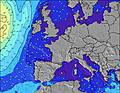 | |||||||||||||||
Onda Altezza (m) Direzione Periodo (s) | ENE 6 | ENE 6 | ENE 6 | ENE 6 | ENE 6 | ENE 6 | NE 6 | NE 5 | ENE 5 | ENE 6 | ENE 6 | ENE 6 | ENE 6 | ENE 6 | ENE 5 | NE 5 | NE 5 | NE 5 | W 8 | W 8 | W 8 | W 8 | W 8 | W 8 |
Grafico delle onde | ||||||||||||||||||||||||
170 | 104 | 123 | 170 | 145 | 93 | 69 | 60 | 90 | 90 | 111 | 131 | 111 | 65 | 34 | 19 | 11 | 5 | 5 | 5 | 5 | 5 | 5 | 5 | |
Vento (km/h) | ||||||||||||||||||||||||
Stato del vento onshore cross-onshore cross-shore cross-offshore offshore piatto | cross-on | cross-on | cross-on | cross-on | cross-on | cross-on | cross-on | cross-on | cross-on | cross | cross-off | cross-on | cross-on | cross-on | cross-on | cross-on | cross | cross-on | cross | cross-off | cross-off | cross-off | cross | cross-on |
Alta Marea | 10:36PM5.35m | 11:09AM5.09m | 11:22PM5.39m | 11:54AM5.05m | 00:07AM5.29m | 12:39PM4.92m | ||||||||||||||||||
Basso Marea | 5:05PM0.25m | 5:32AM-0.22m | 5:51PM0.19m | 6:17AM-0.23m | 6:35PM0.26m | 7:01AM-0.08m | ||||||||||||||||||
— | — | — | — | 6:15 | — | — | — | — | — | — | — | 6:16 | — | — | — | — | — | — | — | 6:16 | — | — | — | |
— | 10:07 | — | — | — | — | — | — | — | 10:07 | — | — | — | — | — | — | — | 10:06 | — | — | — | — | — | 10:05 | |
mm | — | — | — | — | — | — | — | — | — | 1 | 1 | — | — | — | — | — | — | — | — | — | — | — | — | — |
Temp. °C | 22 | 22 | 20 | 19 | 17 | 17 | 19 | 21 | 23 | 21 | 19 | 18 | 17 | 17 | 18 | 20 | 23 | 22 | 22 | 22 | 22 | 19 | 21 | 22 |
Gelo °C | 17 | 19 | 17 | 16 | 14 | 15 | 16 | 18 | 18 | 19 | 18 | 16 | 16 | 15 | 15 | 18 | 21 | 18 | 19 | 20 | 19 | 18 | 19 | 19 |
Onda 1 Altezza (m) Direzione Periodo (s) | W 10 | W 9 | W 9 | W 9 | W 9 | W 9 | W 9 | W 9 | W 8 | W 8 | W 8 | W 8 | W 9 | W 9 | W 9 | NE 5 | NE 5 | NE 5 | NE 4 | ENE 4 | W 8 | WNW 4 | WNW 4 | W 4 |
8 | 7 | 6 | 6 | 6 | 6 | 6 | 6 | 6 | 5 | 6 | 6 | 6 | 6 | 6 | 19 | 11 | 5 | 3 | 2 | 5 | 3 | 2 | 1 | |
Onda 2 Altezza (m) Direzione Periodo (s) | — | — | — | — | — | — | — | — | W 10 | — | — | — | — | — | — | W 8 | W 8 | W 8 | W 8 | W 8 | NE 5 | W 8 | W 8 | W 8 |
— | — | — | — | — | — | — | — | 2 | — | — | — | — | — | — | 6 | 5 | 5 | 5 | 5 | 1 | 5 | 5 | 5 | |
Onda 3 Altezza (m) Direzione Periodo (s) | — | — | — | — | — | — | — | — | — | — | — | — | — | — | — | — | — | — | — | — | — | NE 5 | NE 5 | E 5 |
— | — | — | — | — | — | — | — | — | — | — | — | — | — | — | — | — | — | — | — | — | 1 | 1 | 1 | |
onde vento Altezza (m) Direzione Periodo (s) | ENE 6 | ENE 6 | ENE 6 | ENE 6 | ENE 6 | ENE 6 | NE 6 | NE 5 | ENE 5 | ENE 6 | ENE 6 | ENE 6 | ENE 6 | ENE 6 | ENE 5 | — | — | NW 2 | WNW 3 | WNW 4 | WNW 4 | — | — | NE 4 |
170 | 104 | 123 | 170 | 145 | 93 | 69 | 60 | 90 | 90 | 111 | 131 | 111 | 65 | 34 | — | — | 1 | 4 | 5 | 5 | — | — | 2 | |
Il più vicino Offshore or Glassy | ||||||||||||||||||||||||
Distanza (km) | 307 | 264 | 155 | 340 | 335 | 528 | 480 | 304 | 263 | 79 | 0 | 262 | 108 | 291 | 549 | 597 | 593 | 497 | 592 | 592 | 592 | |||
Migliori previsioni per le condizioni d'onda in Normandy | ||||||||||||||||||||||||
Migliori previsioni per le condizioni d'onda in France | ||||||||||||||||||||||||
Trova Onde Globale | ||||||||||||||||||||||||
- Map Icons:
 Break
Break Live Wave Height (m)
 Live Wind Speed (km/h)
 Surf Rating (10 Max)
 Ocean Swells (m)
- Wind Speed (km/h)
Widget Free Surf-Forecast.com per il tuo sito
La relazione di surf / widget meteo è disponibile qui sotto per incorporare su siti esterni a titolo gratuito e fornisce una sintesi delle nostre La Mondree previsione surf. Basta prendere il frammento di codice html da noi fornito e copiarlo nel proprio sito. È possibile scegliere la lingua preferita e unità metriche / imperiali per il feed delle previsioni surf per soddisfare le esigenze degli utenti del vostro sito .... Clicca qui per ottenere il codice.
 Nearest