
Previsioni:

Previsione a breve termineper lo più asciutto. Warm (Max 20°C giovedì mattina, Min 16°C mercoledì mattina). Vento sarà generalmente leggero. | ||||||||||||||||||||||||
Mercoledì 15 | Giovedì 16 | Venerdì 17 | 18 | |||||||||||||||||||||
5 AM | 8 AM | 11 AM | 2 PM | 5 PM | 8 PM | 11 PM | 2 AM | 5 AM | 8 AM | 11 AM | 2 PM | 5 PM | 8 PM | 11 PM | 2 AM | 5 AM | 8 AM | 11 AM | 2 PM | 5 PM | 8 PM | 11 PM | 2 AM | |
Mappa dell'altezza del moto ondoso |  |  | 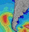 |  | 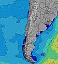 |  |  | 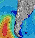 |  |  | ||||||||||||||
Onda Altezza (m) Direzione Periodo (s) | SW 12 | SW 12 | SW 13 | SW 13 | SW 13 | SW 13 | SW 13 | SW 13 | SW 12 | SW 12 | SW 12 | SW 12 | SW 12 | SW 12 | SW 12 | SW 12 | SW 11 | SW 11 | WSW 9 | WSW 11 | WSW 11 | WSW 11 | WSW 10 | WSW 10 |
Grafico delle onde | ||||||||||||||||||||||||
607 | 657 | 444 | 734 | 680 | 669 | 591 | 520 | 481 | 374 | 367 | 277 | 236 | 197 | 134 | 108 | 73 | 59 | 90 | 329 | 419 | 436 | 419 | 370 | |
Vento (km/h) | ||||||||||||||||||||||||
Stato del vento onshore cross-onshore cross-shore cross-offshore offshore piatto | cross-off | glassy | cross-on | on | cross-on | glassy | glassy | off | glassy | cross-off | cross | cross-on | cross-on | glassy | glassy | glassy | glassy | glassy | cross | cross-on | glassy | glassy | glassy | glassy |
Alta Marea | 9:59AM1.41m | 10:33PM0.78m | 10:47AM1.40m | 11:23PM0.82m | 11:33AM1.33m | 00:14AM0.86m | ||||||||||||||||||
Basso Marea | 3:13AM0.04m | 4:50PM-0.04m | 4:06AM0.03m | 5:35PM-0.05m | 4:59AM0.06m | 6:18PM-0.03m | ||||||||||||||||||
7:22 | — | — | — | — | — | — | — | 7:22 | — | — | — | — | — | — | — | 7:22 | — | — | — | — | — | — | 7:22 | |
— | — | — | — | 6:12 | — | — | — | — | — | — | — | 6:12 | — | — | — | — | — | — | — | 6:13 | — | — | 6:13 | |
mm | — | — | — | — | — | — | — | — | — | — | — | — | — | — | — | — | — | — | — | — | — | — | — | — |
Temp. °C | 16 | 16 | 18 | 19 | 16 | 16 | 17 | 16 | 16 | 16 | 20 | 20 | 18 | 16 | 16 | 16 | 16 | 16 | 20 | 20 | 18 | 17 | 17 | 17 |
Gelo °C | 15 | 16 | 18 | 17 | 15 | 16 | 17 | 15 | 16 | 15 | 19 | 18 | 18 | 16 | 16 | 16 | 16 | 15 | 19 | 18 | 18 | 17 | 18 | 17 |
Onda 1 Altezza (m) Direzione Periodo (s) | SW 12 | SW 12 | SW 13 | SW 13 | SW 13 | SW 13 | SW 13 | SW 13 | SW 12 | SW 12 | SW 12 | SW 12 | SW 12 | SW 12 | SW 12 | SW 12 | SW 11 | SW 11 | WSW 9 | WSW 11 | WSW 11 | WSW 11 | WSW 10 | WSW 10 |
607 | 657 | 444 | 734 | 680 | 669 | 591 | 520 | 481 | 374 | 367 | 277 | 236 | 197 | 134 | 108 | 73 | 59 | 90 | 329 | 419 | 436 | 419 | 370 | |
Onda 2 Altezza (m) Direzione Periodo (s) | NW 13 | NW 13 | WSW 12 | NW 13 | WNW 13 | WNW 13 | WNW 13 | WNW 13 | WNW 13 | W 10 | W 10 | WSW 10 | W 10 | W 9 | W 9 | WSW 9 | WSW 9 | WSW 8 | SW 12 | SW 16 | SW 16 | SW 16 | SSW 15 | SW 15 |
7 | 7 | 256 | 7 | 17 | 17 | 17 | 17 | 17 | 8 | 8 | 19 | 17 | 6 | 14 | 26 | 26 | 23 | 86 | 68 | 65 | 64 | 91 | 106 | |
Onda 3 Altezza (m) Direzione Periodo (s) | — | — | NW 13 | — | — | — | — | — | — | WNW 13 | NW 13 | NW 13 | NW 12 | NW 12 | NW 12 | NW 12 | SSW 13 | SSW 18 | SW 17 | WNW 12 | WNW 12 | NW 12 | NW 12 | SW 11 |
— | — | 7 | — | — | — | — | — | — | 17 | 7 | 7 | 6 | 6 | 6 | 6 | 17 | 30 | 47 | 14 | 14 | 6 | 6 | 32 | |
onde vento Altezza (m) Direzione Periodo (s) | — | — | — | — | — | — | — | — | — | — | — | — | — | — | — | — | — | — | — | — | — | — | — | — |
— | — | — | — | — | — | — | — | — | — | — | — | — | — | — | — | — | — | — | — | — | — | — | — | |
Il più vicino Offshore or Glassy | ||||||||||||||||||||||||
Distanza (km) | 0 | 0 | 11 | 139 | 19 | 0 | 0 | 0 | 0 | 0 | 188 | 29 | 15 | 0 | 0 | 0 | 0 | 0 | 188 | 188 | 0 | 0 | 0 | 0 |
Migliori previsioni per le condizioni d'onda in Antofagasta | ||||||||||||||||||||||||
Migliori previsioni per le condizioni d'onda in Chile | ||||||||||||||||||||||||
Trova Onde Globale | ||||||||||||||||||||||||
- Map Icons:
 Break
Break Live Wave Height (m)
 Live Wind Speed (km/h)
 Surf Rating (10 Max)
 Ocean Swells (m)
- Wind Speed (km/h)
Widget Free Surf-Forecast.com per il tuo sito
La relazione di surf / widget meteo è disponibile qui sotto per incorporare su siti esterni a titolo gratuito e fornisce una sintesi delle nostre La Portada previsione surf. Basta prendere il frammento di codice html da noi fornito e copiarlo nel proprio sito. È possibile scegliere la lingua preferita e unità metriche / imperiali per il feed delle previsioni surf per soddisfare le esigenze degli utenti del vostro sito .... Clicca qui per ottenere il codice.
 Nearest