
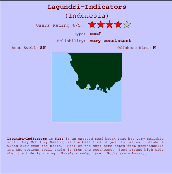
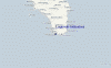
Lagundri-Indicators Surf Guide
Lagundri-Indicators in Nias, Hinako Islands is an exposed reef break that is usually a safe bet. May-Oct (Dry Season) is the optimum time of year for waves. The best wind direction is from the north. Tends to receive distant groundswells and the best swell direction is from the southwest. There is a right breaking reef. Best around high tide when the tide is rising. Unlikely to be too crowded, even when the surf is up. Take care of rocks in the line up.
Lagundri-Indicators Spot Info
| Type: | Rating: | Reliability: | Todays Sea Temp*: |
|---|---|---|---|
| very consistent | 30.1°C*ocean temperature recorded from satellite |
Surfing Lagundri-Indicators:
The best conditions reported for surf at Lagundri-Indicators occur when a Southwest swell combines with an offshore wind direction from the North.

Previsioni Energia d'onda (Potenza): 12hrs


Lagundri-Indicators Surf:
Friday, 17 July 2026, 22:43 Local time| Ven | Sabato 18 | |||
| 10PM | 1AM | 4AM | 7AM | |
| Wave (m) | ||||
| Periodo (s) | 15 | 15 | 14 | 14 |
| Vento (km/h) | ||||
| Stato del vento | cross- off |
cross- off |
cross- off |
cross- off |
- /breaks/Lagundri-Indicators/forecasts/latest
Lagundri-Indicators Surf Guide
Lagundri-Indicators in Nias, Hinako Islands is an exposed reef break that is usually a safe bet. May-Oct (Dry Season) is the optimum time of year for waves. The best wind direction is from the north. Tends to receive distant groundswells and the best swell direction is from the southwest. There is a right breaking reef. Best around high tide when the tide is rising. Unlikely to be too crowded, even when the surf is up. Take care of rocks in the line up.
Lagundri-Indicators Spot Info
Type: Rating: Reliability: Todays Sea Temp*:  Reef
Reef 4
4very consistent 30.1°C*ocean temperature recorded from satelliteSurfing Lagundri-Indicators:
The best conditions reported for surf at Lagundri-Indicators occur when a Southwest swell combines with an offshore wind direction from the North.
Previsioni Energia d'onda (Potenza): 12hrs
Utilizzare la scheda di navigazione in alto per visualizzare Lagundri-Indicators temperatura del mare, Lagundri-Indicators fotografie, Lagundri-Indicators dettagliate previsioni onde, il vento e le previsioni meteo, Lagundri-Indicators webcam, vento corrente da Nias stazioni meteo e Lagundri-Indicators previsioni marea. Il link Indonesia mappe maree apre l'immagine grande, che mostra Indonesia e dei mari circostanti. Queste mappe possono essere animate per mostrare le diverse componenti del moto ondoso, energia delle onde, periodo d'onda, altezza delle onde, insieme con le previsioni del vento e meteo, meteo corrente e osservazioni sullo stato del mare dal Indonesia onda-boe, le navi passanti e stazioni meteo costiere. Ciascuna delle pagine di previsioni per questo surf break rappresenta uno strumento di wavefinder globale e regionale per individuare le migliori condizioni di surf nella zona intorno Lagundri-Indicators.
Lagundri-Indicators Surf:
Friday, 17 July 2026, 22:43 Local timeVen Sabato 18 10PM 1AM 4AM 7AM Wave (m) Periodo (s) 15 15 14 14 Vento (km/h) Stato del vento cross-
offcross-
offcross-
offcross-
off- /breaks/Lagundri-Indicators/forecasts/latest
- /breaks/Lagundri-Indicators/forecasts/latest/six_day
Lagundri-Indicators Surf Guide
Lagundri-Indicators in Nias, Hinako Islands is an exposed reef break that is usually a safe bet. May-Oct (Dry Season) is the optimum time of year for waves. The best wind direction is from the north. Tends to receive distant groundswells and the best swell direction is from the southwest. There is a right breaking reef. Best around high tide when the tide is rising. Unlikely to be too crowded, even when the surf is up. Take care of rocks in the line up.
Lagundri-Indicators Spot Info
Type: Rating: Reliability: Todays Sea Temp*: Reef4very consistent 30.1°C*ocean temperature recorded from satelliteSurfing Lagundri-Indicators:
The best conditions reported for surf at Lagundri-Indicators occur when a Southwest swell combines with an offshore wind direction from the North.
Previsioni Energia d'onda (Potenza): 12hrs
Utilizzare la scheda di navigazione in alto per visualizzare Lagundri-Indicators temperatura del mare, Lagundri-Indicators fotografie, Lagundri-Indicators dettagliate previsioni onde, il vento e le previsioni meteo, Lagundri-Indicators webcam, vento corrente da Nias stazioni meteo e Lagundri-Indicators previsioni marea. Il link Indonesia mappe maree apre l'immagine grande, che mostra Indonesia e dei mari circostanti. Queste mappe possono essere animate per mostrare le diverse componenti del moto ondoso, energia delle onde, periodo d'onda, altezza delle onde, insieme con le previsioni del vento e meteo, meteo corrente e osservazioni sullo stato del mare dal Indonesia onda-boe, le navi passanti e stazioni meteo costiere. Ciascuna delle pagine di previsioni per questo surf break rappresenta uno strumento di wavefinder globale e regionale per individuare le migliori condizioni di surf nella zona intorno Lagundri-Indicators.
Lagundri-Indicators Surf:
Friday, 17 July 2026, 22:43 Local timeVen Sabato 18 10PM 1AM 4AM 7AM Wave (m) Periodo (s) 15 15 14 14 Vento (km/h) Stato del vento cross-
offcross-
offcross-
offcross-
off- /breaks/Lagundri-Indicators/forecasts/latest
Lagundri-Indicators Surf Guide
Lagundri-Indicators in Nias, Hinako Islands is an exposed reef break that is usually a safe bet. May-Oct (Dry Season) is the optimum time of year for waves. The best wind direction is from the north. Tends to receive distant groundswells and the best swell direction is from the southwest. There is a right breaking reef. Best around high tide when the tide is rising. Unlikely to be too crowded, even when the surf is up. Take care of rocks in the line up.
Lagundri-Indicators Spot Info
Type: Rating: Reliability: Todays Sea Temp*: Reef4very consistent 30.1°C*ocean temperature recorded from satelliteSurfing Lagundri-Indicators:
The best conditions reported for surf at Lagundri-Indicators occur when a Southwest swell combines with an offshore wind direction from the North.
Previsioni Energia d'onda (Potenza): 12hrs
Utilizzare la scheda di navigazione in alto per visualizzare Lagundri-Indicators temperatura del mare, Lagundri-Indicators fotografie, Lagundri-Indicators dettagliate previsioni onde, il vento e le previsioni meteo, Lagundri-Indicators webcam, vento corrente da Nias stazioni meteo e Lagundri-Indicators previsioni marea. Il link Indonesia mappe maree apre l'immagine grande, che mostra Indonesia e dei mari circostanti. Queste mappe possono essere animate per mostrare le diverse componenti del moto ondoso, energia delle onde, periodo d'onda, altezza delle onde, insieme con le previsioni del vento e meteo, meteo corrente e osservazioni sullo stato del mare dal Indonesia onda-boe, le navi passanti e stazioni meteo costiere. Ciascuna delle pagine di previsioni per questo surf break rappresenta uno strumento di wavefinder globale e regionale per individuare le migliori condizioni di surf nella zona intorno Lagundri-Indicators.
Lagundri-Indicators Surf:
Friday, 17 July 2026, 22:43 Local timeVen Sabato 18 10PM 1AM 4AM 7AM Wave (m) Periodo (s) 15 15 14 14 Vento (km/h) Stato del vento cross-
offcross-
offcross-
offcross-
offTide Times:
A Lagundri-Indicators (0 km).
PROSSIMA È ALLE (ora locale) rimanente alta marea bassa marea Lagundri-Indicators Tide Times and Tide Chart
Live Weather:
At Minangkabau Airport, 323 km from Lagundri-Indicators.
wind obs. (7 kph from 340 degs) was rejected
(km/h)Air temperature
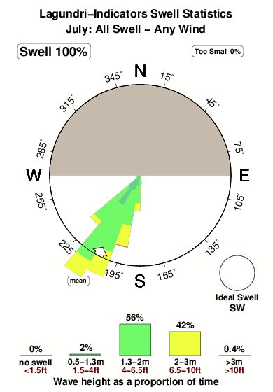
25°COverall Lagundri-Indicators Surf Consistency and Wind Distribution in Luglio
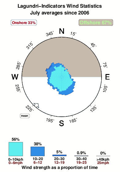


Wind stats for Lagundri-Indicators: see the variation in direction and stength by month.
foto dall' album
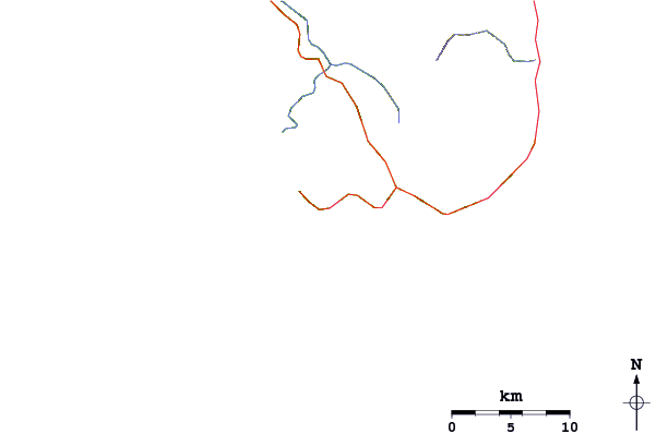
Contorni: Strade e fiumi: seleziona un surf break dal menu 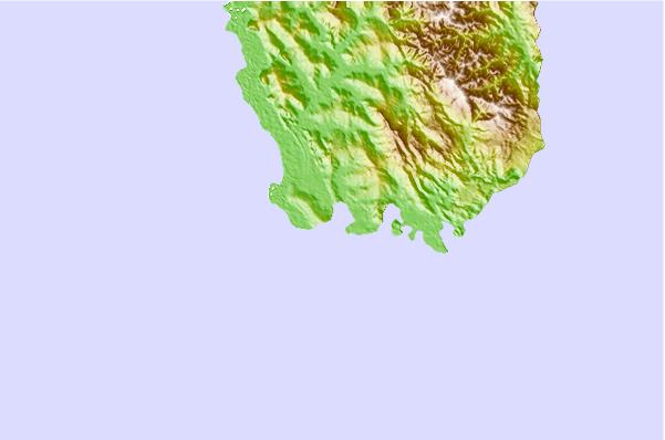
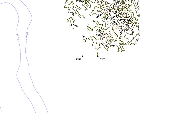
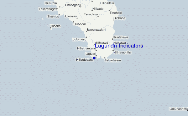
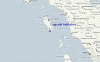
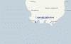
Utilizzare questa mappa sollievo per navigare Nias surf breaks e stazioni di marea che si trovano nella zona diLagundri-Indicators
Altri surf breaks più vicini al Lagundri-Indicators:
(clicca sul nome del luogo per maggiori informazioni)- Closest località surf1 mi
- Second closest località surf1 mi
- Third closest località surf7 mi
- Fourth closest località surf9 mi
- Fifth closest località surf12 mi
Onda boe più vicina a Lagundri-Indicators:
- Closest Onda boa2414 mi
- Second closest Onda boa2491 mi
- Third closest Onda boa2669 mi
- Fourth closest Onda boa2684 mi
- Fifth closest Onda boa2853 mi
Stazioni di marea più vicina alla Lagundri-Indicators:
- Closest marea stazioneSibolga109 mi
- Second closest marea stazioneSinabang161 mi
- Third closest marea stazionePariaman185 mi
- Fourth closest marea stazioneTeluk Nibung222 mi
- Fifth closest marea stazioneBelawan236 mi
Airports
- The nearest passenger airport to Lagundri-Indicators is Binaka (Gunung Sitoli) Airport (GNS) in Indonesia, which is 66 km (41 miles) away (directly).
- The second closest airport to Lagundri-Indicators is Tabing (Padang) Airport (PDG), also in Indonesia, 334 km (207 miles) away.
- /breaks/Lagundri-Indicators/forecasts/latest
 Nearest