
Previsioni:

Previsione a breve termineper lo più asciutto. Warm (Max 21°C Sabato pomeriggio, Min 15°C Sabato notte). Venti decrescenti (venti freschi da NNW Sabato pomeriggio, calma per lunedì notte). | ||||||||||||||||||||||||
Sabato 18 | Domenica 19 | Lunedì 20 | ||||||||||||||||||||||
2 AM | 5 AM | 8 AM | 11 AM | 2 PM | 5 PM | 8 PM | 11 PM | 2 AM | 5 AM | 8 AM | 11 AM | 2 PM | 5 PM | 8 PM | 11 PM | 2 AM | 5 AM | 8 AM | 11 AM | 2 PM | 5 PM | 8 PM | 11 PM | |
Mappa dell'altezza del moto ondoso |  |  |  |  | 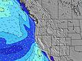 |  |  | 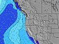 |  | |||||||||||||||
Onda Altezza (m) Direzione Periodo (s) | W 16 | W 16 | W 16 | W 16 | W 16 | W 16 | W 16 | SW 18 | SW 18 | W 15 | NW 8 | NW 8 | NW 8 | NW 8 | NW 8 | SW 17 | SW 17 | SW 17 | SW 17 | NW 8 | NW 8 | SW 16 | SW 16 | SW 16 |
Grafico delle onde | ||||||||||||||||||||||||
251 | 326 | 248 | 245 | 243 | 246 | 252 | 260 | 233 | 233 | 216 | 239 | 316 | 346 | 324 | 362 | 362 | 287 | 270 | 211 | 206 | 198 | 242 | 245 | |
Vento (km/h) | ||||||||||||||||||||||||
Stato del vento onshore cross-onshore cross-shore cross-offshore offshore piatto | cross-off | cross-off | cross | cross-on | cross-on | cross | cross | cross | cross | cross-off | cross | cross | cross-on | cross | cross | cross | cross | cross-on | cross-on | cross-on | cross-on | cross-on | cross-on | glassy |
Alta Marea | 2:50AM1.93m | 4:03PM1.91m | 3:46AM1.69m | 4:43PM1.93m | 4:50AM1.47m | 5:25PM1.92m | ||||||||||||||||||
Basso Marea | 9:33AM-0.14m | 10:09PM0.48m | 10:12AM0.11m | 11:12PM0.43m | 10:52AM0.36m | |||||||||||||||||||
— | 5:56 | — | — | — | — | — | — | — | 5:56 | — | — | — | — | — | — | — | 5:58 | — | — | — | — | — | — | |
— | — | — | — | — | — | 8:51 | — | — | — | — | — | — | — | 8:50 | — | — | — | — | — | — | — | 8:49 | — | |
mm | — | — | — | — | — | — | — | — | — | — | — | — | — | — | — | — | — | — | — | — | — | — | — | — |
Temp. °C | 14 | 13 | 16 | 19 | 20 | 21 | 19 | 16 | 15 | 15 | 17 | 21 | 20 | 20 | 18 | 16 | 16 | 16 | 16 | 17 | 18 | 17 | 16 | 15 |
Gelo °C | 12 | 11 | 14 | 15 | 15 | 16 | 14 | 13 | 12 | 12 | 14 | 17 | 15 | 16 | 15 | 14 | 14 | 14 | 15 | 16 | 18 | 17 | 16 | 16 |
Onda 1 Altezza (m) Direzione Periodo (s) | NW 6 | W 16 | NW 6 | W 16 | W 16 | W 16 | W 16 | NW 7 | NW 8 | NW 8 | NW 8 | NW 8 | W 14 | SW 16 | NW 8 | NW 8 | NW 8 | NW 8 | NW 8 | NW 8 | NW 8 | NW 8 | NW 8 | NW 8 |
42 | 326 | 54 | 245 | 242 | 239 | 236 | 203 | 179 | 183 | 216 | 239 | 153 | 206 | 324 | 277 | 257 | 239 | 239 | 187 | 187 | 171 | 149 | 153 | |
Onda 2 Altezza (m) Direzione Periodo (s) | W 16 | NW 6 | W 16 | WNW 10 | SW 17 | SW 18 | SW 18 | W 15 | W 15 | W 15 | W 15 | W 15 | SW 16 | W 14 | SW 17 | SW 17 | SW 17 | SW 17 | SW 17 | SW 16 | SW 16 | SW 16 | SW 16 | SW 16 |
251 | 41 | 248 | 95 | 243 | 246 | 252 | 233 | 233 | 233 | 165 | 157 | 122 | 106 | 241 | 362 | 362 | 287 | 270 | 211 | 206 | 198 | 242 | 245 | |
Onda 3 Altezza (m) Direzione Periodo (s) | WNW 11 | WNW 11 | WNW 11 | SW 14 | WNW 10 | WNW 10 | SW 13 | SW 18 | SW 18 | SW 19 | SW 16 | SW 16 | SW 19 | S 11 | W 14 | W 14 | W 14 | W 14 | W 14 | WNW 14 | WNW 13 | WNW 13 | WNW 13 | WNW 13 |
98 | 103 | 103 | 102 | 57 | 57 | 45 | 260 | 215 | 127 | 93 | 89 | 15 | 2 | 106 | 106 | 106 | 104 | 103 | 65 | 60 | 58 | 57 | 57 | |
onde vento Altezza (m) Direzione Periodo (s) | — | — | — | NW 6 | NW 6 | NW 7 | NW 7 | — | — | — | — | — | NW 8 | NW 8 | — | — | — | — | — | — | — | — | — | — |
— | — | — | 79 | 150 | 183 | 212 | — | — | — | — | — | 316 | 346 | — | — | — | — | — | — | — | — | — | — | |
Il più vicino Offshore or Glassy | ||||||||||||||||||||||||
Distanza (km) | 11 | 11 | 11 | 74 | 74 | 74 | 59 | 11 | 11 | 11 | 11 | 72 | 74 | 74 | 59 | 11 | 11 | 11 | 11 | 11 | 11 | 11 | 11 | 11 |
Migliori previsioni per le condizioni d'onda in South Oregon | ||||||||||||||||||||||||
Migliori previsioni per le condizioni d'onda in United States | ||||||||||||||||||||||||
Trova Onde Globale | ||||||||||||||||||||||||
- Map Icons:
 Break
Break Live Wave Height (m)
 Live Wind Speed (km/h)
 Surf Rating (10 Max)
 Ocean Swells (m)
- Wind Speed (km/h)
Widget Free Surf-Forecast.com per il tuo sito
La relazione di surf / widget meteo è disponibile qui sotto per incorporare su siti esterni a titolo gratuito e fornisce una sintesi delle nostre Little Joes/Between the Jetties previsione surf. Basta prendere il frammento di codice html da noi fornito e copiarlo nel proprio sito. È possibile scegliere la lingua preferita e unità metriche / imperiali per il feed delle previsioni surf per soddisfare le esigenze degli utenti del vostro sito .... Clicca qui per ottenere il codice.
 Nearest