
Previsioni:

Previsione a breve termineper lo più asciutto. Warm (Max 31°C mercoledì mattina, Min 25°C mercoledì notte). Vento sarà generalmente leggero. | ||||||||||||||||||||||||
Mer 15 | Giovedì 16 | Venerdì 17 | 18 | |||||||||||||||||||||
10 AM | 1 PM | 4 PM | 7 PM | 10 PM | 1 AM | 4 AM | 7 AM | 10 AM | 1 PM | 4 PM | 7 PM | 10 PM | 1 AM | 4 AM | 7 AM | 10 AM | 1 PM | 4 PM | 7 PM | 10 PM | 1 AM | 4 AM | 7 AM | |
Mappa dell'altezza del moto ondoso | 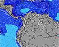 | 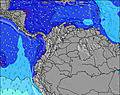 | 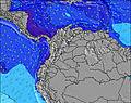 | 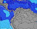 | 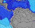 | 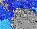 | 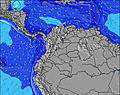 | 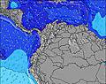 | 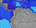 | |||||||||||||||
Onda Altezza (m) Direzione Periodo (s) | NE 9 | NE 8 | NE 8 | NE 9 | NE 9 | NE 8 | NE 8 | NE 8 | NE 8 | NE 8 | NE 8 | NE 9 | NE 9 | NE 8 | NE 8 | NE 8 | NE 8 | NE 8 | NE 8 | NE 9 | NE 9 | NE 8 | NE 8 | NE 8 |
Grafico delle onde | ||||||||||||||||||||||||
974 | 976 | 1082 | 1716 | 1619 | 1097 | 929 | 0 | 883 | 803 | 929 | 1503 | 1415 | 946 | 794 | 804 | 823 | 794 | 800 | 1405 | 1656 | 1052 | 878 | 734 | |
Vento (km/h) | ||||||||||||||||||||||||
Stato del vento onshore cross-onshore cross-shore cross-offshore offshore piatto | cross-on | cross-on | cross-on | cross-on | cross-on | cross-on | cross | cross | cross-on | on | cross-on | cross-on | cross-on | cross-on | cross | cross | cross-on | cross-on | cross-on | cross-on | cross-on | cross | cross | cross-on |
Alta Marea | 12:58PM0.09m | 00:24AM0.40m | 2:15PM0.14m | 1:15AM0.36m | 3:28PM0.19m | 2:06AM0.30m | ||||||||||||||||||
Basso Marea | 7:46AM0.01m | 4:12PM0.07m | 8:28AM0.02m | 5:32PM0.12m | 9:06AM0.04m | 7:28PM0.16m | ||||||||||||||||||
5:39 | — | — | — | — | — | 5:39 | — | — | — | — | — | — | — | 5:39 | — | — | — | — | — | — | — | 5:39 | — | |
— | — | 6:22 | — | — | — | — | — | — | — | 6:22 | — | — | — | — | — | — | — | 6:22 | — | — | — | — | 6:22 | |
mm | — | — | — | — | — | — | — | — | — | — | — | — | — | — | — | — | — | — | — | — | — | — | — | — |
Temp. °C | 29 | 31 | 29 | 26 | 27 | 25 | 25 | 25 | 28 | 30 | 28 | 26 | 26 | 26 | 25 | 25 | 28 | 30 | 29 | 26 | 27 | 26 | 25 | 26 |
Gelo °C | 31 | 32 | 31 | 27 | 28 | 25 | 26 | 26 | 30 | 32 | 30 | 28 | 27 | 28 | 26 | 27 | 31 | 33 | 32 | 28 | 29 | 27 | 26 | 28 |
Onda 1 Altezza (m) Direzione Periodo (s) | — | — | — | — | — | — | — | — | — | — | — | — | — | — | — | — | — | — | — | — | — | — | — | — |
— | — | — | — | — | — | — | — | — | — | — | — | — | — | — | — | — | — | — | — | — | — | — | — | |
Onda 2 Altezza (m) Direzione Periodo (s) | — | — | — | — | — | — | — | — | — | — | — | — | — | — | — | — | — | — | — | — | — | — | — | — |
— | — | — | — | — | — | — | — | — | — | — | — | — | — | — | — | — | — | — | — | — | — | — | — | |
Onda 3 Altezza (m) Direzione Periodo (s) | — | — | — | — | — | — | — | — | — | — | — | — | — | — | — | — | — | — | — | — | — | — | — | — |
— | — | — | — | — | — | — | — | — | — | — | — | — | — | — | — | — | — | — | — | — | — | — | — | |
onde vento Altezza (m) Direzione Periodo (s) | NE 9 | NE 8 | NE 8 | NE 9 | NE 9 | NE 8 | NE 8 | NE 8 | NE 8 | NE 8 | NE 8 | NE 9 | NE 9 | NE 8 | NE 8 | NE 8 | NE 8 | NE 8 | NE 8 | NE 9 | NE 9 | NE 8 | NE 8 | NE 8 |
974 | 976 | 1082 | 1716 | 1619 | 1097 | 929 | 868 | 883 | 803 | 929 | 1503 | 1415 | 946 | 794 | 804 | 823 | 794 | 800 | 1405 | 1656 | 1052 | 878 | 734 | |
Il più vicino Offshore or Glassy | ||||||||||||||||||||||||
Distanza (km) | 195 | 663 | 663 | 658 | 658 | 632 | 208 | 632 | 324 | 663 | 663 | 663 | 658 | 632 | 208 | 621 | 324 | 663 | 663 | 663 | 658 | 195 | 632 | 195 |
Migliori previsioni per le condizioni d'onda in Caribbean Coast | ||||||||||||||||||||||||
Migliori previsioni per le condizioni d'onda in Colombia | ||||||||||||||||||||||||
Trova Onde Globale | ||||||||||||||||||||||||
- Map Icons:
 Break
Break Live Wave Height (m)
 Live Wind Speed (km/h)
 Surf Rating (10 Max)
 Ocean Swells (m)
- Wind Speed (km/h)
Widget Free Surf-Forecast.com per il tuo sito
La relazione di surf / widget meteo è disponibile qui sotto per incorporare su siti esterni a titolo gratuito e fornisce una sintesi delle nostre Los Naranjos previsione surf. Basta prendere il frammento di codice html da noi fornito e copiarlo nel proprio sito. È possibile scegliere la lingua preferita e unità metriche / imperiali per il feed delle previsioni surf per soddisfare le esigenze degli utenti del vostro sito .... Clicca qui per ottenere il codice.
 Nearest