
Previsioni:

Previsione a breve termineper lo più asciutto. Very mild (Max 16°C giovedì mattina, Min 12°C Venerdì notte). Venti in aumento (calma mercoledì notte, venti freschi da N per sabato mattina). | ||||||||||||||||||||||||
Mer 15 | Giovedì 16 | Venerdì 17 | 18 | |||||||||||||||||||||
4 PM | 7 PM | 10 PM | 1 AM | 4 AM | 7 AM | 10 AM | 1 PM | 4 PM | 7 PM | 10 PM | 1 AM | 4 AM | 7 AM | 10 AM | 1 PM | 4 PM | 7 PM | 10 PM | 1 AM | 4 AM | 7 AM | 10 AM | 1 PM | |
Mappa dell'altezza del moto ondoso |  |  |  |  |  |  |  |  | 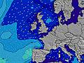 | |||||||||||||||
Onda Altezza (m) Direzione Periodo (s) | NNE 6 | NNE 6 | NNE 6 | NNE 6 | NNE 6 | NNE 6 | NNE 6 | NE 6 | NE 6 | NE 6 | NE 5 | NNE 5 | NNE 5 | N 3 | N 3 | NNE 4 | NNE 5 | NNE 5 | NNE 6 | NNE 6 | NNE 6 | NNE 7 | NNE 7 | NNE 7 |
Grafico delle onde | ||||||||||||||||||||||||
22 | 22 | 15 | 15 | 14 | 14 | 13 | 8 | 8 | 8 | 7 | 5 | 3 | 3 | 6 | 21 | 39 | 51 | 62 | 94 | 130 | 256 | 271 | 256 | |
Vento (km/h) | ||||||||||||||||||||||||
Stato del vento onshore cross-onshore cross-shore cross-offshore offshore piatto | cross-on | cross-on | glassy | glassy | cross-off | cross-off | cross | cross-on | cross | cross | cross-off | cross-off | cross-off | cross-off | cross-off | cross | cross | cross | cross-off | cross-off | cross-off | cross | cross | cross |
Alta Marea | 4:40PM4.47m | 4:50AM4.71m | 5:30PM4.46m | 5:36AM4.77m | 6:18PM4.35m | 6:21AM4.71m | ||||||||||||||||||
Basso Marea | 10:48PM0.49m | 11:18AM-0.15m | 11:33PM0.52m | 12:04PM-0.15m | 00:15AM0.61m | 12:49PM-0.02m | ||||||||||||||||||
— | — | — | — | 4:45 | — | — | — | — | — | — | — | 4:46 | — | — | — | — | — | — | — | 4:48 | — | — | — | |
— | 9:39 | — | — | — | — | — | — | — | 9:37 | — | — | — | — | — | — | — | 9:37 | — | — | — | — | — | 9:36 | |
mm | — | — | — | — | — | — | — | — | — | — | — | — | — | — | — | — | — | — | — | — | — | — | — | — |
Temp. °C | 13 | 13 | 13 | 13 | 13 | 13 | 15 | 16 | 16 | 15 | 14 | 14 | 13 | 14 | 14 | 14 | 15 | 14 | 14 | 14 | 12 | 12 | 13 | 14 |
Gelo °C | 11 | 12 | 13 | 13 | 12 | 12 | 14 | 14 | 14 | 13 | 11 | 11 | 10 | 11 | 9 | 10 | 12 | 11 | 12 | 12 | 8 | 6 | 7 | 9 |
Onda 1 Altezza (m) Direzione Periodo (s) | NNE 6 | NNE 6 | NNE 6 | NNE 6 | NNE 6 | NNE 6 | NNE 6 | NE 6 | NE 6 | NE 6 | NE 5 | NNE 5 | NNE 5 | NNE 5 | — | — | — | — | NNE 6 | NNE 6 | NNE 6 | — | — | — |
22 | 22 | 15 | 15 | 14 | 14 | 13 | 8 | 8 | 8 | 7 | 5 | 3 | 2 | — | — | — | — | 62 | 94 | 130 | — | — | — | |
Onda 2 Altezza (m) Direzione Periodo (s) | E 4 | E 4 | E 4 | ESE 4 | ESE 4 | E 4 | — | — | — | — | — | — | — | — | — | — | — | — | — | — | — | — | — | — |
3 | 1 | 1 | 2 | 2 | 1 | — | — | — | — | — | — | — | — | — | — | — | — | — | — | — | — | — | — | |
Onda 3 Altezza (m) Direzione Periodo (s) | — | SE 5 | — | — | — | — | — | — | — | — | — | — | — | — | — | — | — | — | — | — | — | — | — | — |
— | 1 | — | — | — | — | — | — | — | — | — | — | — | — | — | — | — | — | — | — | — | — | — | — | |
onde vento Altezza (m) Direzione Periodo (s) | — | — | — | — | — | — | — | — | — | NNE 2 | NNE 2 | — | N 3 | N 3 | N 3 | NNE 4 | NNE 5 | NNE 5 | — | — | — | NNE 7 | NNE 7 | NNE 7 |
— | — | — | — | — | — | — | — | — | 1 | 1 | — | 1 | 3 | 6 | 21 | 39 | 51 | — | — | — | 256 | 271 | 256 | |
Il più vicino Offshore or Glassy | ||||||||||||||||||||||||
Distanza (km) | 415 | 369 | 348 | 366 | 438 | 440 | 440 | 362 | 348 | 348 | 348 | 348 | 393 | 393 | 393 | 1435 | 1435 | 1435 | 3 | 0 | 51 | 57 | 57 | 57 |
Migliori previsioni per le condizioni d'onda in North East England | ||||||||||||||||||||||||
Migliori previsioni per le condizioni d'onda in United Kingdom | ||||||||||||||||||||||||
Trova Onde Globale | ||||||||||||||||||||||||
- Map Icons:
 Break
Break Live Wave Height (m)
 Live Wind Speed (km/h)
 Surf Rating (10 Max)
 Ocean Swells (m)
- Wind Speed (km/h)
Widget Free Surf-Forecast.com per il tuo sito
La relazione di surf / widget meteo è disponibile qui sotto per incorporare su siti esterni a titolo gratuito e fornisce una sintesi delle nostre Low Newton previsione surf. Basta prendere il frammento di codice html da noi fornito e copiarlo nel proprio sito. È possibile scegliere la lingua preferita e unità metriche / imperiali per il feed delle previsioni surf per soddisfare le esigenze degli utenti del vostro sito .... Clicca qui per ottenere il codice.
 Nearest