Previsioni:

Previsione a breve terminepioggia leggera (Totale 5mm), per lo più che cade giovedì pomeriggio. Warm (Max 20°C mercoledì pomeriggio, Min 13°C giovedì notte). Vento sarà generalmente leggero. | ||||||||||||||||||||||||
Mar 14 | Mercoledì 15 | Giovedì 16 | Venerdì 17 | |||||||||||||||||||||
8 PM | 11 PM | 2 AM | 5 AM | 8 AM | 11 AM | 2 PM | 5 PM | 8 PM | 11 PM | 2 AM | 5 AM | 8 AM | 11 AM | 2 PM | 5 PM | 8 PM | 11 PM | 2 AM | 5 AM | 8 AM | 11 AM | 2 PM | 5 PM | |
Mappa dell'altezza del moto ondoso | 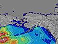 | 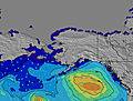 | 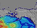 | 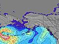 | 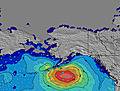 | 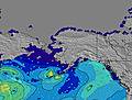 | 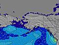 | 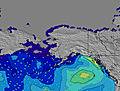 | 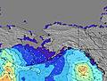 | |||||||||||||||
Onda Altezza (m) Direzione Periodo (s) | W 9 | W 9 | W 9 | W 10 | W 10 | W 9 | W 9 | W 9 | W 9 | W 9 | W 18 | W 19 | W 18 | W 18 | W 17 | W 17 | W 16 | W 16 | W 16 | W 16 | W 16 | W 16 | W 16 | W 16 |
Grafico delle onde | ||||||||||||||||||||||||
74 | 71 | 76 | 96 | 94 | 83 | 80 | 79 | 60 | 57 | 101 | 61 | 104 | 96 | 147 | 138 | 133 | 192 | 192 | 190 | 252 | 249 | 178 | 176 | |
Vento (km/h) | ||||||||||||||||||||||||
Stato del vento onshore cross-onshore cross-shore cross-offshore offshore piatto | cross-on | cross | cross | cross | cross-on | cross-on | cross-on | cross-on | cross-on | cross | cross-on | cross | cross-on | cross-on | cross-on | cross-on | cross-on | cross-on | cross-on | cross-on | cross | cross-on | cross-on | cross-on |
Alta Marea | 5:09PM1.59m | 1:53AM2.51m | 5:31PM1.65m | 2:46AM2.35m | 5:59PM1.73m | 3:38AM2.12m | ||||||||||||||||||
Basso Marea | 7:50PM1.52m | 10:02AM-0.73m | 9:11PM1.43m | 10:41AM-0.57m | 10:21PM1.33m | 11:16AM-0.33m | ||||||||||||||||||
— | — | — | 5:30 | — | — | — | — | — | — | — | 5:31 | — | — | — | — | — | — | — | 5:31 | — | — | — | — | |
9:12 | — | — | — | — | — | — | — | 9:10 | — | — | — | — | — | — | — | 9:09 | — | — | — | — | — | — | 9:08 | |
mm | — | — | — | — | — | — | — | — | — | — | — | — | 1 | — | 1 | 2 | 1 | — | — | — | — | — | — | — |
Temp. °C | 19 | 16 | 16 | 16 | 17 | 19 | 20 | 19 | 18 | 17 | 16 | 16 | 16 | 17 | 16 | 15 | 15 | 15 | 14 | 13 | 14 | 16 | 18 | 18 |
Gelo °C | 17 | 14 | 14 | 15 | 16 | 18 | 18 | 16 | 16 | 15 | 15 | 15 | 16 | 16 | 14 | 13 | 13 | 14 | 13 | 12 | 13 | 15 | 16 | 15 |
Onda 1 Altezza (m) Direzione Periodo (s) | W 9 | W 9 | W 9 | W 10 | W 10 | W 9 | W 9 | W 9 | W 9 | W 9 | W 9 | W 8 | W 8 | W 8 | W 8 | W 8 | W 8 | W 8 | W 8 | W 8 | W 16 | W 16 | W 16 | W 11 |
74 | 71 | 76 | 96 | 94 | 83 | 80 | 79 | 56 | 54 | 54 | 52 | 51 | 66 | 63 | 61 | 61 | 82 | 80 | 60 | 252 | 249 | 178 | 123 | |
Onda 2 Altezza (m) Direzione Periodo (s) | W 13 | W 13 | W 13 | W 13 | W 13 | W 13 | W 13 | W 13 | W 13 | W 18 | W 18 | W 19 | W 18 | W 18 | W 17 | W 17 | W 16 | W 16 | W 16 | W 16 | W 8 | W 8 | W 8 | W 16 |
30 | 54 | 32 | 32 | 32 | 32 | 31 | 29 | 50 | 57 | 101 | 61 | 104 | 96 | 147 | 138 | 133 | 192 | 192 | 190 | 43 | 42 | 32 | 176 | |
Onda 3 Altezza (m) Direzione Periodo (s) | SW 13 | SW 13 | SW 13 | SW 13 | SW 13 | W 19 | W 19 | W 18 | W 18 | W 13 | W 12 | W 12 | W 12 | W 12 | W 12 | SW 16 | SW 16 | SW 16 | SW 16 | SW 16 | SW 16 | SW 16 | WNW 12 | SW 16 |
27 | 27 | 27 | 27 | 26 | 29 | 64 | 60 | 60 | 28 | 28 | 27 | 26 | 11 | 11 | 40 | 40 | 40 | 40 | 40 | 39 | 39 | 44 | 63 | |
onde vento Altezza (m) Direzione Periodo (s) | — | — | — | — | — | — | — | — | — | — | — | — | — | — | — | — | — | — | — | — | — | — | — | — |
— | — | — | — | — | — | — | — | — | — | — | — | — | — | — | — | — | — | — | — | — | — | — | — | |
Il più vicino Offshore or Glassy | ||||||||||||||||||||||||
Distanza (km) | 97 | 15 | 15 | 15 | 28 | 28 | 1255 | 1254 | 20 | 15 | 20 | 15 | 33 | 51 | 51 | 51 | 51 | 4 | 4 | 4 | 4 | 20 | 163 | 1255 |
Migliori previsioni per le condizioni d'onda in Washington State | ||||||||||||||||||||||||
Migliori previsioni per le condizioni d'onda in United States | ||||||||||||||||||||||||
Trova Onde Globale | ||||||||||||||||||||||||
- Map Icons:
 Break
Break Live Wave Height (m)
 Live Wind Speed (km/h)
 Surf Rating (10 Max)
 Ocean Swells (m)
- Wind Speed (km/h)
Widget Free Surf-Forecast.com per il tuo sito
La relazione di surf / widget meteo è disponibile qui sotto per incorporare su siti esterni a titolo gratuito e fornisce una sintesi delle nostre Lyre River previsione surf. Basta prendere il frammento di codice html da noi fornito e copiarlo nel proprio sito. È possibile scegliere la lingua preferita e unità metriche / imperiali per il feed delle previsioni surf per soddisfare le esigenze degli utenti del vostro sito .... Clicca qui per ottenere il codice.
 Nearest