

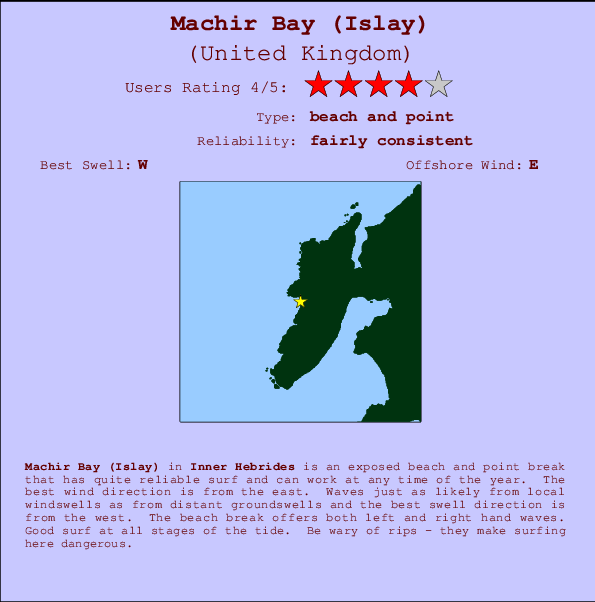
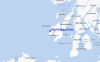
Machir Bay (Islay) Surf Guide
Machir Bay in Islay is an exposed beach and point break that has quite reliable surf and can work at any time of the year. Offshore winds are from the east. Groundswells and windswells are equally likely and the best swell direction is from the west. The beach breaks offer lefts and rights. Surfable at all stages of the tide. Watch out for dangerous rips.
Machir Bay (Islay) Spot Info
| Type: | Rating: | Reliability: | Todays Sea Temp*: |
|---|---|---|---|
| fairly consistent | 13.5°C*ocean temperature recorded from satellite |
Surfing Machir Bay (Islay):
The best conditions reported for surf at Machir Bay (Islay) occur when a West swell combines with an offshore wind direction from the East.
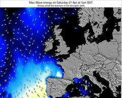
Previsioni Energia d'onda (Potenza): 12hrs


Machir Bay (Islay) Surf:
Thursday, 16 July 2026, 07:54 Local time| Mer | Giovedì 16 | |||
| 10PM | 1AM | 4AM | 7AM | |
| Wave (m) | ||||
| Periodo (s) | 9 | 9 | 8 | 8 |
| Vento (km/h) | ||||
| Stato del vento | cross- off |
cross- off |
glass | off |
- /breaks/Machir-Bay/forecasts/latest
Machir Bay (Islay) Surf Guide
Machir Bay in Islay is an exposed beach and point break that has quite reliable surf and can work at any time of the year. Offshore winds are from the east. Groundswells and windswells are equally likely and the best swell direction is from the west. The beach breaks offer lefts and rights. Surfable at all stages of the tide. Watch out for dangerous rips.
Machir Bay (Islay) Spot Info
Type: Rating: Reliability: Todays Sea Temp*:  Beach and point
 4
4fairly consistent 13.5°C*ocean temperature recorded from satelliteSurfing Machir Bay (Islay):
The best conditions reported for surf at Machir Bay (Islay) occur when a West swell combines with an offshore wind direction from the East.
Previsioni Energia d'onda (Potenza): 12hrs
Utilizzare la scheda di navigazione in alto per visualizzare Machir Bay (Islay) temperatura del mare, Machir Bay (Islay) fotografie, Machir Bay (Islay) dettagliate previsioni onde, il vento e le previsioni meteo, Machir Bay (Islay) webcam, vento corrente da Scot - Inner Hebrides stazioni meteo e Machir Bay (Islay) previsioni marea. Il link United Kingdom mappe maree apre l'immagine grande, che mostra United Kingdom e dei mari circostanti. Queste mappe possono essere animate per mostrare le diverse componenti del moto ondoso, energia delle onde, periodo d'onda, altezza delle onde, insieme con le previsioni del vento e meteo, meteo corrente e osservazioni sullo stato del mare dal United Kingdom onda-boe, le navi passanti e stazioni meteo costiere. Ciascuna delle pagine di previsioni per questo surf break rappresenta uno strumento di wavefinder globale e regionale per individuare le migliori condizioni di surf nella zona intorno Machir Bay (Islay).
Machir Bay (Islay) Surf:
Thursday, 16 July 2026, 07:54 Local timeMer Giovedì 16 10PM 1AM 4AM 7AM Wave (m) Periodo (s) 9 9 8 8 Vento (km/h) Stato del vento cross-
offcross-
offglass off - /breaks/Machir-Bay/forecasts/latest
- /breaks/Machir-Bay/forecasts/latest/six_day
Machir Bay (Islay) Surf Guide
Machir Bay in Islay is an exposed beach and point break that has quite reliable surf and can work at any time of the year. Offshore winds are from the east. Groundswells and windswells are equally likely and the best swell direction is from the west. The beach breaks offer lefts and rights. Surfable at all stages of the tide. Watch out for dangerous rips.
Machir Bay (Islay) Spot Info
Type: Rating: Reliability: Todays Sea Temp*: Beach and point4fairly consistent 13.5°C*ocean temperature recorded from satelliteSurfing Machir Bay (Islay):
The best conditions reported for surf at Machir Bay (Islay) occur when a West swell combines with an offshore wind direction from the East.
Previsioni Energia d'onda (Potenza): 12hrs
Utilizzare la scheda di navigazione in alto per visualizzare Machir Bay (Islay) temperatura del mare, Machir Bay (Islay) fotografie, Machir Bay (Islay) dettagliate previsioni onde, il vento e le previsioni meteo, Machir Bay (Islay) webcam, vento corrente da Scot - Inner Hebrides stazioni meteo e Machir Bay (Islay) previsioni marea. Il link United Kingdom mappe maree apre l'immagine grande, che mostra United Kingdom e dei mari circostanti. Queste mappe possono essere animate per mostrare le diverse componenti del moto ondoso, energia delle onde, periodo d'onda, altezza delle onde, insieme con le previsioni del vento e meteo, meteo corrente e osservazioni sullo stato del mare dal United Kingdom onda-boe, le navi passanti e stazioni meteo costiere. Ciascuna delle pagine di previsioni per questo surf break rappresenta uno strumento di wavefinder globale e regionale per individuare le migliori condizioni di surf nella zona intorno Machir Bay (Islay).
Machir Bay (Islay) Surf:
Thursday, 16 July 2026, 07:54 Local timeMer Giovedì 16 10PM 1AM 4AM 7AM Wave (m) Periodo (s) 9 9 8 8 Vento (km/h) Stato del vento cross-
offcross-
offglass off - /breaks/Machir-Bay/forecasts/latest
Machir Bay (Islay) Surf Guide
Machir Bay in Islay is an exposed beach and point break that has quite reliable surf and can work at any time of the year. Offshore winds are from the east. Groundswells and windswells are equally likely and the best swell direction is from the west. The beach breaks offer lefts and rights. Surfable at all stages of the tide. Watch out for dangerous rips.
Machir Bay (Islay) Spot Info
Type: Rating: Reliability: Todays Sea Temp*: Beach and point4fairly consistent 13.5°C*ocean temperature recorded from satelliteSurfing Machir Bay (Islay):
The best conditions reported for surf at Machir Bay (Islay) occur when a West swell combines with an offshore wind direction from the East.
Previsioni Energia d'onda (Potenza): 12hrs
Utilizzare la scheda di navigazione in alto per visualizzare Machir Bay (Islay) temperatura del mare, Machir Bay (Islay) fotografie, Machir Bay (Islay) dettagliate previsioni onde, il vento e le previsioni meteo, Machir Bay (Islay) webcam, vento corrente da Scot - Inner Hebrides stazioni meteo e Machir Bay (Islay) previsioni marea. Il link United Kingdom mappe maree apre l'immagine grande, che mostra United Kingdom e dei mari circostanti. Queste mappe possono essere animate per mostrare le diverse componenti del moto ondoso, energia delle onde, periodo d'onda, altezza delle onde, insieme con le previsioni del vento e meteo, meteo corrente e osservazioni sullo stato del mare dal United Kingdom onda-boe, le navi passanti e stazioni meteo costiere. Ciascuna delle pagine di previsioni per questo surf break rappresenta uno strumento di wavefinder globale e regionale per individuare le migliori condizioni di surf nella zona intorno Machir Bay (Islay).
Machir Bay (Islay) Surf:
Thursday, 16 July 2026, 07:54 Local timeMer Giovedì 16 10PM 1AM 4AM 7AM Wave (m) Periodo (s) 9 9 8 8 Vento (km/h) Stato del vento cross-
offcross-
offglass off Tide Times:
Per Saligo (Islay), %{dist} %{km} da %{location}.
PROSSIMA È ALLE (ora locale) rimanente alta marea bassa marea Machir Bay (Islay) Tide Times and Tide Chart
Live Weather:
At Islay Port Ellen, 18 km from Machir Bay (Islay).
calm
(km/h)
Dry and partly cloudyAir temperature
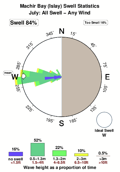
13°COverall Machir Bay (Islay) Surf Consistency and Wind Distribution in Luglio
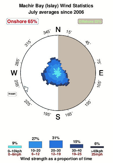


Wind stats for Machir Bay (Islay): see the variation in direction and stength by month.
foto dall' album
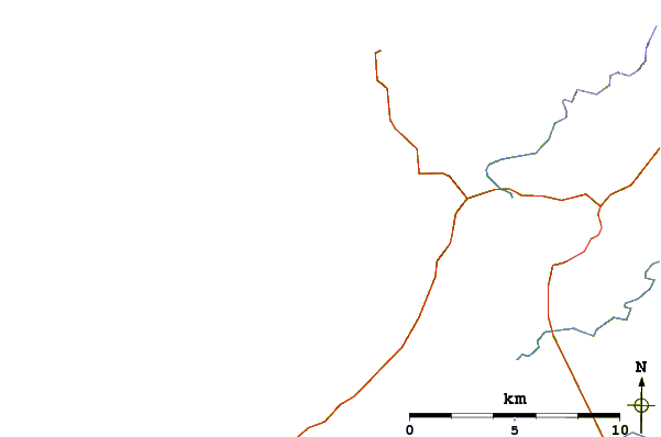
Contorni: Strade e fiumi: seleziona un surf break dal menu 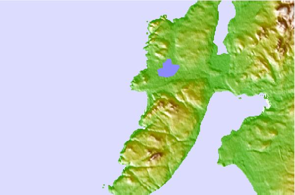
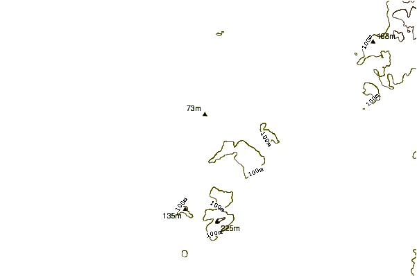
Utilizzare questa mappa sollievo per navigare Scot - Inner Hebrides surf breaks e stazioni di marea che si trovano nella zona diMachir Bay (Islay)
Altri surf breaks più vicini al Machir Bay (Islay):
(clicca sul nome del luogo per maggiori informazioni)- Closest località surf2 mi
- Second closest località surf5 mi
- Third closest località surf9 mi
- Fourth closest località surf10 mi
- Fifth closest località surf32 mi
Onda boe più vicina a Machir Bay (Islay):
- Closest Onda boa30 mi
- Second closest Onda boa118 mi
- Third closest Onda boa133 mi
- Fourth closest Onda boa141 mi
- Fifth closest Onda boa149 mi
Stazioni di marea più vicina alla Machir Bay (Islay):
- Closest marea stazionePort Ellen, Islay, Western Scotland15 mi
- Second closest marea stazionePortrush41 mi
- Third closest marea stazioneBallycastle41 mi
- Fourth closest marea stazionePortstewart43 mi
- Fifth closest marea stazioneOban58 mi
Airports
- The closest passenger airport to Machir Bay (Islay) is Islay Airport (ILY) in U.k, 17 km (11 miles) away (directly).
- The second nearest airport to Machir Bay (Islay) is Tiree Airport (TRE) in U.k., 84 km (52 miles) away.
- Third is Londonderry Eglinton Airport (LDY) in North Ireland, 93 km (58 miles) away.
- Prestwick Airport (PIK) in U.k is 121 km (75 miles) away.
- Aldergrove (Belfast) Airport (BFS) in North Ireland is the fifth nearest airport to Machir Bay (Islay) and is 126 km (78 miles) away.
- /breaks/Machir-Bay/forecasts/latest

 Nearest