
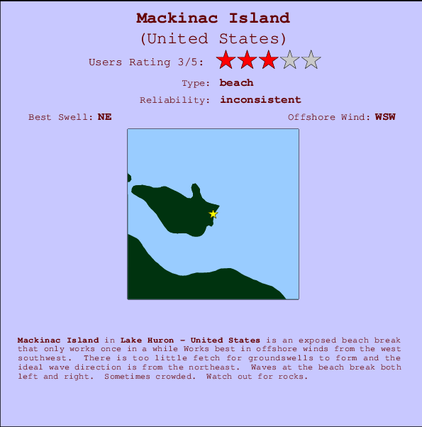
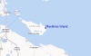
Mackinac Island Surf Guide
Mackinac Island in Lake Huron is an exposed beach break that has unreliable waves Works best in offshore winds from the west southwest. Short period wind swells are the rule and the best wave direction is from the northeast. Waves at the beach are both lefts and rights. A fairly popluar wave that can sometimes get crowded Take care to avoid the rocks.
Mackinac Island Spot Info
| Type: | Rating: | Reliability: | Todays Sea Temp*: |
|---|---|---|---|
| inconsistent | 20.8°C*ocean temperature recorded from satellite |
Surfing Mackinac Island:
The best conditions reported for surf at Mackinac Island occur when a Northeast swell combines with an offshore wind direction from the West-southwest.
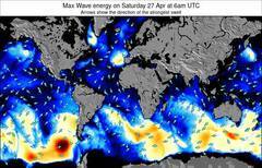
Previsioni Energia d'onda (Potenza): 12hrs

Mackinac Island Surf:
Tuesday, 14 July 2026, 10:18 Local time| Martedì 14 | ||||
| 11AM | 2PM | 5PM | 8PM | |
| Wave (m) | ||||
| Periodo (s) | - | - | - | - |
| Vento (km/h) | ||||
| Stato del vento | cross- off |
off | off | cross- off |
- /breaks/Mackinac-Island/forecasts/latest
Mackinac Island Surf Guide
Mackinac Island in Lake Huron is an exposed beach break that has unreliable waves Works best in offshore winds from the west southwest. Short period wind swells are the rule and the best wave direction is from the northeast. Waves at the beach are both lefts and rights. A fairly popluar wave that can sometimes get crowded Take care to avoid the rocks.
Mackinac Island Spot Info
Type: Rating: Reliability: Todays Sea Temp*:  Beach
Beach 3
3inconsistent 20.8°C*ocean temperature recorded from satelliteSurfing Mackinac Island:
The best conditions reported for surf at Mackinac Island occur when a Northeast swell combines with an offshore wind direction from the West-southwest.
Previsioni Energia d'onda (Potenza): 12hrs
Utilizzare la scheda di navigazione in alto per visualizzare Mackinac Island temperatura del mare, Mackinac Island fotografie, Mackinac Island dettagliate previsioni onde, il vento e le previsioni meteo, Mackinac Island webcam, vento corrente da Lake Huron stazioni meteo e Mackinac Island previsioni marea. Il link United States mappe maree apre l'immagine grande, che mostra United States e dei mari circostanti. Queste mappe possono essere animate per mostrare le diverse componenti del moto ondoso, energia delle onde, periodo d'onda, altezza delle onde, insieme con le previsioni del vento e meteo, meteo corrente e osservazioni sullo stato del mare dal United States onda-boe, le navi passanti e stazioni meteo costiere. Ciascuna delle pagine di previsioni per questo surf break rappresenta uno strumento di wavefinder globale e regionale per individuare le migliori condizioni di surf nella zona intorno Mackinac Island.
Mackinac Island Surf:
Tuesday, 14 July 2026, 10:18 Local timeMartedì 14 11AM 2PM 5PM 8PM Wave (m) Periodo (s) - - - - Vento (km/h) Stato del vento cross-
offoff off cross-
off- /breaks/Mackinac-Island/forecasts/latest
- /breaks/Mackinac-Island/forecasts/latest/six_day
Mackinac Island Surf Guide
Mackinac Island in Lake Huron is an exposed beach break that has unreliable waves Works best in offshore winds from the west southwest. Short period wind swells are the rule and the best wave direction is from the northeast. Waves at the beach are both lefts and rights. A fairly popluar wave that can sometimes get crowded Take care to avoid the rocks.
Mackinac Island Spot Info
Type: Rating: Reliability: Todays Sea Temp*: Beach3inconsistent 20.8°C*ocean temperature recorded from satelliteSurfing Mackinac Island:
The best conditions reported for surf at Mackinac Island occur when a Northeast swell combines with an offshore wind direction from the West-southwest.
Previsioni Energia d'onda (Potenza): 12hrs
Utilizzare la scheda di navigazione in alto per visualizzare Mackinac Island temperatura del mare, Mackinac Island fotografie, Mackinac Island dettagliate previsioni onde, il vento e le previsioni meteo, Mackinac Island webcam, vento corrente da Lake Huron stazioni meteo e Mackinac Island previsioni marea. Il link United States mappe maree apre l'immagine grande, che mostra United States e dei mari circostanti. Queste mappe possono essere animate per mostrare le diverse componenti del moto ondoso, energia delle onde, periodo d'onda, altezza delle onde, insieme con le previsioni del vento e meteo, meteo corrente e osservazioni sullo stato del mare dal United States onda-boe, le navi passanti e stazioni meteo costiere. Ciascuna delle pagine di previsioni per questo surf break rappresenta uno strumento di wavefinder globale e regionale per individuare le migliori condizioni di surf nella zona intorno Mackinac Island.
Mackinac Island Surf:
Tuesday, 14 July 2026, 10:18 Local timeMartedì 14 11AM 2PM 5PM 8PM Wave (m) Periodo (s) - - - - Vento (km/h) Stato del vento cross-
offoff off cross-
off- /breaks/Mackinac-Island/forecasts/latest
Mackinac Island Surf Guide
Mackinac Island in Lake Huron is an exposed beach break that has unreliable waves Works best in offshore winds from the west southwest. Short period wind swells are the rule and the best wave direction is from the northeast. Waves at the beach are both lefts and rights. A fairly popluar wave that can sometimes get crowded Take care to avoid the rocks.
Mackinac Island Spot Info
Type: Rating: Reliability: Todays Sea Temp*: Beach3inconsistent 20.8°C*ocean temperature recorded from satelliteSurfing Mackinac Island:
The best conditions reported for surf at Mackinac Island occur when a Northeast swell combines with an offshore wind direction from the West-southwest.
Previsioni Energia d'onda (Potenza): 12hrs
Utilizzare la scheda di navigazione in alto per visualizzare Mackinac Island temperatura del mare, Mackinac Island fotografie, Mackinac Island dettagliate previsioni onde, il vento e le previsioni meteo, Mackinac Island webcam, vento corrente da Lake Huron stazioni meteo e Mackinac Island previsioni marea. Il link United States mappe maree apre l'immagine grande, che mostra United States e dei mari circostanti. Queste mappe possono essere animate per mostrare le diverse componenti del moto ondoso, energia delle onde, periodo d'onda, altezza delle onde, insieme con le previsioni del vento e meteo, meteo corrente e osservazioni sullo stato del mare dal United States onda-boe, le navi passanti e stazioni meteo costiere. Ciascuna delle pagine di previsioni per questo surf break rappresenta uno strumento di wavefinder globale e regionale per individuare le migliori condizioni di surf nella zona intorno Mackinac Island.
Mackinac Island Surf:
Tuesday, 14 July 2026, 10:18 Local timeMartedì 14 11AM 2PM 5PM 8PM Wave (m) Periodo (s) - - - - Vento (km/h) Stato del vento cross-
offoff off cross-
offTide Times:
Per Ship Sands Island, Nunavut, %{dist} %{km} da %{location}.
PROSSIMA È ALLE (ora locale) rimanente alta marea bassa marea Mackinac Island Tide Times and Tide Chart
Live Weather:
At BUOY-CYGM4, 14 km from Mackinac Island.
moderate winds from the WSW
(km/h)Air temperature
29.7°CCurrent weather near Mackinac Island
Buoy Data:
At Mackinac Straits West Buoy, 20 miles from Mackinac Island.
4AM 5AM 6AM 7AM Attualità dei dati 5 hr 4 hr 3 hr 2 hr Altezza delle onde (m) 

foto dall' album
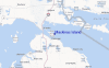
Contorni: Strade e fiumi: seleziona un surf break dal menu 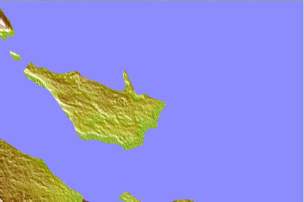
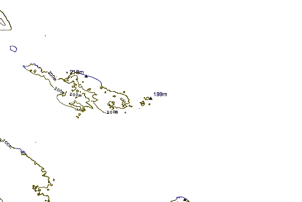
Utilizzare questa mappa sollievo per navigare Lake Huron surf breaks e stazioni di marea che si trovano nella zona diMackinac Island
Altri surf breaks più vicini al Mackinac Island:
(clicca sul nome del luogo per maggiori informazioni)- Closest località surf88 mi
- Second closest località surf98 mi
- Third closest località surf104 mi
- Fourth closest località surf106 mi
- Fifth closest località surf136 mi
Onda boe più vicina a Mackinac Island:
- Closest Onda boa20 mi
- Second closest Onda boa43 mi
- Third closest Onda boa76 mi
- Fourth closest Onda boa80 mi
- Fifth closest Onda boa86 mi
Stazioni di marea più vicina alla Mackinac Island:
- Closest marea stazioneShip Sands Island406 mi
- Second closest marea stazioneMoosonee418 mi
- Third closest marea stazioneRevillon Wharf418 mi
- Fourth closest marea stazioneNicholson Creek420 mi
- Fifth closest marea stazioneSand Head431 mi
Airports
- The closest passenger airport to Mackinac Island is Sault Ste Marie Airport (YAM) in Canada, which is 80 km (50 miles) away (directly).
- The second nearest airport to Mackinac Island is Gore Bay Manitoulin Airport (YZE), also in Canada, 141 km (88 miles) away.
- The third closest airport is Roscommon Co (Houghton Lake) Airport (HTL) in USA, 158 km (98 miles) away.
- /breaks/Mackinac-Island/forecasts/latest

 Nearest