
Previsioni:

Previsione a breve terminePioggia abbondante (Totale 21mm), più pesante durante sabato notte. Warm (Max 23°C Domenica mattina, Min 21°C Sabato pomeriggio). Venti decrescenti (raffiche di vento da SW Sabato notte, calma per lunedì mattina). | ||||||||||||||||||||||||
Sabato 18 | Domenica 19 | Lunedì 20 | ||||||||||||||||||||||
2 AM | 5 AM | 8 AM | 11 AM | 2 PM | 5 PM | 8 PM | 11 PM | 2 AM | 5 AM | 8 AM | 11 AM | 2 PM | 5 PM | 8 PM | 11 PM | 2 AM | 5 AM | 8 AM | 11 AM | 2 PM | 5 PM | 8 PM | 11 PM | |
Mappa dell'altezza del moto ondoso | 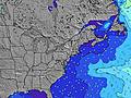 | 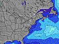 |  | 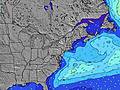 | 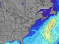 |  | 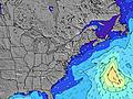 | 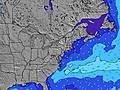 |  | |||||||||||||||
Onda Altezza (m) Direzione Periodo (s) | SSW 5 | SW 5 | SW 5 | SSW 3 | SSW 4 | SSW 4 | SSW 5 | SSW 5 | SSW 6 | SW 6 | SW 7 | SW 7 | SSW 8 | SSW 7 | SSW 8 | SSW 8 | SSW 8 | SSW 8 | SSW 8 | SSW 8 | SSW 8 | SSW 8 | S 8 | S 8 |
Grafico delle onde | ||||||||||||||||||||||||
10 | 13 | 13 | 7 | 23 | 42 | 57 | 84 | 160 | 175 | 213 | 188 | 187 | 146 | 138 | 110 | 110 | 110 | 87 | 92 | 87 | 99 | 114 | 111 | |
Vento (km/h) | ||||||||||||||||||||||||
Stato del vento onshore cross-onshore cross-shore cross-offshore offshore piatto | cross-on | cross-on | on | on | on | on | on | on | cross-on | cross-on | cross | off | off | cross | cross-on | on | cross-on | off | off | glassy | cross-on | cross-on | cross-on | cross-on |
Alta Marea | 3:18AM0.80m | 3:53PM0.76m | 4:11AM0.77m | 4:44PM0.74m | 5:05AM0.72m | 5:35PM0.73m | ||||||||||||||||||
Basso Marea | 9:03AM-0.04m | 9:24PM0.02m | 9:53AM-0.00m | 10:19PM0.04m | 10:43AM0.04m | |||||||||||||||||||
— | 5:22 | — | — | — | — | — | — | — | 5:22 | — | — | — | — | — | — | — | 5:24 | — | — | — | — | — | — | |
— | — | — | — | — | — | 8:09 | — | — | — | — | — | — | — | 8:09 | — | — | — | — | — | — | — | 8:08 | — | |
mm | — | — | — | — | — | 1 | — | 14 | 2 | 3 | 1 | — | — | — | — | — | — | — | — | — | — | — | — | — |
Temp. °C | 23 | 22 | 22 | 22 | 22 | 21 | 22 | 22 | 22 | 22 | 23 | 22 | 23 | 23 | 22 | 22 | 21 | 21 | 21 | 21 | 22 | 22 | 21 | 22 |
Gelo °C | 21 | 20 | 18 | 18 | 18 | 17 | 17 | 17 | 16 | 18 | 22 | 20 | 21 | 22 | 20 | 21 | 21 | 19 | 19 | 20 | 20 | 19 | 18 | 20 |
Onda 1 Altezza (m) Direzione Periodo (s) | SSW 5 | S 14 | SE 14 | SE 13 | SE 13 | SE 13 | — | E 13 | SE 13 | SE 13 | SE 13 | SW 7 | SSW 8 | SSW 7 | SSW 8 | SSW 8 | SSW 8 | SSW 8 | SSW 8 | SSW 8 | SSW 8 | — | — | N 9 |
10 | 4 | 7 | 7 | 7 | 7 | — | 3 | 7 | 7 | 7 | 188 | 187 | 146 | 138 | 110 | 110 | 110 | 87 | 92 | 87 | — | — | 1 | |
Onda 2 Altezza (m) Direzione Periodo (s) | S 14 | SE 8 | SE 8 | SE 8 | SE 8 | SE 8 | SE 13 | — | SE 8 | SE 8 | — | SE 13 | SE 13 | N 5 | NNE 4 | NNE 4 | N 4 | N 4 | N 4 | N 4 | N 4 | SE 12 | SE 12 | SE 12 |
4 | 3 | 3 | 3 | 3 | 3 | 7 | — | 3 | 3 | — | 7 | 6 | 11 | 6 | 3 | 1 | 1 | 1 | 1 | 1 | 6 | 6 | 6 | |
Onda 3 Altezza (m) Direzione Periodo (s) | SE 8 | — | — | E 8 | E 8 | E 8 | E 8 | E 8 | E 8 | E 8 | — | — | E 13 | SE 12 | SE 12 | SE 12 | SE 12 | SE 12 | SE 12 | SE 12 | SE 12 | SE 12 | — | SE 9 |
3 | — | — | 1 | 1 | 1 | 1 | 1 | 1 | 1 | — | — | 3 | 6 | 6 | 6 | 6 | 6 | 6 | 6 | 6 | 6 | — | 3 | |
onde vento Altezza (m) Direzione Periodo (s) | WSW 4 | SW 5 | SW 5 | SSW 3 | SSW 4 | SSW 4 | SSW 5 | SSW 5 | SSW 6 | SW 6 | SW 7 | NNW 3 | N 4 | — | — | — | — | — | — | — | — | SSW 8 | S 8 | S 8 |
5 | 13 | 13 | 7 | 23 | 42 | 57 | 84 | 160 | 175 | 213 | 5 | 11 | — | — | — | — | — | — | — | — | 99 | 114 | 111 | |
Il più vicino Offshore or Glassy | ||||||||||||||||||||||||
Distanza (km) | 531 | 531 | 986 | 986 | 2654 | 449 | 334 | 337 | 439 | 105 | 106 | 0 | 0 | 78 | 74 | 78 | 76 | 0 | 0 | 0 | 128 | 128 | 531 | 531 |
Migliori previsioni per le condizioni d'onda in Massachusetts | ||||||||||||||||||||||||
Migliori previsioni per le condizioni d'onda in United States | ||||||||||||||||||||||||
Trova Onde Globale | ||||||||||||||||||||||||
- Map Icons:
 Break
Break Live Wave Height (m)
 Live Wind Speed (km/h)
 Surf Rating (10 Max)
 Ocean Swells (m)
- Wind Speed (km/h)
Widget Free Surf-Forecast.com per il tuo sito
La relazione di surf / widget meteo è disponibile qui sotto per incorporare su siti esterni a titolo gratuito e fornisce una sintesi delle nostre Madaket previsione surf. Basta prendere il frammento di codice html da noi fornito e copiarlo nel proprio sito. È possibile scegliere la lingua preferita e unità metriche / imperiali per il feed delle previsioni surf per soddisfare le esigenze degli utenti del vostro sito .... Clicca qui per ottenere il codice.
 Nearest