
Previsioni:

Previsione a breve termineper lo più asciutto. Very mild (Max 17°C giovedì pomeriggio, Min 9°C Venerdì notte). Vento sarà generalmente leggero. | ||||||||||||||||||||||||
Gio 16 | Venerdì 17 | Sabato 18 | Dom 19 | |||||||||||||||||||||
3 PM | 6 PM | 9 PM | 12 AM | 3 AM | 6 AM | 9 AM | 12 PM | 3 PM | 6 PM | 9 PM | 12 AM | 3 AM | 6 AM | 9 AM | 12 PM | 3 PM | 6 PM | 9 PM | 12 AM | 3 AM | 6 AM | 9 AM | 12 PM | |
Mappa dell'altezza del moto ondoso |  |  |  |  |  |  |  |  | 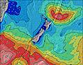 | |||||||||||||||
Onda Altezza (m) Direzione Periodo (s) | ESE 17 | ESE 17 | ESE 17 | ESE 16 | ESE 16 | ESE 16 | ESE 16 | ESE 16 | ESE 16 | ESE 15 | ESE 15 | ESE 15 | ESE 15 | ESE 14 | ESE 14 | ESE 14 | S 24 | S 23 | S 22 | S 21 | S 20 | S 19 | S 18 | S 18 |
Grafico delle onde | ||||||||||||||||||||||||
235 | 754 | 896 | 988 | 1137 | 1271 | 1447 | 1429 | 1376 | 1288 | 1271 | 1121 | 1106 | 956 | 943 | 917 | 915 | 3788 | 4109 | 4180 | 3329 | 2899 | 2325 | 1974 | |
Vento (km/h) | ||||||||||||||||||||||||
Stato del vento onshore cross-onshore cross-shore cross-offshore offshore piatto | off | off | cross-off | cross-off | cross-off | off | glassy | cross | on | cross-on | cross | cross | cross | cross-off | off | glassy | cross | glassy | off | off | cross-off | off | cross-off | cross-off |
Alta Marea | 7:11PM1.96m | 7:42AM1.78m | 8:06PM1.93m | 8:36AM1.77m | 8:58PM1.88m | 9:27AM1.75m | ||||||||||||||||||
Basso Marea | 12:53PM0.04m | 1:34AM0.06m | 1:47PM0.03m | 2:28AM0.06m | 2:42PM0.06m | 3:21AM0.09m | ||||||||||||||||||
— | — | — | — | — | 7:22 | — | — | — | — | — | — | — | 7:22 | — | — | — | — | — | — | — | 7:22 | — | — | |
5:05 | — | — | — | — | — | — | — | 5:06 | — | — | — | — | — | — | — | 5:06 | — | — | — | — | — | — | 5:07 | |
mm | — | — | — | — | — | — | — | — | — | — | — | — | — | — | — | — | — | — | — | — | — | — | — | — |
Temp. °C | 17 | 15 | 13 | 12 | 11 | 10 | 10 | 12 | 12 | 11 | 11 | 10 | 9 | 9 | 9 | 11 | 12 | 11 | 11 | 10 | 9 | 9 | 10 | 11 |
Gelo °C | 13 | 11 | 9 | 9 | 9 | 8 | 9 | 10 | 10 | 8 | 8 | 7 | 6 | 6 | 7 | 9 | 10 | 10 | 9 | 7 | 6 | 6 | 8 | 9 |
Onda 1 Altezza (m) Direzione Periodo (s) | ESE 17 | ESE 17 | ESE 17 | ESE 16 | ESE 16 | ESE 16 | ESE 16 | ESE 16 | ESE 16 | ESE 15 | ESE 15 | ESE 15 | ESE 15 | ESE 14 | ESE 14 | ESE 14 | ESE 14 | S 23 | S 22 | S 21 | S 20 | S 19 | S 18 | S 18 |
235 | 754 | 896 | 988 | 1137 | 1271 | 1447 | 1429 | 1376 | 1288 | 1271 | 1121 | 1106 | 956 | 943 | 917 | 777 | 3788 | 4109 | 4180 | 3329 | 2899 | 2325 | 1974 | |
Onda 2 Altezza (m) Direzione Periodo (s) | E 14 | S 17 | S 16 | S 16 | S 5 | S 5 | S 6 | S 8 | S 10 | S 10 | S 10 | S 10 | S 14 | S 14 | S 12 | S 12 | S 12 | ESE 14 | ESE 14 | ESE 13 | ESE 13 | ESE 13 | ESE 13 | ESE 13 |
144 | 23 | 20 | 20 | 22 | 16 | 21 | 80 | 231 | 346 | 367 | 265 | 590 | 469 | 356 | 280 | 276 | 704 | 604 | 586 | 506 | 468 | 390 | 384 | |
Onda 3 Altezza (m) Direzione Periodo (s) | S 17 | NE 10 | — | SW 10 | S 16 | S 16 | S 15 | S 15 | S 19 | S 17 | S 16 | S 15 | SSW 14 | — | S 28 | S 26 | S 24 | S 11 | S 11 | — | — | — | — | — |
24 | 4 | — | 4 | 20 | 19 | 42 | 40 | 110 | 214 | 231 | 205 | 236 | — | 15 | 120 | 915 | 302 | 256 | — | — | — | — | — | |
onde vento Altezza (m) Direzione Periodo (s) | WNW 3 | SW 17 | SSW 4 | SSW 5 | — | — | — | — | — | — | — | — | — | — | — | — | — | — | — | — | — | — | — | — |
3 | 143 | 8 | 29 | — | — | — | — | — | — | — | — | — | — | — | — | — | — | — | — | — | — | — | — | |
Il più vicino Offshore or Glassy | ||||||||||||||||||||||||
Distanza (km) | 0 | 0 | 36 | 0 | 0 | 0 | 0 | 4 | 4 | 4 | 4 | 4 | 4 | 0 | 0 | 0 | 4 | 0 | 0 | 0 | 0 | 0 | 0 | 0 |
Migliori previsioni per le condizioni d'onda in Gisborne and Mahia | ||||||||||||||||||||||||
Migliori previsioni per le condizioni d'onda in New Zealand | ||||||||||||||||||||||||
Trova Onde Globale | ||||||||||||||||||||||||
- Map Icons:
 Break
Break Live Wave Height (m)
 Live Wind Speed (km/h)
 Surf Rating (10 Max)
 Ocean Swells (m)
- Wind Speed (km/h)
Widget Free Surf-Forecast.com per il tuo sito
La relazione di surf / widget meteo è disponibile qui sotto per incorporare su siti esterni a titolo gratuito e fornisce una sintesi delle nostre Mahanga Beach previsione surf. Basta prendere il frammento di codice html da noi fornito e copiarlo nel proprio sito. È possibile scegliere la lingua preferita e unità metriche / imperiali per il feed delle previsioni surf per soddisfare le esigenze degli utenti del vostro sito .... Clicca qui per ottenere il codice.
 Nearest