
Previsioni:

Previsione a breve termineQualche pioggerella, più pesante durante domenica mattina. Very mild (Max 18°C Domenica mattina, Min 14°C Domenica mattina). Vento sarà generalmente leggero. | ||||||||||||||||||||||||
Domenica 2 | Lunedì 3 | Martedì 4 | ||||||||||||||||||||||
2 AM | 5 AM | 8 AM | 11 AM | 2 PM | 5 PM | 8 PM | 11 PM | 2 AM | 5 AM | 8 AM | 11 AM | 2 PM | 5 PM | 8 PM | 11 PM | 2 AM | 5 AM | 8 AM | 11 AM | 2 PM | 5 PM | 8 PM | 11 PM | |
Mappa dell'altezza del moto ondoso |  | 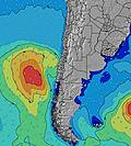 |  |  | 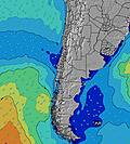 |  |  | 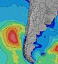 |  | |||||||||||||||
Onda Altezza (m) Direzione Periodo (s) | WNW 9 | W 13 | W 12 | W 12 | W 12 | WSW 12 | WSW 12 | WSW 12 | WSW 12 | WSW 12 | WSW 12 | WSW 12 | WSW 12 | WSW 12 | WSW 12 | WSW 12 | WSW 12 | WSW 12 | WSW 12 | WSW 12 | WSW 12 | WSW 12 | WSW 12 | WSW 12 |
Grafico delle onde | ||||||||||||||||||||||||
397 | 1729 | 2322 | 2024 | 1914 | 2044 | 2013 | 1840 | 1678 | 1706 | 1578 | 1455 | 1180 | 1211 | 1347 | 1407 | 1430 | 1310 | 1197 | 1220 | 1071 | 933 | 838 | 706 | |
Vento (km/h) | ||||||||||||||||||||||||
Stato del vento onshore cross-onshore cross-shore cross-offshore offshore piatto | cross-off | glassy | glassy | cross-off | glassy | glassy | cross | cross-on | glassy | glassy | cross | cross-on | cross-on | glassy | glassy | glassy | glassy | glassy | cross | cross-on | cross-on | cross-on | cross | cross-on |
Alta Marea | 00:28AM1.01m | 12:29PM1.29m | 1:04AM1.04m | 1:03PM1.20m | 1:43AM1.07m | 1:41PM1.08m | ||||||||||||||||||
Basso Marea | 6:08AM0.24m | 6:59PM0.14m | 6:50AM0.29m | 7:28PM0.18m | 7:38AM0.34m | 8:01PM0.23m | ||||||||||||||||||
— | 7:35 | — | — | — | — | — | — | — | 7:33 | — | — | — | — | — | — | — | 7:33 | — | — | — | — | — | — | |
— | — | — | — | — | 6:08 | — | — | — | — | — | — | — | 6:09 | — | — | — | — | — | — | — | 6:09 | — | — | |
mm | — | 1 | 1 | — | — | — | — | — | — | — | — | — | — | — | — | — | — | — | — | — | — | — | — | — |
Temp. °C | 15 | 14 | 14 | 16 | 18 | 16 | 16 | 16 | 16 | 16 | 16 | 17 | 17 | 16 | 16 | 15 | 16 | 16 | 16 | 17 | 17 | 17 | 16 | 16 |
Gelo °C | 11 | 13 | 13 | 14 | 16 | 15 | 15 | 15 | 16 | 15 | 14 | 15 | 16 | 15 | 16 | 15 | 16 | 15 | 15 | 16 | 15 | 15 | 15 | 16 |
Onda 1 Altezza (m) Direzione Periodo (s) | WNW 9 | W 13 | W 12 | W 12 | W 12 | WSW 12 | WSW 12 | WSW 12 | WSW 12 | WSW 12 | WSW 12 | WSW 12 | WSW 12 | WSW 12 | WSW 12 | WSW 12 | WSW 12 | WSW 12 | WSW 12 | WSW 12 | WSW 12 | WSW 12 | WSW 12 | WSW 12 |
397 | 1729 | 2322 | 2024 | 1914 | 2044 | 2013 | 1840 | 1678 | 1706 | 1578 | 1455 | 1180 | 1211 | 1347 | 1407 | 1430 | 1310 | 1197 | 1220 | 1071 | 933 | 838 | 706 | |
Onda 2 Altezza (m) Direzione Periodo (s) | SW 12 | SW 12 | SW 11 | SW 11 | SW 11 | SW 12 | — | — | — | — | — | SW 10 | SW 10 | SSW 10 | SSW 9 | SSW 9 | SSW 9 | SSW 9 | SW 20 | SW 20 | SW 19 | SW 19 | SW 19 | SW 18 |
367 | 273 | 155 | 147 | 97 | 66 | — | — | — | — | — | 79 | 98 | 63 | 59 | 32 | 32 | 30 | 62 | 61 | 133 | 131 | 129 | 162 | |
Onda 3 Altezza (m) Direzione Periodo (s) | WSW 13 | — | NW 12 | WNW 15 | WNW 15 | — | — | — | — | — | — | — | — | — | SW 21 | — | SW 20 | SW 20 | SW 20 | NW 12 | NW 12 | NW 13 | NW 11 | W 13 |
137 | — | 6 | 23 | 21 | — | — | — | — | — | — | — | — | — | 17 | — | 15 | 62 | 62 | 6 | 6 | 6 | 5 | 3 | |
onde vento Altezza (m) Direzione Periodo (s) | N 4 | — | — | — | — | — | — | — | — | — | — | — | — | — | — | — | — | — | SSW 8 | SSW 8 | SW 4 | SW 5 | SSW 5 | SW 6 |
14 | — | — | — | — | — | — | — | — | — | — | — | — | — | — | — | — | — | 59 | 6 | 40 | 67 | 87 | 95 | |
Il più vicino Offshore or Glassy | ||||||||||||||||||||||||
Distanza (km) | 11 | 0 | 5 | 0 | 0 | 0 | 13 | 25 | 0 | 0 | 25 | 38 | 25 | 0 | 0 | 0 | 0 | 0 | 25 | 25 | 25 | 25 | 25 | 25 |
Migliori previsioni per le condizioni d'onda in Santiago | ||||||||||||||||||||||||
Migliori previsioni per le condizioni d'onda in Chile | ||||||||||||||||||||||||
Trova Onde Globale | ||||||||||||||||||||||||
- Map Icons:
 Break
Break Live Wave Height (m)
 Live Wind Speed (km/h)
 Surf Rating (10 Max)
 Ocean Swells (m)
- Wind Speed (km/h)
Widget Free Surf-Forecast.com per il tuo sito
La relazione di surf / widget meteo è disponibile qui sotto per incorporare su siti esterni a titolo gratuito e fornisce una sintesi delle nostre Maitencillo previsione surf. Basta prendere il frammento di codice html da noi fornito e copiarlo nel proprio sito. È possibile scegliere la lingua preferita e unità metriche / imperiali per il feed delle previsioni surf per soddisfare le esigenze degli utenti del vostro sito .... Clicca qui per ottenere il codice.
 Nearest