
Previsioni:

Previsione a breve termineQualche pioggerella, più pesante durante sabato notte. Warm (Max 27°C giovedì pomeriggio, Min 25°C giovedì notte). Vento sarà generalmente leggero. | |||||||||||||||||||||
Gio 16 | Venerdì 17 | Sabato 18 | |||||||||||||||||||
11 AM | 2 PM | 5 PM | 8 PM | 11 PM | 2 AM | 5 AM | 8 AM | 11 AM | 2 PM | 5 PM | 8 PM | 11 PM | 2 AM | 5 AM | 8 AM | 11 AM | 2 PM | 5 PM | 8 PM | 11 PM | |
Mappa dell'altezza del moto ondoso |  |  |  |  |  |  | 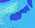 |  | |||||||||||||
Onda Altezza (m) Direzione Periodo (s) | WNW 15 | WNW 15 | WNW 15 | WNW 15 | WNW 14 | WNW 14 | WNW 14 | W 14 | W 14 | W 14 | W 14 | W 14 | W 14 | W 14 | W 14 | W 13 | W 13 | W 13 | W 13 | W 13 | W 13 |
Grafico delle onde | |||||||||||||||||||||
360 | 355 | 355 | 284 | 280 | 280 | 280 | 268 | 264 | 200 | 198 | 195 | 192 | 189 | 134 | 130 | 126 | 89 | 87 | 87 | 87 | |
Vento (km/h) | |||||||||||||||||||||
Stato del vento onshore cross-onshore cross-shore cross-offshore offshore piatto | cross-on | on | on | glassy | cross-off | glassy | cross | glassy | cross-on | cross-on | on | glassy | cross-off | cross-off | glassy | glassy | on | cross-on | cross-on | glassy | glassy |
Alta Marea | 5:42PM0.85m | 6:13AM0.45m | 6:17PM0.77m | 7:09AM0.48m | 6:50PM0.67m | ||||||||||||||||
Basso Marea | 10:42AM0.06m | 00:39AM0.08m | 11:32AM0.14m | 1:11AM0.09m | 12:27PM0.22m | ||||||||||||||||
— | — | — | — | — | — | 5:54 | — | — | — | — | — | — | — | 5:54 | — | — | — | — | — | — | |
— | — | 7:06 | — | — | — | — | — | — | — | 7:06 | — | — | — | — | — | — | — | 7:05 | — | — | |
mm | — | — | — | — | — | — | — | — | — | — | — | — | — | — | — | — | — | — | — | — | — |
Temp. °C | 27 | 27 | 27 | 26 | 26 | 25 | 25 | 26 | 27 | 27 | 27 | 27 | 26 | 26 | 25 | 26 | 27 | 27 | 27 | 26 | 26 |
Gelo °C | 29 | 28 | 29 | 29 | 29 | 29 | 28 | 29 | 29 | 29 | 29 | 31 | 29 | 30 | 29 | 29 | 29 | 29 | 30 | 30 | 30 |
Onda 1 Altezza (m) Direzione Periodo (s) | WNW 15 | WNW 15 | WNW 15 | WNW 15 | NNE 7 | WNW 14 | WNW 14 | W 14 | W 14 | NNE 7 | NNE 7 | NNE 7 | NNE 7 | NNE 7 | NNE 7 | NNE 6 | NNE 6 | NNE 7 | NNE 7 | NNE 7 | NNE 6 |
360 | 355 | 355 | 284 | 73 | 280 | 280 | 268 | 264 | 51 | 70 | 70 | 51 | 40 | 56 | 55 | 48 | 54 | 66 | 62 | 51 | |
Onda 2 Altezza (m) Direzione Periodo (s) | NNE 7 | NNE 7 | NNE 7 | NNE 7 | WNW 14 | NNE 7 | NNE 7 | NNE 7 | NNE 7 | W 14 | SSW 16 | SSW 16 | SSW 14 | SSW 14 | W 14 | SSW 14 | SSW 14 | SSW 14 | SSW 14 | SSW 13 | S 12 |
43 | 41 | 41 | 59 | 280 | 51 | 41 | 31 | 31 | 200 | 259 | 344 | 218 | 218 | 134 | 210 | 156 | 160 | 210 | 133 | 73 | |
Onda 3 Altezza (m) Direzione Periodo (s) | SW 12 | SSW 13 | SSW 14 | SSW 18 | SSW 18 | SSW 17 | SSW 16 | S 16 | S 16 | S 16 | W 14 | W 14 | W 14 | W 14 | S 14 | W 13 | W 13 | W 13 | W 13 | W 13 | W 13 |
73 | 109 | 129 | 174 | 240 | 97 | 91 | 132 | 131 | 183 | 198 | 195 | 192 | 189 | 148 | 130 | 126 | 89 | 87 | 87 | 87 | |
onde vento Altezza (m) Direzione Periodo (s) | SSW 7 | SW 7 | N 7 | — | SSE 10 | — | — | — | — | — | SSE 9 | S 3 | N 7 | N 7 | — | S 9 | W 2 | WNW 3 | W 3 | W 3 | W 2 |
10 | 7 | 26 | — | 20 | — | — | — | — | — | 16 | 3 | 35 | 34 | — | 40 | 1 | 3 | 1 | 1 | 1 | |
Il più vicino Offshore or Glassy | |||||||||||||||||||||
Distanza (km) | 34 | 34 | 17 | 0 | 0 | 0 | 14 | 0 | 34 | 17 | 32 | 0 | 0 | 0 | 0 | 0 | 34 | 34 | 17 | 0 | 0 |
Migliori previsioni per le condizioni d'onda in Big Island | |||||||||||||||||||||
Migliori previsioni per le condizioni d'onda in United States | |||||||||||||||||||||
Trova Onde Globale | |||||||||||||||||||||
- Map Icons:
 Break
Break Live Wave Height (m)
 Live Wind Speed (km/h)
 Surf Rating (10 Max)
 Ocean Swells (m)
- Wind Speed (km/h)
Widget Free Surf-Forecast.com per il tuo sito
La relazione di surf / widget meteo è disponibile qui sotto per incorporare su siti esterni a titolo gratuito e fornisce una sintesi delle nostre Makalawena previsione surf. Basta prendere il frammento di codice html da noi fornito e copiarlo nel proprio sito. È possibile scegliere la lingua preferita e unità metriche / imperiali per il feed delle previsioni surf per soddisfare le esigenze degli utenti del vostro sito .... Clicca qui per ottenere il codice.
 Nearest