
Previsioni:

Previsione a breve termineper lo più asciutto. Warm (Max 26°C giovedì mattina, Min 24°C mercoledì notte). Principalmente venti freschi. | ||||||||||||||||||||||||
Mer 15 | Giovedì 16 | Venerdì 17 | Sabato 18 | |||||||||||||||||||||
6 PM | 9 PM | 12 AM | 3 AM | 6 AM | 9 AM | 12 PM | 3 PM | 6 PM | 9 PM | 12 AM | 3 AM | 6 AM | 9 AM | 12 PM | 3 PM | 6 PM | 9 PM | 12 AM | 3 AM | 6 AM | 9 AM | 12 PM | 3 PM | |
Mappa dell'altezza del moto ondoso | 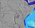 | 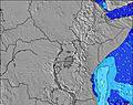 | 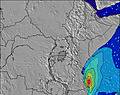 | 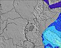 | 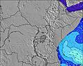 | 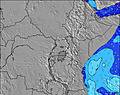 | 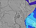 | 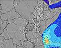 | 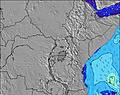 | |||||||||||||||
Onda Altezza (m) Direzione Periodo (s) | SSE 6 | SSE 6 | SSE 6 | SSE 6 | SSE 7 | ESE 10 | ESE 10 | ESE 9 | SSE 6 | SSE 6 | SSE 7 | SSE 7 | SSE 7 | SSE 7 | SSE 7 | SSE 7 | SSE 7 | SSE 7 | SSE 7 | SSE 7 | S 7 | S 7 | S 7 | S 7 |
Grafico delle onde | ||||||||||||||||||||||||
172 | 177 | 183 | 146 | 144 | 154 | 154 | 168 | 161 | 245 | 313 | 332 | 270 | 299 | 306 | 338 | 358 | 334 | 384 | 344 | 277 | 277 | 264 | 226 | |
Vento (km/h) | ||||||||||||||||||||||||
Stato del vento onshore cross-onshore cross-shore cross-offshore offshore piatto | cross | cross | cross | cross | cross | cross | cross | cross | cross | cross | cross | cross | cross | cross | cross | cross | cross | cross | cross | cross | cross | cross | cross | cross |
Alta Marea | 4:54PM3.62m | 5:26AM3.12m | 5:36PM3.56m | 6:07AM3.21m | 6:17PM3.42m | 6:47AM3.23m | ||||||||||||||||||
Basso Marea | 11:20PM0.33m | 11:23AM0.55m | 11:59PM0.33m | 12:08PM0.57m | 00:35AM0.39m | 12:51PM0.67m | ||||||||||||||||||
— | — | — | — | 6:26 | — | — | — | — | — | — | — | 6:26 | — | — | — | — | — | — | — | 6:26 | — | — | — | |
6:22 | — | — | — | — | — | — | — | 6:23 | — | — | — | — | — | — | — | 6:23 | — | — | — | — | — | — | 6:23 | |
mm | — | — | — | — | — | — | — | — | — | — | — | — | — | — | — | — | — | — | — | — | — | — | — | — |
Temp. °C | 25 | 24 | 24 | 24 | 24 | 25 | 26 | 26 | 25 | 25 | 24 | 24 | 24 | 25 | 26 | 26 | 25 | 24 | 24 | 24 | 24 | 25 | 26 | 26 |
Gelo °C | 24 | 23 | 23 | 24 | 24 | 23 | 24 | 24 | 23 | 24 | 22 | 23 | 23 | 23 | 23 | 23 | 23 | 22 | 23 | 23 | 23 | 23 | 23 | 23 |
Onda 1 Altezza (m) Direzione Periodo (s) | ESE 9 | ESE 9 | ESE 9 | ESE 9 | ESE 11 | ESE 10 | ESE 10 | ESE 9 | ESE 9 | ESE 9 | ESE 10 | ESE 10 | ESE 10 | ESE 10 | ESE 10 | ESE 10 | ESE 10 | ESE 9 | ESE 9 | ESE 9 | ESE 9 | ESE 9 | ESE 9 | ESE 10 |
133 | 96 | 96 | 136 | 78 | 154 | 154 | 168 | 136 | 110 | 69 | 68 | 103 | 105 | 105 | 65 | 103 | 98 | 96 | 94 | 193 | 188 | 188 | 179 | |
Onda 2 Altezza (m) Direzione Periodo (s) | S 16 | ESE 11 | SE 11 | S 15 | ESE 9 | ESE 9 | ESE 9 | S 13 | S 12 | — | S 11 | S 11 | S 11 | S 11 | — | — | — | — | — | S 10 | — | — | — | ESE 9 |
5 | 12 | 32 | 4 | 48 | 8 | 8 | 3 | 3 | — | 2 | 2 | 10 | 9 | — | — | — | — | — | 8 | — | — | — | 27 | |
Onda 3 Altezza (m) Direzione Periodo (s) | S 11 | S 16 | S 16 | S 11 | S 11 | S 12 | S 13 | — | — | — | — | — | — | — | — | — | — | — | — | — | — | — | — | — |
2 | 5 | 5 | 2 | 2 | 3 | 3 | — | — | — | — | — | — | — | — | — | — | — | — | — | — | — | — | — | |
onde vento Altezza (m) Direzione Periodo (s) | SSE 6 | SSE 6 | SSE 6 | SSE 6 | SSE 7 | SSE 6 | SSE 6 | SSE 6 | SSE 6 | SSE 6 | SSE 7 | SSE 7 | SSE 7 | SSE 7 | SSE 7 | SSE 7 | SSE 7 | SSE 7 | SSE 7 | SSE 7 | S 7 | S 7 | S 7 | S 7 |
172 | 177 | 183 | 146 | 144 | 125 | 121 | 134 | 161 | 245 | 313 | 332 | 270 | 299 | 306 | 338 | 358 | 334 | 384 | 344 | 277 | 277 | 264 | 226 | |
Il più vicino Offshore or Glassy | ||||||||||||||||||||||||
Distanza (km) | 2536 | 2343 | 2249 | 2249 | 402 | 295 | 295 | 2609 | 2538 | 2301 | 1712 | 1712 | 402 | 2249 | 1712 | 295 | 2374 | 2374 | 1712 | 2293 | 408 | 295 | 295 | 295 |
Migliori previsioni per le condizioni d'onda in Kenya | ||||||||||||||||||||||||
Migliori previsioni per le condizioni d'onda in Kenya | ||||||||||||||||||||||||
Trova Onde Globale | ||||||||||||||||||||||||
- Map Icons:
 Break
Break Live Wave Height (m)
 Live Wind Speed (km/h)
 Surf Rating (10 Max)
 Ocean Swells (m)
- Wind Speed (km/h)
Widget Free Surf-Forecast.com per il tuo sito
La relazione di surf / widget meteo è disponibile qui sotto per incorporare su siti esterni a titolo gratuito e fornisce una sintesi delle nostre Malindi Bay previsione surf. Basta prendere il frammento di codice html da noi fornito e copiarlo nel proprio sito. È possibile scegliere la lingua preferita e unità metriche / imperiali per il feed delle previsioni surf per soddisfare le esigenze degli utenti del vostro sito .... Clicca qui per ottenere il codice.
 Nearest