

Manglecito Surf Guide
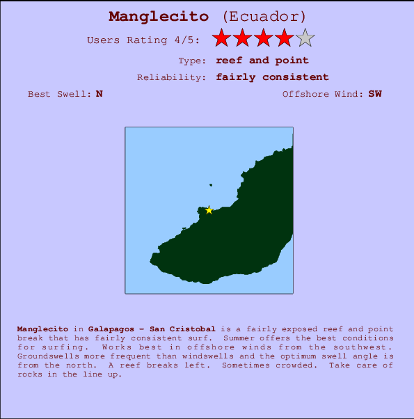
Manglecito in Galapagos - San Cristobal is a quite exposed reef and point break that has quite consistent surf. Summer offers the optimum conditions for surfing. Works best in offshore winds from the southwest. Groundswells more frequent than windswells and the ideal swell angle is from the north. A left hand reef. When the surf is up, it can get quite busy in the water. Rocks are a hazard.
Manglecito Spot Info
| Type: | Rating: | Reliability: | Todays Sea Temp*: |
|---|---|---|---|
| fairly consistent | 26.2°C*ocean temperature recorded from satellite |
Surfing Manglecito:
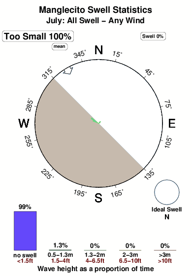
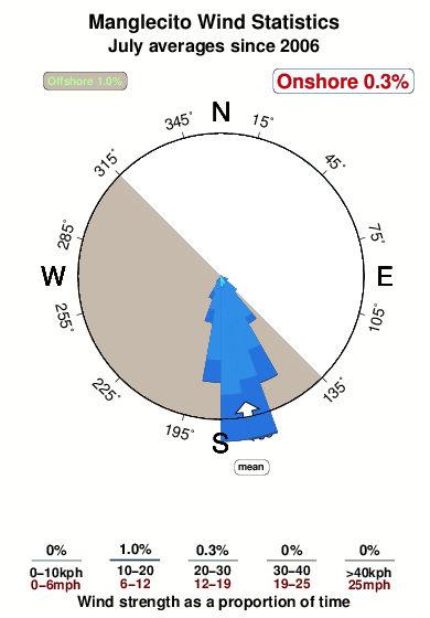
The best conditions reported for surf at Manglecito occur when a North swell combines with an offshore wind direction from the Southwest.

Previsioni Energia d'onda (Potenza): 12hrs

Manglecito Surf:
Saturday, 18 July 2026, 14:01 Local time| Sabato 18 | Dom | |||
| 3PM | 6PM | 9PM | 0AM | |
| Wave (m) | ||||
| Periodo (s) | - | 8 | 10 | 10 |
| Vento (km/h) | ||||
| Stato del vento | cross- off |
cross- off |
cross- off |
cross- off |
- /breaks/Manglecito/forecasts/latest
Manglecito Surf Guide
Manglecito in Galapagos - San Cristobal is a quite exposed reef and point break that has quite consistent surf. Summer offers the optimum conditions for surfing. Works best in offshore winds from the southwest. Groundswells more frequent than windswells and the ideal swell angle is from the north. A left hand reef. When the surf is up, it can get quite busy in the water. Rocks are a hazard.
Manglecito Spot Info
Type: Rating: Reliability: Todays Sea Temp*:  Reef and point
 4
4fairly consistent 26.2°C*ocean temperature recorded from satelliteSurfing Manglecito:
The best conditions reported for surf at Manglecito occur when a North swell combines with an offshore wind direction from the Southwest.
Previsioni Energia d'onda (Potenza): 12hrs
Utilizzare la scheda di navigazione in alto per visualizzare Manglecito temperatura del mare, Manglecito fotografie, Manglecito dettagliate previsioni onde, il vento e le previsioni meteo, Manglecito webcam, vento corrente da Galapagos - San Cristobal stazioni meteo e Manglecito previsioni marea. Il link Ecuador mappe maree apre l'immagine grande, che mostra Ecuador e dei mari circostanti. Queste mappe possono essere animate per mostrare le diverse componenti del moto ondoso, energia delle onde, periodo d'onda, altezza delle onde, insieme con le previsioni del vento e meteo, meteo corrente e osservazioni sullo stato del mare dal Ecuador onda-boe, le navi passanti e stazioni meteo costiere. Ciascuna delle pagine di previsioni per questo surf break rappresenta uno strumento di wavefinder globale e regionale per individuare le migliori condizioni di surf nella zona intorno Manglecito.
Manglecito Surf:
Saturday, 18 July 2026, 14:01 Local timeSabato 18 Dom 3PM 6PM 9PM 0AM Wave (m) Periodo (s) - 8 10 10 Vento (km/h) Stato del vento cross-
offcross-
offcross-
offcross-
off- /breaks/Manglecito/forecasts/latest
- /breaks/Manglecito/forecasts/latest/six_day
Manglecito Surf Guide
Manglecito in Galapagos - San Cristobal is a quite exposed reef and point break that has quite consistent surf. Summer offers the optimum conditions for surfing. Works best in offshore winds from the southwest. Groundswells more frequent than windswells and the ideal swell angle is from the north. A left hand reef. When the surf is up, it can get quite busy in the water. Rocks are a hazard.
Manglecito Spot Info
Type: Rating: Reliability: Todays Sea Temp*: Reef and point4fairly consistent 26.2°C*ocean temperature recorded from satelliteSurfing Manglecito:
The best conditions reported for surf at Manglecito occur when a North swell combines with an offshore wind direction from the Southwest.
Previsioni Energia d'onda (Potenza): 12hrs
Utilizzare la scheda di navigazione in alto per visualizzare Manglecito temperatura del mare, Manglecito fotografie, Manglecito dettagliate previsioni onde, il vento e le previsioni meteo, Manglecito webcam, vento corrente da Galapagos - San Cristobal stazioni meteo e Manglecito previsioni marea. Il link Ecuador mappe maree apre l'immagine grande, che mostra Ecuador e dei mari circostanti. Queste mappe possono essere animate per mostrare le diverse componenti del moto ondoso, energia delle onde, periodo d'onda, altezza delle onde, insieme con le previsioni del vento e meteo, meteo corrente e osservazioni sullo stato del mare dal Ecuador onda-boe, le navi passanti e stazioni meteo costiere. Ciascuna delle pagine di previsioni per questo surf break rappresenta uno strumento di wavefinder globale e regionale per individuare le migliori condizioni di surf nella zona intorno Manglecito.
Manglecito Surf:
Saturday, 18 July 2026, 14:01 Local timeSabato 18 Dom 3PM 6PM 9PM 0AM Wave (m) Periodo (s) - 8 10 10 Vento (km/h) Stato del vento cross-
offcross-
offcross-
offcross-
off- /breaks/Manglecito/forecasts/latest
Manglecito Surf Guide
Manglecito in Galapagos - San Cristobal is a quite exposed reef and point break that has quite consistent surf. Summer offers the optimum conditions for surfing. Works best in offshore winds from the southwest. Groundswells more frequent than windswells and the ideal swell angle is from the north. A left hand reef. When the surf is up, it can get quite busy in the water. Rocks are a hazard.
Manglecito Spot Info
Type: Rating: Reliability: Todays Sea Temp*: Reef and point4fairly consistent 26.2°C*ocean temperature recorded from satelliteSurfing Manglecito:
The best conditions reported for surf at Manglecito occur when a North swell combines with an offshore wind direction from the Southwest.
Previsioni Energia d'onda (Potenza): 12hrs
Utilizzare la scheda di navigazione in alto per visualizzare Manglecito temperatura del mare, Manglecito fotografie, Manglecito dettagliate previsioni onde, il vento e le previsioni meteo, Manglecito webcam, vento corrente da Galapagos - San Cristobal stazioni meteo e Manglecito previsioni marea. Il link Ecuador mappe maree apre l'immagine grande, che mostra Ecuador e dei mari circostanti. Queste mappe possono essere animate per mostrare le diverse componenti del moto ondoso, energia delle onde, periodo d'onda, altezza delle onde, insieme con le previsioni del vento e meteo, meteo corrente e osservazioni sullo stato del mare dal Ecuador onda-boe, le navi passanti e stazioni meteo costiere. Ciascuna delle pagine di previsioni per questo surf break rappresenta uno strumento di wavefinder globale e regionale per individuare le migliori condizioni di surf nella zona intorno Manglecito.
Manglecito Surf:
Saturday, 18 July 2026, 14:01 Local timeSabato 18 Dom 3PM 6PM 9PM 0AM Wave (m) Periodo (s) - 8 10 10 Vento (km/h) Stato del vento cross-
offcross-
offcross-
offcross-
offTide Times:
A Manglecito (0 km).
PROSSIMA È ALLE (ora locale) rimanente alta marea bassa marea Manglecito Tide Times and Tide Chart
Live Weather:
At San Cristóbal Airport (Galapagos), 11 km from Manglecito.
moderate winds from the S
(km/h)
Dry and partly cloudyAir temperature
29°COverall Manglecito Surf Consistency and Wind Distribution in Luglio
foto dall' album
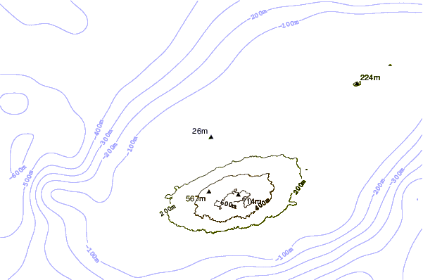
Contorni: Strade e fiumi: seleziona un surf break dal menu 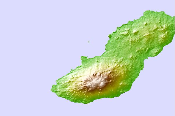
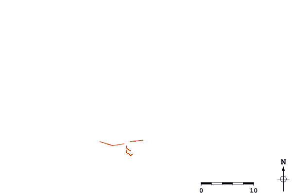
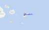
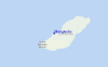
Utilizzare questa mappa sollievo per navigare Galapagos - San Cristobal surf breaks e stazioni di marea che si trovano nella zona diManglecito
Altri surf breaks più vicini al Manglecito:
(clicca sul nome del luogo per maggiori informazioni)- Closest località surf8 mi
- Second closest località surf9 mi
- Third closest località surf9 mi
- Fourth closest località surf10 mi
- Fifth closest località surf21 mi
Onda boe più vicina a Manglecito:
- Closest Onda boa1321 mi
- Second closest Onda boa1337 mi
- Third closest Onda boa1462 mi
- Fourth closest Onda boa1608 mi
- Fifth closest Onda boa1847 mi
Stazioni di marea più vicina alla Manglecito:
- Closest marea stazioneSan Cristobal9 mi
- Second closest marea stazionePuerto Ayora55 mi
- Third closest marea stazioneIsla Baltra58 mi
- Fourth closest marea stazioneSalinas599 mi
- Fifth closest marea stazioneLa Libertad602 mi
Airports
- The nearest passenger airport to Manglecito is Seymour (Galapagos) Airport (GPS) in Galapagos I. (ecuador, which is 92 km (57 miles) away (directly).
- The second closest airport to Manglecito is General Ulpiano Paez (Salinas) Airport (SNC) in Ecuador, 961 km (597 miles) away.
- /breaks/Manglecito/forecasts/latest


 Nearest