
Previsioni:

Previsione a breve terminepioggia leggera (Totale 2mm), per lo più che cade Sabato mattina. Warm (Max 20°C Venerdì pomeriggio, Min 12°C mercoledì notte). Vento sarà generalmente leggero. | ||||||||||||||||||||
Mer 29 | Giovedì 30 | Venerdì 31 | ||||||||||||||||||
2 PM | 5 PM | 8 PM | 11 PM | 2 AM | 5 AM | 8 AM | 11 AM | 2 PM | 5 PM | 8 PM | 11 PM | 2 AM | 5 AM | 8 AM | 11 AM | 2 PM | 5 PM | 8 PM | 11 PM | |
Mappa dell'altezza del moto ondoso |  | 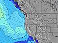 |  | 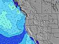 |  |  | 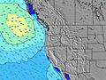 |  | ||||||||||||
Onda Altezza (m) Direzione Periodo (s) | SW 17 | SW 17 | SW 16 | SW 16 | SW 16 | SW 16 | SW 16 | SW 16 | SW 16 | SW 16 | SW 16 | SW 16 | SW 15 | SW 15 | SW 15 | SW 15 | SW 15 | W 8 | W 8 | SW 14 |
Grafico delle onde | ||||||||||||||||||||
290 | 280 | 257 | 254 | 251 | 251 | 251 | 203 | 248 | 201 | 196 | 151 | 147 | 141 | 137 | 136 | 144 | 173 | 161 | 132 | |
Vento (km/h) | ||||||||||||||||||||
Stato del vento onshore cross-onshore cross-shore cross-offshore offshore piatto | cross-on | cross-on | cross-on | cross-off | off | off | glassy | on | on | cross-on | cross-on | cross-off | cross-off | cross-off | glassy | cross-on | cross-on | cross-on | cross | cross-off |
Alta Marea | 2:10PM1.91m | 00:58AM2.40m | 2:38PM1.97m | 1:36AM2.35m | 3:05PM2.05m | |||||||||||||||
Basso Marea | 7:13PM0.90m | 8:02AM-0.21m | 7:52PM0.82m | 8:32AM-0.17m | 8:33PM0.74m | |||||||||||||||
— | — | — | — | — | 5:56 | — | — | — | — | — | — | — | 5:56 | — | — | — | — | — | — | |
— | — | 8:47 | — | — | — | — | — | — | — | 8:46 | — | — | — | — | — | — | — | 8:45 | — | |
mm | — | — | — | — | — | — | — | — | — | — | — | — | — | — | — | — | — | — | — | — |
Temp. °C | 17 | 17 | 15 | 13 | 12 | 12 | 13 | 15 | 15 | 18 | 17 | 15 | 14 | 14 | 15 | 19 | 20 | 19 | 18 | 16 |
Gelo °C | 15 | 15 | 13 | 12 | 11 | 11 | 12 | 14 | 13 | 16 | 15 | 13 | 12 | 12 | 14 | 17 | 18 | 17 | 17 | 16 |
Onda 1 Altezza (m) Direzione Periodo (s) | W 9 | WNW 8 | WNW 8 | WNW 8 | WNW 8 | WNW 8 | WNW 8 | WNW 8 | WNW 8 | WNW 8 | WNW 8 | WNW 9 | WNW 9 | WNW 9 | WNW 9 | WNW 8 | W 8 | W 8 | W 8 | W 8 |
186 | 180 | 176 | 144 | 119 | 116 | 94 | 87 | 67 | 67 | 51 | 79 | 103 | 129 | 126 | 120 | 144 | 173 | 161 | 130 | |
Onda 2 Altezza (m) Direzione Periodo (s) | SW 17 | SW 17 | SW 16 | SW 16 | SW 16 | SW 16 | SW 16 | SW 16 | SW 16 | SW 16 | SW 16 | SW 16 | SW 15 | SW 15 | SW 15 | SW 15 | SW 15 | SW 14 | SW 14 | SW 14 |
290 | 280 | 257 | 254 | 251 | 251 | 251 | 203 | 248 | 201 | 196 | 151 | 147 | 141 | 137 | 136 | 134 | 132 | 132 | 132 | |
Onda 3 Altezza (m) Direzione Periodo (s) | — | — | — | SSW 11 | SSW 11 | SSW 11 | SSW 11 | SSW 11 | SSW 11 | SSW 11 | SSW 11 | SSW 11 | SSW 11 | — | — | — | — | — | — | SW 8 |
— | — | — | 12 | 12 | 12 | 13 | 11 | 12 | 12 | 11 | 11 | 12 | — | — | — | — | — | — | 3 | |
onde vento Altezza (m) Direzione Periodo (s) | — | — | — | — | — | — | — | — | — | — | — | — | — | — | — | — | — | — | — | — |
— | — | — | — | — | — | — | — | — | — | — | — | — | — | — | — | — | — | — | — | |
Il più vicino Offshore or Glassy | ||||||||||||||||||||
Distanza (km) | 186 | 985 | 491 | 7 | 7 | 7 | 7 | 135 | 301 | 391 | 186 | 7 | 7 | 7 | 7 | 273 | 391 | 491 | 64 | 7 |
Migliori previsioni per le condizioni d'onda in North Oregon | ||||||||||||||||||||
Migliori previsioni per le condizioni d'onda in United States | ||||||||||||||||||||
Trova Onde Globale | ||||||||||||||||||||
- Map Icons:
 Break
Break Live Wave Height (m)
 Live Wind Speed (km/h)
 Surf Rating (10 Max)
 Ocean Swells (m)
- Wind Speed (km/h)
Widget Free Surf-Forecast.com per il tuo sito
La relazione di surf / widget meteo è disponibile qui sotto per incorporare su siti esterni a titolo gratuito e fornisce una sintesi delle nostre Manzanita previsione surf. Basta prendere il frammento di codice html da noi fornito e copiarlo nel proprio sito. È possibile scegliere la lingua preferita e unità metriche / imperiali per il feed delle previsioni surf per soddisfare le esigenze degli utenti del vostro sito .... Clicca qui per ottenere il codice.
 Nearest